Loading today’s discovery…
Scotland’s Architecture
Discover the stories behind Scotland’s buildings, from familiar landmarks to unexpected finds.
Today’s postcard
A building, a photograph and a story to share.
Six places to begin
From the north coast to Galloway: follow a photograph into a place and its story.

.jpg)
Bettyhill
Farr Old Church, Strathnaver Museum
From parish church to museum
An eighteenth-century church now tells the story of the Highland Clearances and its community.
Discover the story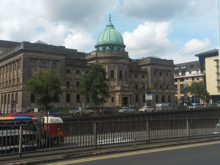

Glasgow
The Mitchell Library
A landmark for public knowledge
Look up at the copper dome of a library built to give Glasgow’s collections a monumental home.
Discover the story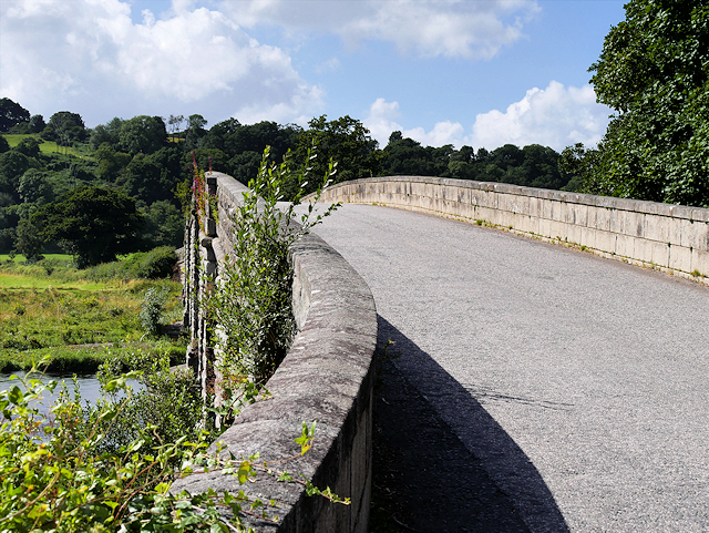


New Galloway
Ken Bridge
Five arches, two centuries of crossings
John Rennie’s granite bridge has carried traffic across the Water of Ken since 1821.
Discover the story

Edinburgh
Longmore House
From hospital to heritage headquarters
This long classical frontage began as a hospital for people needing long-term care.
Discover the story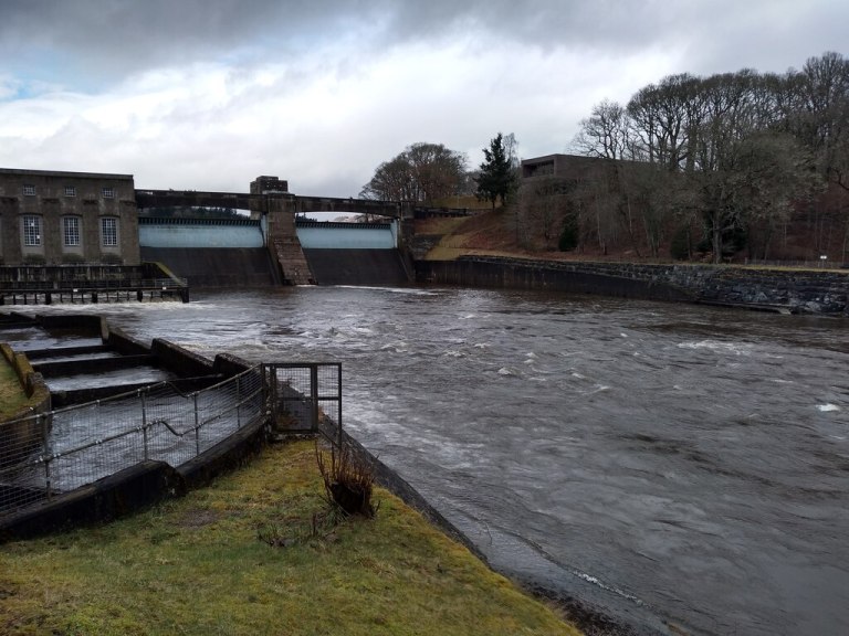


Pitlochry
Pitlochry Dam and Power Station
Electricity with a public purpose
Discover how a working dam helped finance electricity supplies to remote Highland communities.
Discover the story

Rothes
Rothes Parish Church
A clock with a journey of its own
The church clock came from Nairn Town Hall, repaired and presented by a jeweller formerly of Rothes.
Discover the storyExplore 3,231 published Heritage Records across 303 published Places, with source-linked research, interactive maps and clear routes to further evidence.
Explore Scotland by place
Select a marker to open that Place and explore its buildings and stories. Nearby Places are grouped at wider views; select a numbered group or zoom in to reveal them. Optional layers add official HES listed buildings and scheduled monuments, nearby Wikipedia article locations, and NLS historical mapping.
Use the + and − controls at the map’s upper-left to change scale. They work with both the modern and historical maps.
Nearby published Places
Distances are straight-line estimates from your approximate device location, not walking distances or access guidance.
Showing 302 published Places. Markers are approximate catalogue centres.
Map information, accuracy and rights
Each Place marker is an approximate centre calculated from its published mapped records. Showing your location is optional: the site uses it only in this page and does not save it. Published Place names are matched in this page. Other submitted place names are sent through a throttled, temporarily cached search to the OpenStreetMap Nominatim gazetteer and limited to Scottish results; do not enter personal or confidential information. Gazetteer points and boundaries are approximate and do not create a Scotland’s Architecture record. A submitted postcode is sent to Postcodes.io to obtain an approximate postcode centroid; Scotland’s Architecture does not save the postcode query. Postcode centroids are not address locations. Modern map tiles are supplied by OpenStreetMap. The optional historical overlay is the Ordnance Survey six-inch first edition for Scotland, principally surveyed in the 1840s–1880s, supplied by the National Library of Scotland. Sheet dates and coverage vary, and the historical map must not be read as current geography.
1 published Place without a reliable mapped record is listed below but omitted from the map.
The optional listed-buildings layer appears from city and large-town scale (zoom 12), clusters nearby designations, and links to official HES records. Lettered markers show the authoritative HES listing categories A, B and C. The separate scheduled-monuments layer appears from regional scale (zoom 10), uses purple SM markers at approximate designation centres, and links to the official HES record for the statutory boundary. It is independent of the listed-building category filter. Purple SM markers already attached to Scotland’s Architecture records remain curated catalogue markers. The opt-in Wikipedia layer shows geotagged English Wikipedia articles in the current close map view. W markers are supplied independently by Wikipedia, may cover subjects beyond architecture, and are not affected by HES filters. Turning it on sends the visible map centre and approximate radius to Wikimedia; Scotland’s Architecture does not save that request. Plan a heritage walk loads a Place-wide HES inventory, suggests a Category A-led order of principal stops, and divides longer itineraries into cross-device Google Maps legs without a paid integration. The site map displays numbered stops but deliberately draws no connecting line: Google chooses the actual pedestrian streets and paths, distance and time. Optional Category B and C candidates are shown only by proximity to a selected landmark marker and are not assumed to lie on Google’s route. Printable notes retain complete source and Google route URLs. This is a discovery aid rather than a statutory property-boundary search. For additional historic-map comparison and wider archaeological layers, visit PastMap; check current designation status and the full legal extent in the linked official HES record.
Historical map: Ordnance Survey six-inch first edition, Scotland, 1843–1882, National Library of Scotland, licensed under CC BY 4.0. Listed-building and scheduled-monument data contains Historic Environment Scotland and OS data © Historic Environment Scotland and Crown Copyright and database right 2026, licensed under the Open Government Licence v3.0. Wikipedia article titles, coordinates and links are supplied by Wikipedia contributors. Place-name search results are © OpenStreetMap contributors and available under the ODbL. Postcode data includes Ordnance Survey, Royal Mail, National Statistics and NRS data under the licences described by Postcodes.io.
New across Scotland
Recent additions selected from different Places, so that each visit opens more than one part of the country.
-
Arthur’s O’on (Arthur’s Oven)
A remarkably complete domed Roman monument stood above the River Carron until its demolition in 1743; antiquarian drawings preserve the appearance of one of Scotland’s most grievous architectural losses.
-
Fort George
A remarkably complete eighteenth-century artillery fortress near Ardersier, where bastioned defences, ordered barracks and continuing military use meet public heritage interpretation.
-
Crathes Castle
Crathes Castle near Banchory is a Category A listed late-sixteenth-century tower house, renowned for painted ceilings and its formal garden.
-
Fyvie Castle
Fyvie Castle in Aberdeenshire is a Category A listed, many-towered residence with medieval origins, Renaissance rebuilding and a nationally important designed landscape.
-
Calanais (Callanish) Standing Stones
A monumental Neolithic stone circle, avenues and chambered cairn form the celebrated prehistoric heart of Calanais on the west coast of Lewis.
-
Ness of Brodgar
A monumental Neolithic complex between two lochs reveals extraordinary buildings, art and communal activity at the centre of Orkney’s ceremonial landscape.
Research you can check
Sources & Method
See how records are researched, sourced and reviewed, including uncertainty and image rights.
Corrections
Share better evidence, report an error or help improve a Place or building record.
Accessibility
Read the accessibility statement and find practical information about using the maps and records.