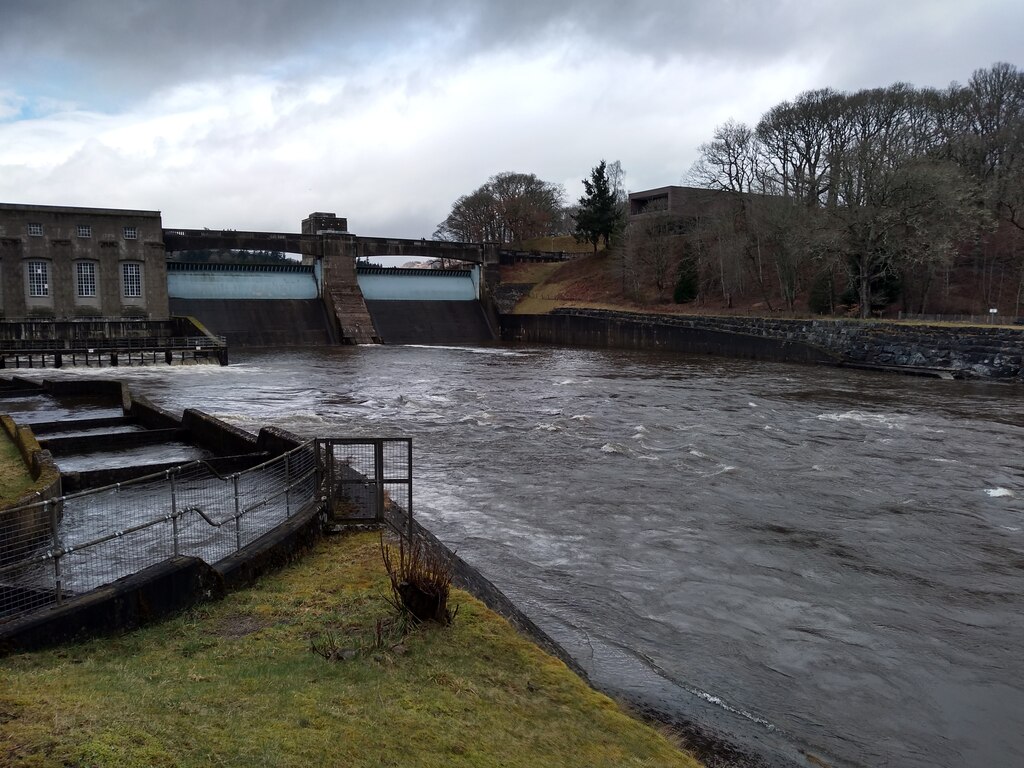
Image: Pitlochry Dam and Power Station by Robert Struthers, 12 March 2022, sourced from Wikimedia Commons and licensed under CC BY-SA 2.0.


Bold modern-classical architecture gives civic presence to a working dam and power station central to Scotland’s post-war hydro-electric programme.
Quick facts
- Date
- 1947–51
- Architect / designer
- Harold Ogle Tarbolton, architect; J Guthrie Brown of Sir Alexander Gibb and Partners, consulting engineer
- Type
- Combined dam and classical-modern hydro-electric power station with public walkway
- Designation
- Listed building, Category A (LB47534)
- OS grid reference
- NN 93542 57719
Architecture, archaeology and continuing use
The seven-bay turbine hall is integrated with the dam and faced in disciplined modern materials, including precast concrete. Drum gates, a balustraded walkway and the broad waters of Loch Faskally make the engineering sequence publicly legible, while the fish pass adds an ecological response to the altered river.
Its story
The North of Scotland Hydro-Electric Board developed the station between 1947 and 1951 as part of the Tummel-Garry scheme. Revenue from generation helped finance electricity supply to more remote Highland communities. A dedicated visitor centre opened in 2017 to interpret that wider social and engineering history.
Why it is included
Category A designation recognises an archetypal early Hydro Board scheme in which ambitious engineering, public purpose and confident modern architecture were conceived together.
What to notice
- The long turbine-hall front integrated with the dam.
- Drum gates and the walkway crossing above them.
- Modern classical proportions applied to industrial infrastructure.
Reading the surroundings
The station and dam remain operational. Use the signed public walkway and visitor areas only, observe closures and warnings, and never enter generating, control or water-management zones.
Timeline
- 1947 Construction began on the combined dam and power-station complex.
- 1951 The completed station entered the Hydro Board’s Tummel-Garry generating system.
- 20 December 2000 The complex received Category A listed-building status.
- January 2017 A new visitor centre opened to explain Highland hydro-electric development.
What we know — and what remains uncertain
The fish ladder and visitor centre are important to public understanding but are not necessarily all included within the statutory listed-building boundary.
Sources & further reading
- Historic Environment Scotland: Pitlochry Dam and Power Station, LB47534 — Designation status, mapped location, date, fabric and architectural or archaeological interest.
- Pitlochry Dam Visitor Centre — Current operating and visitor use, public interpretation, facilities and contact information.
- Pitlochry Dam Visitor Centre: about — Opening of the visitor centre in 2017 and its hydro-electric interpretation role.
Location
OS grid reference NN 93542 57719 · Location confidence: High: the national designation supplies an official mapped National Grid Reference; an additional source confirms the Place relationship, history or current identity. · Select the marker to open its satellite view in Google Maps. On desktop, drag Pegman (the yellow figure) onto a blue road. On mobile, turn on the Street View layer and tap a blue road. Other photo markers may be user-contributed.
Suggest a marker correction
Suggest a more accurate position
The teal marker is the current published position. The orange marker starts slightly to its right so both remain visible; this is only a visual starting position. Tap the correct place on the map or drag the orange marker. Sending this form creates a private review entry only; it does not move the published marker.
Check this area in Google Maps Choose the Satellite layer there if useful.
Map: © OpenStreetMap contributors. You can also enter checked coordinates below.