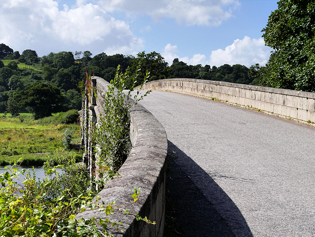
Image: Ken Bridge by David Dixon, 8 August 2016, sourced from Wikimedia Commons and licensed under CC BY-SA 2.0.


John Rennie’s long, low sequence of five granite arches carries a public road across the broad floodplain of the Water of Ken.
Quick facts
- Date
- 1820–1821
- Architect / designer
- John Rennie
- Type
- Five-span granite road bridge
- Designation
- Listed building, Category A (LB3316)
- OS grid reference
- NX 64048 78357
Architecture, archaeology and continuing use
Five graduated segmental arches extend for roughly 350 feet, with the widest span at the centre. Rock-faced granite contrasts with polished soffits and parapet surfaces, while rounded cutwaters and splayed abutments emphasise the bridge’s controlled flow.
Its story
Rennie designed the bridge late in his career, and it was completed in 1821 to improve the principal valley crossing. Its combination of hydraulic confidence and restrained masonry has kept it both useful and architecturally admired.
Why it is included
Category A engineering, major authorship and uninterrupted transport use make Ken Bridge the strongest infrastructure record for New Galloway.
What to notice
- Five arches increasing toward the centre.
- Rounded cutwaters rising from the river bed.
- Long, low curve of the parapet across the floodplain.
Reading the surroundings
This is a live road bridge. Use lawful pedestrian provision, obey traffic signs and never step into the carriageway, climb the parapets or enter river land for a photograph.
Timeline
- 1820 John Rennie prepared the bridge design.
- 1821 The five-span granite crossing was completed.
- 2026 The A712 continues to use Rennie’s masonry structure.
What we know — and what remains uncertain
Routine road conditions can change; current traffic restrictions should always be checked locally before travel.
Sources & further reading
- Historic Environment Scotland: Ken Bridge, LB3316 — Designation status, mapped location, date, fabric and architectural or archaeological interest.
- New Galloway and Kells Local Place Plan — Current community identification of Ken Bridge, its Rennie authorship, date and Category A status.
- Dumfries and Galloway Council: list of public roads — Independent confirmation of the A712 as a maintained public road.
Location
OS grid reference NX 64048 78357 · Location confidence: High: the national designation supplies an official mapped National Grid Reference; the independent source confirms the Place relationship, history or current identity. · Select the marker to open its satellite view in Google Maps. On desktop, drag Pegman (the yellow figure) onto a blue road. On mobile, turn on the Street View layer and tap a blue road. Other photo markers may be user-contributed.
Suggest a marker correction
Suggest a more accurate position
The teal marker is the current published position. The orange marker starts slightly to its right so both remain visible; this is only a visual starting position. Tap the correct place on the map or drag the orange marker. Sending this form creates a private review entry only; it does not move the published marker.
Check this area in Google Maps Choose the Satellite layer there if useful.
Map: © OpenStreetMap contributors. You can also enter checked coordinates below.