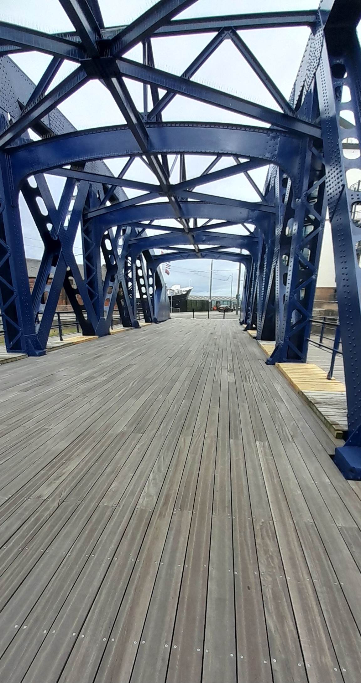
Image: Victoria Swing Bridge, Leith by StrontiumDog1979, sourced from Wikimedia Commons and licensed under CC BY-SA 4.0.

Scotland’s largest counterweighted swing bridge marks the point where the Water of Leith reaches the historic docks.
Quick facts
- Date
- Built 1871–1874; altered 1896; restored 2000 and repaired in later phases
- Architect / designer
- Alexander Meadows Rendel; 1896 alterations by Peter Whyte
- Type
- Hydraulic counterweighted swing bridge with wrought-iron trusses and timber deck
- Designation
- Listed building, Category A (LB27644)
- OS grid reference
- NT 27104 76822
Architecture and continuing use
Bowed wrought-iron trusses flank a timber deck and former railway alignment. Hydraulic machinery once rotated the span to clear a wide channel, while pedestrian walkways and the turning circle record its combined transport functions.
Its story
The expanding Albert and Edinburgh docks required a crossing that could carry road and rail traffic without blocking ships. Later alterations and repairs followed the decline of heavy dock traffic and adaptation for community access.
Why it is included
The bridge is an exceptional meeting of movable engineering, industrial townscape and a popular long-distance urban walkway.
What to notice
- Bowed truss profile over the water.
- Central deck and flanking pedestrian walkways.
- Turning-circle geometry and relationship to dock walls.
Reading the surroundings
Use the maintained pedestrian route and obey temporary closures or port instructions. Stay within barriers, take care on wet timber and do not enter operational dock land.
Timeline
- Built 1871–1874 The expanding Albert and Edinburgh docks required a crossing that could carry road and rail traffic without blocking ships. Later alterations and repairs followed the decline of heavy dock traffic and adaptation for community access.
- Present Historic pedestrian crossing and eastern end-point of the Water of Leith Walkway.
What we know — and what remains uncertain
Repair phases and port operations can alter access. The bridge is preserved as a historic crossing and is not described as routinely opening for vessels.
Sources & further reading
- Historic Environment Scotland: Victoria Swing Bridge, Leith, LB27644 — Designation status, mapped location, construction phases, fabric, authorship and architectural or historical interest.
- Water of Leith Conservation Trust: Victoria Bridge — Current walkway role, restoration and dock history.
- Water of Leith Conservation Trust: Forth Ports repair plans — Repair scope, bridge construction and commitment to pedestrian access.
Location
OS grid reference NT 27104 76822 · Location confidence: High: the statutory designation supplies an official mapped National Grid Reference and the current source confirms the Place relationship or present identity. · Select the marker to open its satellite view in Google Maps. On desktop, drag Pegman (the yellow figure) onto a blue road. On mobile, turn on the Street View layer and tap a blue road. Other photo markers may be user-contributed.
Suggest a marker correction
Suggest a more accurate position
The teal marker is the current published position. The orange marker starts slightly to its right so both remain visible; this is only a visual starting position. Tap the correct place on the map or drag the orange marker. Sending this form creates a private review entry only; it does not move the published marker.
Check this area in Google Maps Choose the Satellite layer there if useful.
Map: © OpenStreetMap contributors. You can also enter checked coordinates below.