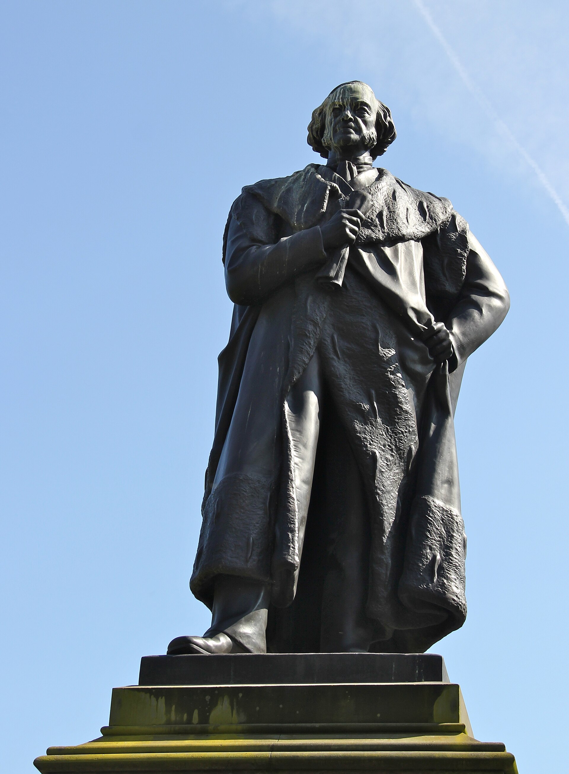
Image: Adam Black Statue, Edinburgh by Stefan Schäfer, 20 May 2012, sourced from Wikimedia Commons and licensed under CC BY-SA 3.0.

Publisher and lord provost Adam Black sits with a scroll in the gardens below the city he helped govern.
Quick facts
- Date
- Erected 1877
- Architect / designer
- John Hutchison
- Type
- Bronze seated publisher and politician on a stone pedestal
- Designation
- Listed building, Category A (LB27842)
- OS grid reference
- NT 25512 73883
Architecture and continuing use
A seated bronze figure in civic robes rests above a substantial panelled pedestal. The calm pose and scroll emphasise public service and print culture.
Its story
John Hutchison created the monument in 1877. Black’s career connected the publishing firm A. and C. Black with Edinburgh civic government and parliamentary politics.
Why it is included
The Category A monument adds publishing, municipal leadership and a strong seated portrait to the gardens’ commemorative landscape.
What to notice
- Scroll held by the figure.
- Civic robes and seated pose.
- Relationship to the station, gardens and Old Town skyline.
Reading the surroundings
Use public garden paths during opening hours and respect any work zones or planting. Do not climb the pedestal.
Timeline
- Erected 1877 John Hutchison created the monument in 1877. Black’s career connected the publishing firm A. and C. Black with Edinburgh civic government and parliamentary politics.
- Present Council-managed public monument in East Princes Street Gardens.
What we know — and what remains uncertain
Seasonal planting and temporary events may alter the immediate setting and viewing angle.
Sources & further reading
- Historic Environment Scotland: Adam Black Monument, LB27842 — Designation status, mapped location, construction phases, fabric, authorship and architectural or historical interest.
- City of Edinburgh Council: Princes Street Gardens management plan — Council management, public access and monument inventory.
- Edinburgh World Heritage: Twelve Monuments — Conservation and public-interpretation context for the monument.
Location
OS grid reference NT 25512 73883 · Location confidence: High: the statutory designation supplies an official mapped National Grid Reference and the current source confirms the Place relationship or present identity. · Select the marker to open its satellite view in Google Maps. On desktop, drag Pegman (the yellow figure) onto a blue road. On mobile, turn on the Street View layer and tap a blue road. Other photo markers may be user-contributed.
Suggest a marker correction
Suggest a more accurate position
The teal marker is the current published position. The orange marker starts slightly to its right so both remain visible; this is only a visual starting position. Tap the correct place on the map or drag the orange marker. Sending this form creates a private review entry only; it does not move the published marker.
Check this area in Google Maps Choose the Satellite layer there if useful.
Map: © OpenStreetMap contributors. You can also enter checked coordinates below.