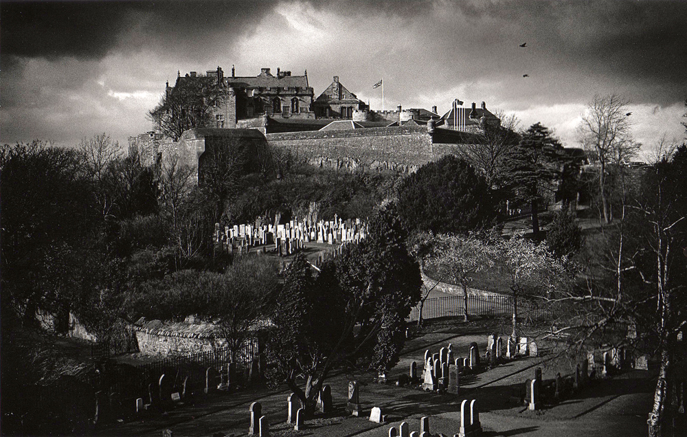
Image: Stirling Castle crowning the rocky hill above Broad Street and the Old Town graveyard by Ken MacGregor, licensed under CC BY-SA 4.0.

A royal and military complex occupies a volcanic crag above the Forth, combining defences, palace, great hall, chapel, kitchens and later barracks.
Quick facts
- Date
- Documented from the early 12th century; major surviving royal work late 15th to late 16th centuries; later military additions
- Architect / designer
- Successive royal works; individual medieval and Renaissance designers are only partly documented
- Type
- Royal castle, palace and later military complex
- Designation
- Scheduled royal castle complex (SM90291)
- OS grid reference
- NS 78992 94068
A castle built from position and ceremony
Natural cliffs protect much of the site while outer defences control the town approach. Within them, the Inner Close gathers the Great Hall, Royal Palace, King’s Old Building and Chapel Royal into a setting designed for court life as much as warfare.
Its story
A castle is documented by about 1110. It changed hands during the Wars of Independence and became a favoured Stewart royal residence. James IV, James V and James VI commissioned the principal late-medieval and Renaissance buildings. From the seventeenth century, military use increasingly altered the complex and continued into the twentieth century.
Why it is included
It demonstrates how topography, national strategy, royal display and long military occupation can create a complex architectural ensemble rather than a single-period castle.
What to notice
- The relationship between steep natural rock and built defensive walls.
- The contrasting scale and colour of the Great Hall and Royal Palace around the Inner Close.
- Views across the Forth valley that explain the site’s strategic importance.
Reading the surroundings
The castle is a major ticketed attraction at the top of Stirling’s historic core. Weather, steep approaches, events and temporary access arrangements should be checked with Historic Environment Scotland.
Timeline
- c.1110 The earliest certain documentary reference records an existing castle chapel.
- 1490s–1500s James IV commissioned major royal buildings and defences.
- c.1540 James V’s Royal Palace was created.
- 1650s–1964 Long military occupation altered and maintained the complex.
What we know — and what remains uncertain
The scheduled area contains many phases and structures. This point represents the visitor complex and must not be read as the complete legal boundary or as a claim that all visible work is medieval.
Sources & further reading
- Historic Environment Scotland: Stirling Castle, SM90291 — Scheduling, exact grid reference, chronology, strategic setting and national importance.
- Historic Environment Scotland: history and stories — Official visitor interpretation of the castle buildings and royal history.
- Historic Environment Scotland: Stirling Castle — Current visitor operation and access context.
Location
OS grid reference NS 78992 94068 · Location confidence: High for the castle complex: the scheduled-monument record supplies an exact grid reference. The marker is a catalogue point, not the scheduled boundary. · Select the marker to open its satellite view in Google Maps. On desktop, drag Pegman (the yellow figure) onto a blue road. On mobile, turn on the Street View layer and tap a blue road. Other photo markers may be user-contributed.
Suggest a marker correction
Suggest a more accurate position
The teal marker is the current published position. The orange marker starts slightly to its right so both remain visible; this is only a visual starting position. Tap the correct place on the map or drag the orange marker. Sending this form creates a private review entry only; it does not move the published marker.
Check this area in Google Maps Choose the Satellite layer there if useful.
Map: © OpenStreetMap contributors. You can also enter checked coordinates below.