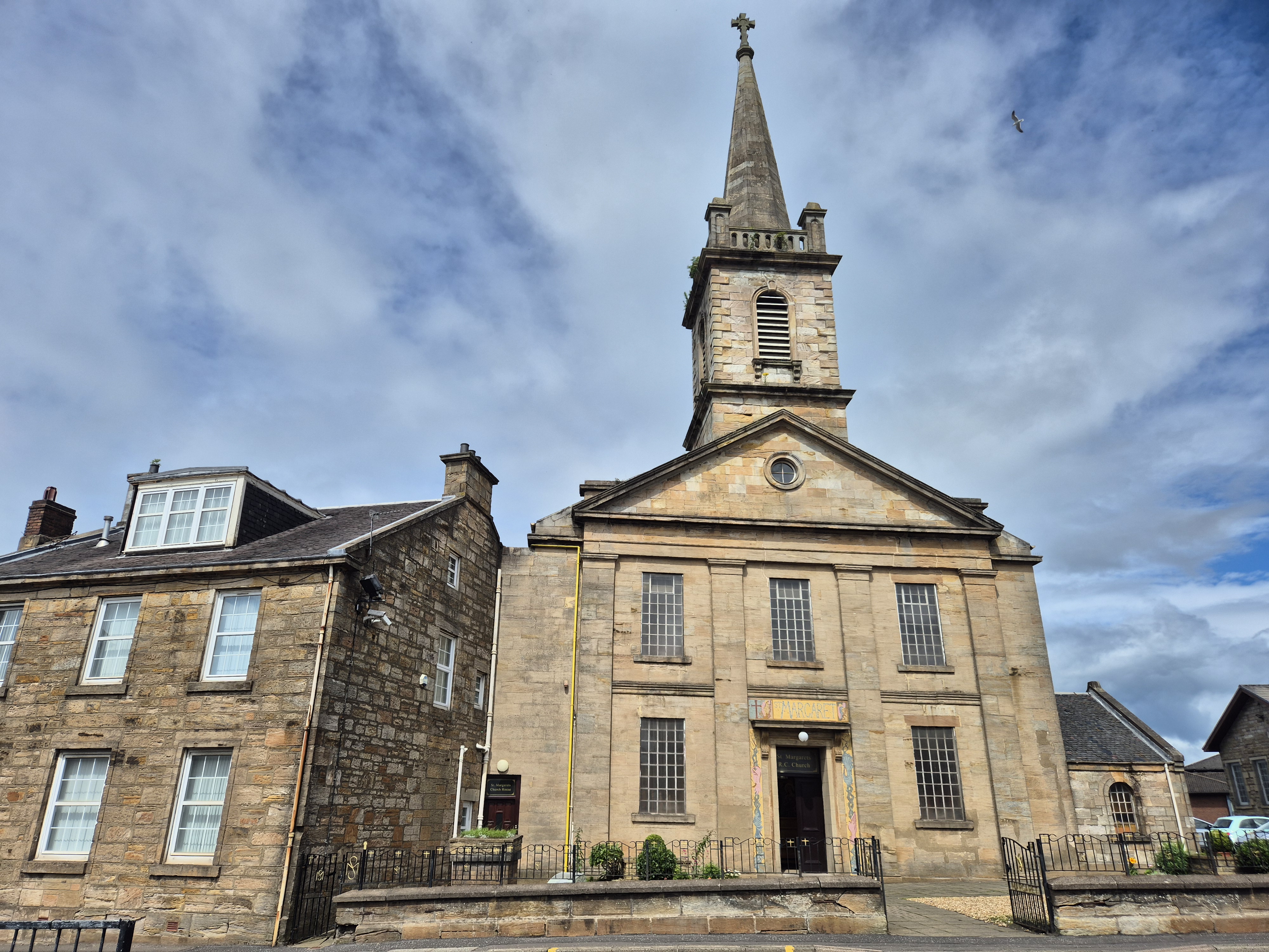


A classical church presents a pedimented front and prominent steeple.
Quick facts
- Date
- 1839; steeple added later according to parish history
- Architect / designer
- Wilkie and Gray
- Type
- Church and presbytery
- OS grid reference
- NS 76469 65599
The building and its setting
Large pilasters divide the sandstone front beneath a pediment. The tower and spire rise above it; tall round-arched side windows contrast with the stronger geometry of the entrance elevation.
Its story
The church opened in 1839. Parish history relates its construction to an expanding Catholic population whose worship had previously taken place in hired rooms or required travel to Glasgow. It distinguishes the later steeple from the initial building.
Why it is included
This early nineteenth-century Catholic church provides a different architectural and chronological strand from the later public buildings.
What to look for
- The pilastered classical front
- The transition from pediment to tower and spire
Reading the surroundings
Observe from public space; check current arrangements before entering buildings or grounds.
What we know — and what remains uncertain
The exact date of the steeple has not been established here. The statutory group also includes the presbytery and boundary wall.
Sources & further reading
- Historic Environment Scotland: LB20924 — Designation, location, architectural description and historical information; not a current condition survey.
- St Margaret’s parish: In the Beginning — Parish account of worship before construction, opening in 1839 and later steeple.
Location
OS grid reference NS 76469 65599 · Location confidence: HES catalogue grid converted to WGS84; approximate record location, not an entrance or boundary. · Select the marker to open its satellite view in Google Maps. On desktop, drag Pegman (the yellow figure) onto a blue road. On mobile, turn on the Street View layer and tap a blue road. Other photo markers may be user-contributed.
Suggest a marker correction
Suggest a more accurate position
The teal marker is the current published position. The orange marker starts slightly to its right so both remain visible; this is only a visual starting position. Tap the correct place on the map or drag the orange marker. Sending this form creates a private review entry only; it does not move the published marker.
Check this area in Google Maps Choose the Satellite layer there if useful.
Map: © OpenStreetMap contributors. You can also enter checked coordinates below.