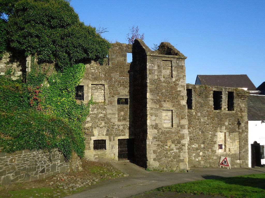
Image: John Cowane’s House by Robert Murray, sourced from Wikimedia Commons and licensed under CC BY-SA 2.0.

The roofless remains of a wealthy Stirling merchant’s house preserve a stair tower, turret and evidence of several seventeenth-century building campaigns.
Quick facts
- Date
- Main phases about 1603, 1633 and 1697; roof and upper storey removed 1877
- Architect / designer
- Historic merchant builders not identified
- Type
- Ruined U-plan seventeenth-century merchant house with stair tower
- Designation
- Listed building, Category A (LB41466)
- OS grid reference
- NS 79326 93851
Architecture and continuing use
Rubble walls define an original three-storey and attic U-plan. A square stair tower faces the wynd and a corbelled corner turret survives in fragmentary form above the enclosed garden.
Its story
Parts may derive from Andrew Cowane’s house of 1603, with additions in 1633 and 1697. The unsafe upper storey and roof were removed in 1877; Cowane’s Trust later recovered the ruin and is planning conservation and community use.
Why it is included
The Category A ruin offers rare evidence for an early modern merchant household and for the continuing charitable legacy of John Cowane.
What to notice
- Square stair tower facing the wynd.
- Changes in rubble masonry between building phases.
- Relationship between ruin, elevated garden and steep Old Town route.
Reading the surroundings
The ruin is restricted and should be viewed only from lawful public space or an advertised event. Do not enter locked areas or unstable masonry; St Mary’s Wynd is steep and uneven.
Timeline
- Main phases about 1603, 1633 and 1697 Parts may derive from Andrew Cowane’s house of 1603, with additions in 1633 and 1697. The unsafe upper storey and roof were removed in 1877; Cowane’s Trust later recovered the ruin and is planning conservation and community use.
- Present Locked conserved ruin and garden subject to a community-led restoration and access project.
What we know — and what remains uncertain
The Trust’s reopening and garden proposals depend on funding and approvals; no completion date or routine visitor access is assumed.
Sources & further reading
- Historic Environment Scotland: John Cowane’s House, LB41466 — Designation status, mapped location, construction phases, fabric, authorship and architectural or historical interest.
- Cowane’s Trust: John Cowane’s House — Current restricted condition, ownership history, architectural phases and restoration objectives.
- Cowane’s Trust: public consultation — Community proposals for access, interpretation, garden use and future programming.
Location
OS grid reference NS 79326 93851 · Location confidence: High: the statutory designation supplies an official mapped National Grid Reference and the current source confirms the Place relationship or present identity. · Select the marker to open its satellite view in Google Maps. On desktop, drag Pegman (the yellow figure) onto a blue road. On mobile, turn on the Street View layer and tap a blue road. Other photo markers may be user-contributed.
Suggest a marker correction
Suggest a more accurate position
The teal marker is the current published position. The orange marker starts slightly to its right so both remain visible; this is only a visual starting position. Tap the correct place on the map or drag the orange marker. Sending this form creates a private review entry only; it does not move the published marker.
Check this area in Google Maps Choose the Satellite layer there if useful.
Map: © OpenStreetMap contributors. You can also enter checked coordinates below.