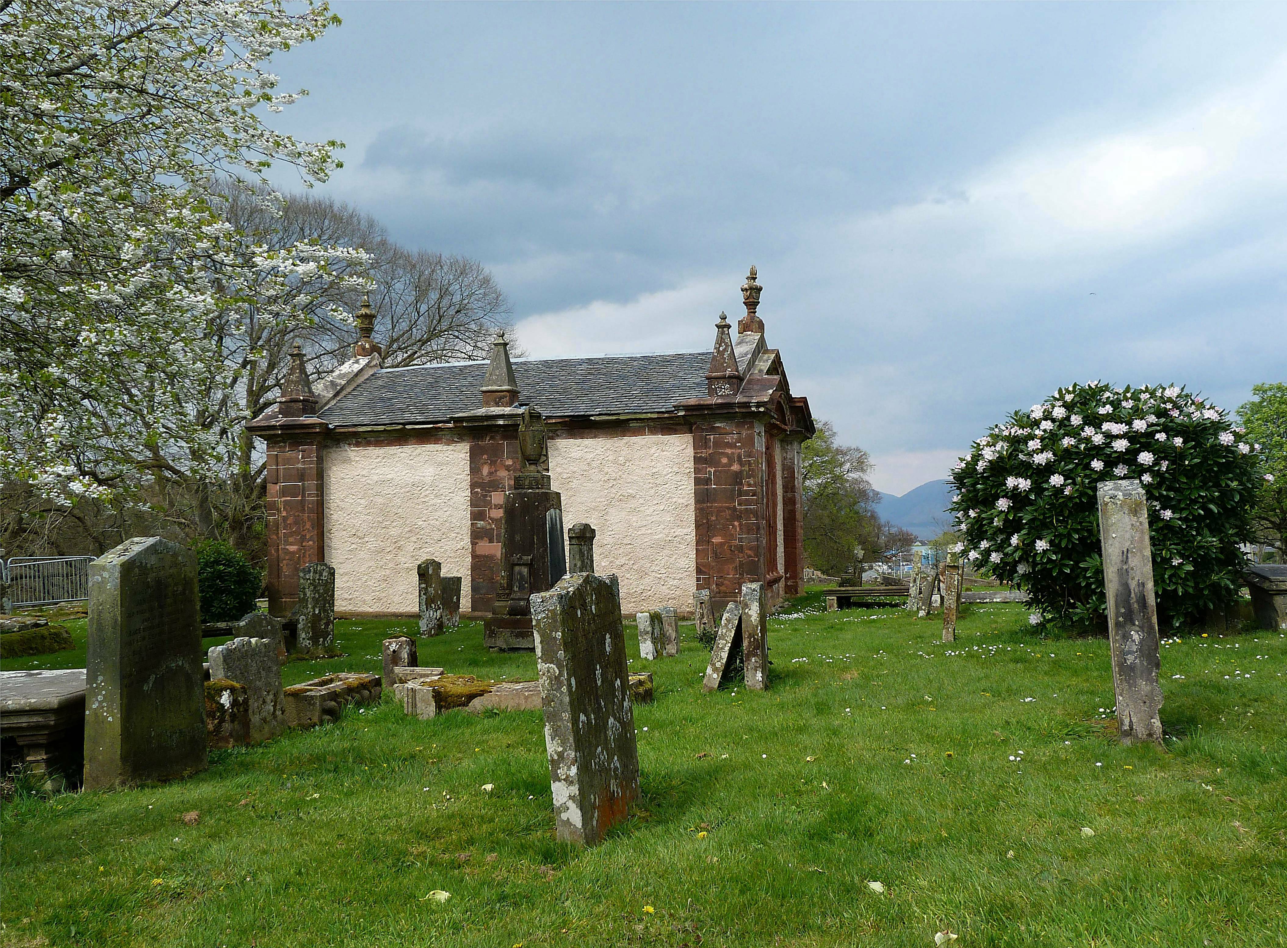
Image: Low stone Bute Mausoleum in the graveyard of the High Kirk of Rothesay, with carved roofline details by Raibeart MacAoidh, licensed under CC BY-SA 2.0.

A compact classical mausoleum, animated by obelisks and urns, marks the burial landscape above the historic town.
Quick facts
- Date
- Late eighteenth century
- Architect / designer
- Architect not identified in the designation
- Type
- Pedimented rectangular mausoleum with obelisk pinnacles and urn finials
- Designation
- Listed building, Category A (LB40446)
- OS grid reference
- NS 08579 63723
Architecture and continuing use
The single-storey rectangular structure is harled and detailed in red sandstone. Broken pediments, pilasters, panelled obelisk pinnacles and urn finials give ceremonial emphasis to a small building.
Its story
The mausoleum was built in the late eighteenth century for the Bute family within the High Kirk burial ground. The cemetery remains managed for limited reopenings and ashes rather than new lairs.
Why it is included
It combines high-quality funerary architecture with the dynastic history that shaped Bute and Rothesay over many centuries.
What to notice
- Broken pediments on the principal fronts.
- Panelled obelisk pinnacles and urn-shaped finials.
- Contrast between white harl and red sandstone dressings.
Reading the surroundings
Treat the cemetery as a place of burial. Use authorised paths, avoid monuments and unstable ground, and do not assume the mausoleum interior is open.
Timeline
- Late eighteenth century The mausoleum was built in the late eighteenth century for the Bute family within the High Kirk burial ground. The cemetery remains managed for limited reopenings and ashes rather than new lairs.
- Present Historic funerary monument within Rothesay High Street Cemetery.
What we know — and what remains uncertain
The public source confirms cemetery operating status rather than routine interior access to this mausoleum.
Sources & further reading
- Historic Environment Scotland: Bute Mausoleum at the High Kirk of Rothesay, LB40446 — Designation status, mapped location, construction phases, fabric, authorship and architectural or historical interest.
- Argyll and Bute Council: cemetery status register — Council evidence for the present operating status of Rothesay High Street Cemetery.
Location
OS grid reference NS 08579 63723 · Location confidence: High: the statutory designation supplies an official mapped National Grid Reference and the current source confirms the Place relationship or present identity. · Select the marker to open its satellite view in Google Maps. On desktop, drag Pegman (the yellow figure) onto a blue road. On mobile, turn on the Street View layer and tap a blue road. Other photo markers may be user-contributed.
Suggest a marker correction
Suggest a more accurate position
The teal marker is the current published position. The orange marker starts slightly to its right so both remain visible; this is only a visual starting position. Tap the correct place on the map or drag the orange marker. Sending this form creates a private review entry only; it does not move the published marker.
Check this area in Google Maps Choose the Satellite layer there if useful.
Map: © OpenStreetMap contributors. You can also enter checked coordinates below.