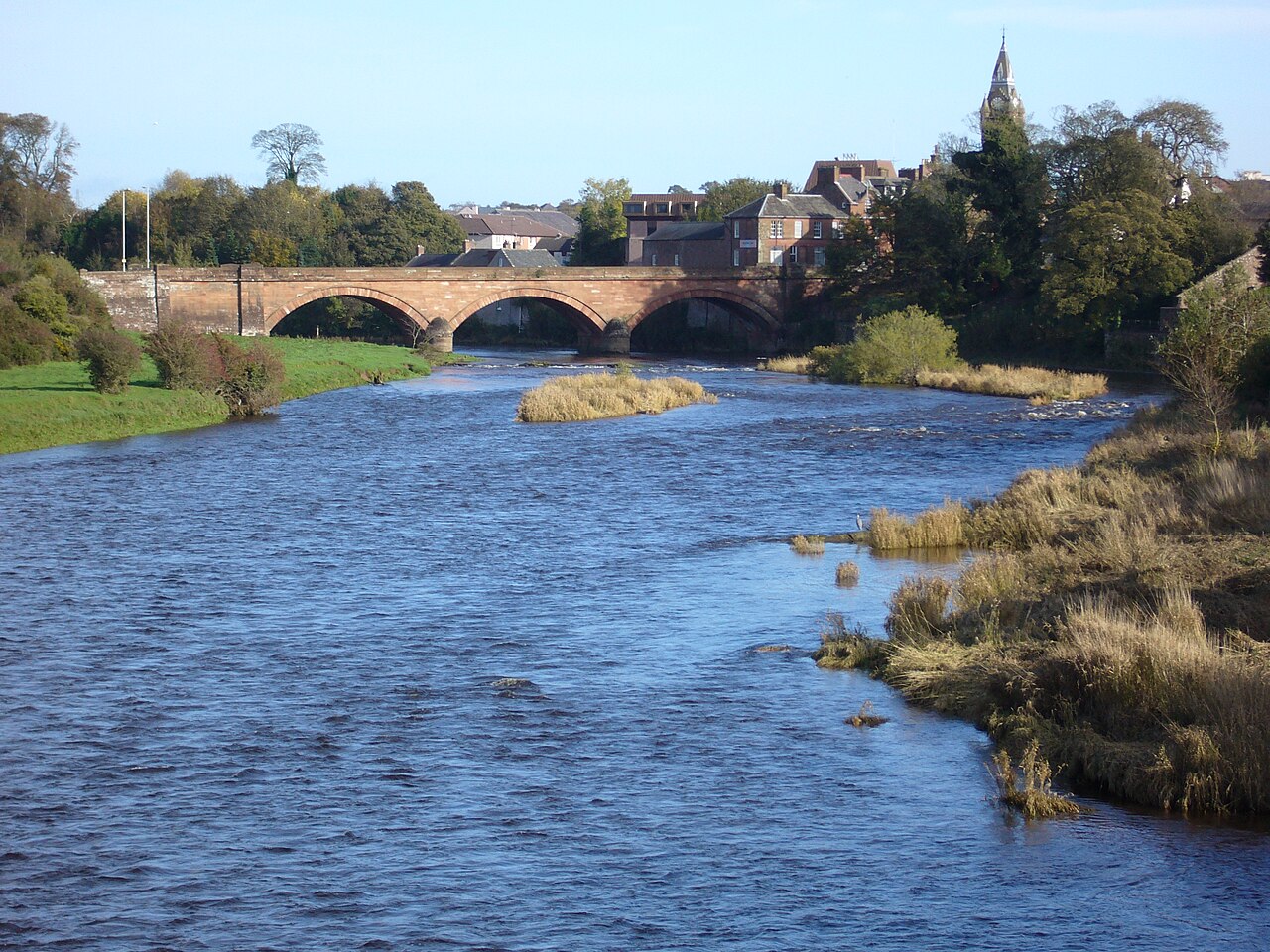
Annan Bridge. Photograph: Red Sunset / Wikimedia Commons, CC BY-SA 3.0.

Three broad segmental arches carry Annan’s historic river crossing in a restrained design by engineer Robert Stevenson.
Quick facts
- Date
- 1826
- Architect / designer
- Robert Stevenson, engineer
- Type
- Three-span red-sandstone road bridge
- Designation
- Listed building, Category A (LB21061)
- OS grid reference
- NY 19107 66585
Architecture, archaeology and continuing use
Red ashlar forms three nearly equal arches with channelled voussoirs. Rounded cutwaters, battered abutments, pilaster strips and an unbroken parapet give the long crossing strength without heavy ornament.
Its story
Thomas Telford found the earlier bridge beyond repair in 1814. Robert Stevenson designed its replacement, completed in 1826 as part of the improved road network serving the burgh and the border region.
Why it is included
Category A recognition, important engineering authorship and continued transport use make the bridge a working monument rather than an isolated relic.
What to notice
- Three low segmental arches across the river.
- Rounded cutwaters rising beneath the parapet.
- Battered abutments anchoring the crossing.
Reading the surroundings
Use the pavements and lawful riverside routes, remain alert to traffic and do not climb parapets, cutwaters or riverbank structures.
Timeline
- 1814 Thomas Telford reported that the preceding bridge could not be repaired economically.
- 1826 Robert Stevenson’s three-span replacement was completed.
- 2026 The bridge continues to carry public road and pedestrian movement.
What we know — and what remains uncertain
The designation’s historic title mentions the A75; this record describes the present function without asserting a current road number.
Sources & further reading
- Historic Environment Scotland: Annan Bridge, LB21061 — Designation status, mapped location, date, fabric and architectural or archaeological interest.
- Walking in and around Annan — Current public-route context and local identification of the bridge.
Location
OS grid reference NY 19107 66585 · Location confidence: High: the national designation supplies an official mapped National Grid Reference; the independent source confirms the Place relationship, history or current identity. · Select the marker to open its satellite view in Google Maps. On desktop, drag Pegman (the yellow figure) onto a blue road. On mobile, turn on the Street View layer and tap a blue road. Other photo markers may be user-contributed.
Suggest a marker correction
Suggest a more accurate position
The teal marker is the current published position. The orange marker starts slightly to its right so both remain visible; this is only a visual starting position. Tap the correct place on the map or drag the orange marker. Sending this form creates a private review entry only; it does not move the published marker.
Check this area in Google Maps Choose the Satellite layer there if useful.
Map: © OpenStreetMap contributors. You can also enter checked coordinates below.