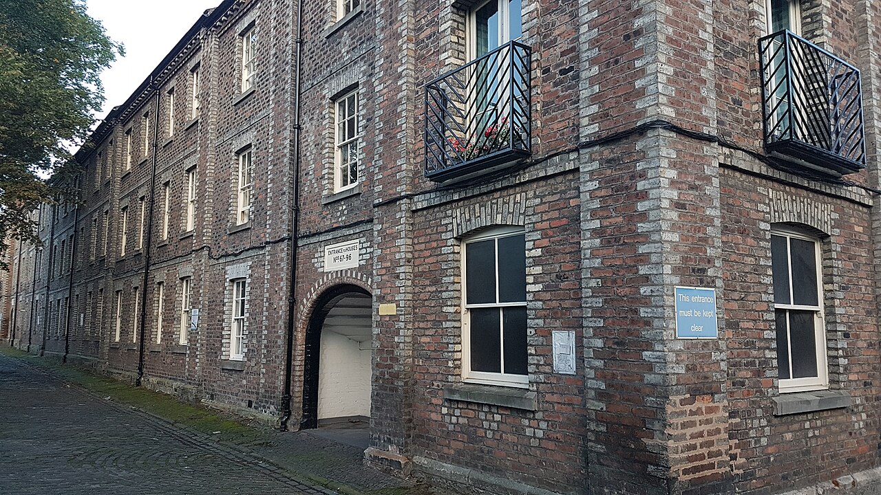
A brick quadrangle of working-class housing whose street elevations enclose a courtyard with open access galleries.
Quick facts
Date: c.1860; published sources differ
Design and delivery: William Lambie Moffat
Designation: Category B listed building; LB29662
Model housing in Fountainbridge
Three-storey ranges surround a near-square court, with taller towers marking the corners. Different colours of brick, bands between floors and projecting cornices articulate the long elevations. Round-arched passages lead from the surrounding streets into the court.
William Lambie Moffat’s design offered an alternative to Edinburgh’s stone tenement. Housing reform took architectural form in a purpose-built ensemble, with repeated dwellings and circulation arranged around a shared open space.
Galleries and everyday use
Within the court, slender columns support galleries serving the upper floors. Repeated doors and windows make the individual dwellings legible along these communal routes. HES identifies surviving cast-iron drying poles as well as gallery railings: clothes drying and access belonged to the organisation of the court.
The photographs show two distinct faces of the development: a formally ordered street frontage and the more exposed circulation of the inner elevations. The galleries, shared ground and maintenance of common fabric are central to the building’s housing history.
Date and designation
HES dates the design to 1860 and cites its absence from the 1859 Post Office Directory map and appearance in 1860. Edinburgh Libraries gives 1857. The date is therefore given here as circa 1860, with the discrepancy retained.
The Category B designation covers Nos 1–96. This Edinburgh ensemble is separate from Rosemount Square, Aberdeen.
Location and Photos
The exterior can be viewed from Gardner’s Crescent and the surrounding public streets. The courtyard and galleries serve residents’ homes.


Explore further
Sources & further reading
- Historic Environment Scotland, LB29662 — Architect, form, materials, galleries, drying poles, date evidence and designation.
- Edinburgh Libraries, Capital Collections, item 14319 — Working-class purpose and the alternative 1857 date.
Location
OS grid reference NT 24511 73070 · Location confidence: HES LB29662 representative point, transformed from OSGB36. · Select the marker to open its satellite view in Google Maps. On desktop, drag Pegman (the yellow figure) onto a blue road. On mobile, turn on the Street View layer and tap a blue road. Other photo markers may be user-contributed.
Suggest a marker correction
Suggest a more accurate position
The teal marker is the current published position. The orange marker starts slightly to its right so both remain visible; this is only a visual starting position. Tap the correct place on the map or drag the orange marker. Sending this form creates a private review entry only; it does not move the published marker.
Check this area in Google Maps Choose the Satellite layer there if useful.
Map: © OpenStreetMap contributors. You can also enter checked coordinates below.
In these guides: Public Housing in Scotland: A Photo Guide to Designs and Types