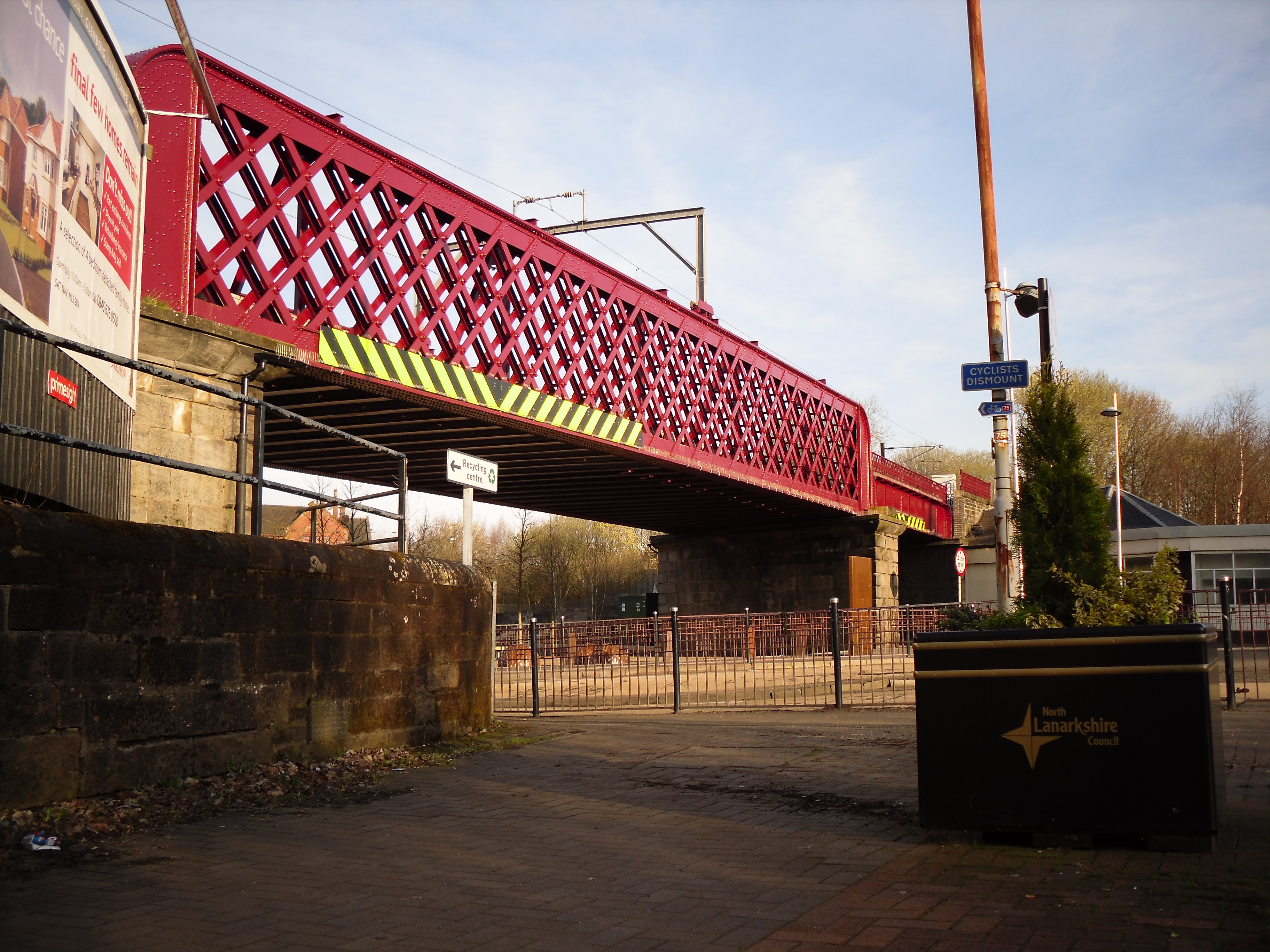


Lattice ironwork spans a junction shaped by road, railway and the former canal.
Quick facts
- Date
- 1870–72; possible later rebuilding of the northern section
- Architect / designer
- Individual designer not established in the sources reviewed
- Type
- Railway bridge
- OS grid reference
- NS 73054 65087
The building and its setting
Wrought-iron lattice trusses rest on substantial masonry supports. Decorative bosses enliven the riveted structure. The northern West Canal Street section differs in its plate girders and ornamental oval and circular elements.
Its story
HES dates the principal bridge to 1870–72, when raising the railway resolved a hazardous crossing associated with the canal. It suggests that the northern section may have been rebuilt in 1898. The museum’s heritage trail explains Coatbridge Cross as the meeting point of canal, road, rail and pedestrian movement.
Why it is included
The bridge records the engineering changes needed to move people and industrial goods through a congested town centre.
What to look for
- Lattice trusses and rivet bosses
- contrasting northern girder work
Reading the surroundings
View from public pavements around the Cross and West Canal Street, using designated crossings.
What we know — and what remains uncertain
The 1898 attribution is tentative and applies to the northern section; it should not replace the 1870–72 date for the main bridge. The point marks the structure, not an access route.
Sources & further reading
- Historic Environment Scotland: LB49872 — Designation, catalogue location, architectural description, dating and attribution; historical description is not a current condition survey.
- NorthLan Museums: North Calder Heritage Trail — Explains the junction’s former canal relationship and the present underground course.
Location
OS grid reference NS 73054 65087 · Location confidence: HES catalogue grid converted to WGS84; a record point, not a boundary or entrance. · Select the marker to open its satellite view in Google Maps. On desktop, drag Pegman (the yellow figure) onto a blue road. On mobile, turn on the Street View layer and tap a blue road. Other photo markers may be user-contributed.
Suggest a marker correction
Suggest a more accurate position
The teal marker is the current published position. The orange marker starts slightly to its right so both remain visible; this is only a visual starting position. Tap the correct place on the map or drag the orange marker. Sending this form creates a private review entry only; it does not move the published marker.
Check this area in Google Maps Choose the Satellite layer there if useful.
Map: © OpenStreetMap contributors. You can also enter checked coordinates below.