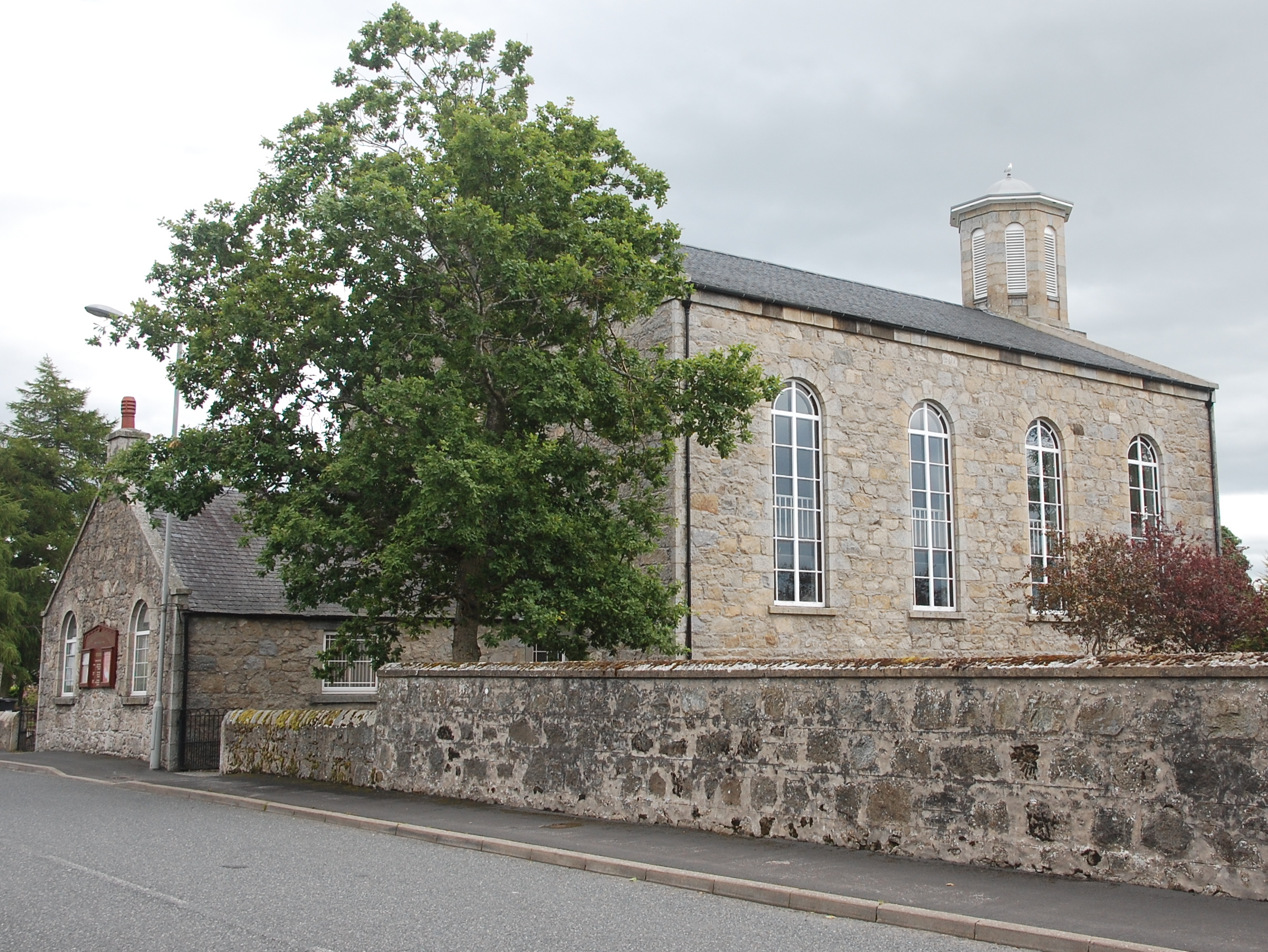
Opened in 1842, New Marnoch Church is a prominent gabled hall church whose octagonal tower records a decisive episode in Aberchirder’s nineteenth-century religious history.


Quick facts
- Designation
- Category B listed building
- Date
- 1841–42
- Architect
- James Henderson
- National Grid Reference
- NJ 62876 52624
History
The building followed a prolonged dispute within Marnoch parish. James Henderson designed it in 1841 and it opened in 1842. The congregation’s history then intersected with the Disruption of 1843: one body joined the Free Church, the two churches returned to the Church of Scotland in 1929, and the congregations united in 1953. The sequence gives the building significance beyond its architectural presence.
Architecture and setting
The church is a gabled rectangular hall with a vestry and a four-stage octagonal tower. Its tower, openings and disciplined masonry make it an important marker in the eastern part of the village. The listing describes the architectural form and chronology; designation does not establish public access.
Sources
- Historic Environment Scotland: New Marnoch Church, Main Street (LB19914) — designation record, description and historical notes.
Source checked 22 October 2026. Listing identifies special architectural or historic interest; it does not imply public access.
Location
OS grid reference NJ 62876 52624 · Location confidence: High — coordinate derived from the current HES designation NGR · Select the marker to open its satellite view in Google Maps. On desktop, drag Pegman (the yellow figure) onto a blue road. On mobile, turn on the Street View layer and tap a blue road. Other photo markers may be user-contributed.
Suggest a marker correction
Suggest a more accurate position
The teal marker is the current published position. The orange marker starts slightly to its right so both remain visible; this is only a visual starting position. Tap the correct place on the map or drag the orange marker. Sending this form creates a private review entry only; it does not move the published marker.
Check this area in Google Maps Choose the Satellite layer there if useful.
Map: © OpenStreetMap contributors. You can also enter checked coordinates below.