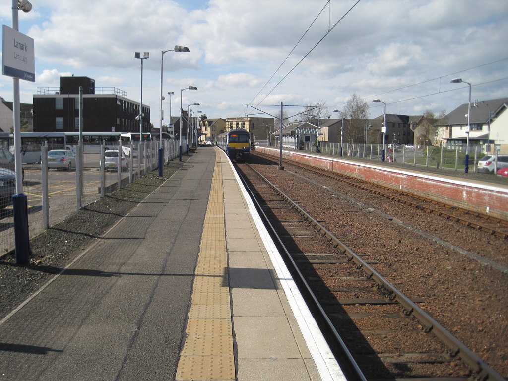


Lanark's working railway terminus retains historic buildings that mark the arrival of the railway age in the county town.
Quick facts
- Date
- 1855; later alterations
- Architect / designer
- Caledonian Railway engineers; individual architect unrecorded
- Type
- Railway terminus and station buildings
- Designation
- Listed building, Category B (LB36930)
- OS grid reference
- NS 88595 43665
Architecture and continuing use
Low stone station ranges address the platform and approach, their railway detailing and linear arrangement expressing the practical needs of a terminus. Later operational change has been absorbed without erasing the historic identity.
Its story
The branch connected Lanark to the Caledonian Railway network and reshaped movement to the town. Continued passenger service keeps the historic station embedded in everyday life rather than isolated as transport archaeology.
Why it is included
Surviving railway fabric, continuous operation and the station's importance to Lanark's regional role support Category B inclusion.
What to notice
- The relationship between platform, stone ranges and terminus track.
- Railway openings and eaves details.
- The short approach from the historic town centre.
Reading the surroundings
This is an operating station. Use public passenger areas, remain behind platform safety lines and consult ScotRail for facilities and service disruption.
Timeline
- 5 June 1855 Passenger trains began serving the new Lanark terminus.
- 1974 Electrification modernised operation of the Lanark branch.
- 1995 The surviving historic station fabric entered the statutory list.
What we know — and what remains uncertain
Operational fittings and platform equipment change over time; the record concentrates on the listed historic station fabric and continuing rail function.
Sources & further reading
- Historic Environment Scotland: Lanark Railway Station, LB36930 — Designation status, mapped location, date, fabric, authorship and architectural or historical interest.
- ScotRail: Lanark station — Current passenger use, station code, facilities and travel information.
Location
OS grid reference NS 88595 43665 · Location confidence: High: the statutory designation supplies an official mapped National Grid Reference and the current source confirms the Lanark relationship or present identity. · Select the marker to open its satellite view in Google Maps. On desktop, drag Pegman (the yellow figure) onto a blue road. On mobile, turn on the Street View layer and tap a blue road. Other photo markers may be user-contributed.
Suggest a marker correction
Suggest a more accurate position
The teal marker is the current published position. The orange marker starts slightly to its right so both remain visible; this is only a visual starting position. Tap the correct place on the map or drag the orange marker. Sending this form creates a private review entry only; it does not move the published marker.
Check this area in Google Maps Choose the Satellite layer there if useful.
Map: © OpenStreetMap contributors. You can also enter checked coordinates below.