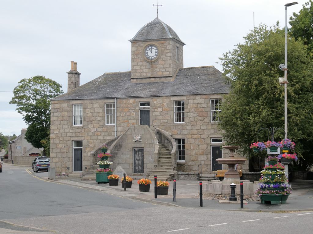
Image: Kintore Town House by Oliver Dixon, sourced from Wikimedia Commons and licensed under CC BY-SA 2.0.

A double stair and ogee-roofed clock tower give Kintore’s compact Town House the authority of an eighteenth-century burgh landmark.
Quick facts
- Date
- Construction begun 1737; completed 1747
- Architect / designer
- Architect not identified in the designation
- Type
- Burgh town house with external stair and clock tower
- Designation
- Listed building, Category A (LB36312)
- OS grid reference
- NJ 79238 16317
Architecture and continuing use
Granite walls form a two-storey, five-window civic block with a rear wing. Its broad outside stair leads directly to the former council chamber, while the clock tower and curving roof lift the building above the low enclosure of The Square.
Its story
Building began soon after the Earl of Kintore became provost and was completed in 1747. The Town House accommodated council business, a court, jail, school, post office and shops before local-government reorganisation ended most civic use in 1974.
Why it is included
Category A listing recognises the architectural and historical importance of an unusually complete small-burgh town house at the centre of one of Scotland’s old royal burghs.
What to notice
- The paired external stairs meeting at the chamber door.
- The compact clock tower beneath its ogee roof.
- The Keith family arms fixed to the stair front.
Reading the surroundings
View the exterior from public space in The Square. Do not assume the interior is open: enter only for an advertised event or arranged visit and keep clear of any conservation or project work.
Timeline
- 1737 Work began on a new civic building for the burgh.
- 1747 The Town House was completed after a decade of construction.
- 1914 The Earl of Kintore transferred the Burgh Buildings to the town.
- 1974 Local-government reorganisation ended its regular council role.
What we know — and what remains uncertain
The current community-reuse project is still developing, so interior access and future occupation should be checked with its organisers.
Sources & further reading
- Historic Environment Scotland: Kintore Town House, LB36312 — Current designation status, mapped location, date, fabric and architectural or archaeological interest.
- Trove designation: LB36312 — Parallel national record identity and archival context.
- Kintore: About Kintore and the Town House — Local history, former functions, ownership and current community-reuse plans.
- Kintore: Town House history — Building chronology and later civic use.
Location
OS grid reference NJ 79238 16317 · Location confidence: High: the current national designation supplies an exact mapped National Grid Reference; public text separately states access and current-use uncertainty. · Select the marker to open its satellite view in Google Maps. On desktop, drag Pegman (the yellow figure) onto a blue road. On mobile, turn on the Street View layer and tap a blue road. Other photo markers may be user-contributed.
Suggest a marker correction
Suggest a more accurate position
The teal marker is the current published position. The orange marker starts slightly to its right so both remain visible; this is only a visual starting position. Tap the correct place on the map or drag the orange marker. Sending this form creates a private review entry only; it does not move the published marker.
Check this area in Google Maps Choose the Satellite layer there if useful.
Map: © OpenStreetMap contributors. You can also enter checked coordinates below.