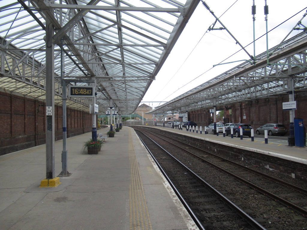


Classical stone offices lead into a light-filled concourse and iron-supported platform canopies.
Quick facts
- Date
- Present buildings 1898–99; railway opened 1858
- Architect / designer
- James Carswell, North British Railway engineering department
- Type
- Railway terminus
- OS grid reference
- NS 29696 82379
The building and its setting
The pink sandstone street front uses pilasters and pediments to give the terminus civic presence. Behind it, brick ranges enclose a partly glazed barrel-vaulted concourse. Decorative iron columns carry the platform roofs, making structural work an important part of the design.
Its story
The enlarged station followed pressure to improve cramped earlier accommodation. Trove dates the original railway opening to 1858, and records photography after a restoration scheme in 2000. ScotRail’s current station information confirms its continuing role in the passenger network.
Why it is included
Explains the transport infrastructure supporting the town’s growth.
What to look for
- The classical street front beside the Municipal Buildings
- The glazed concourse and cast-iron canopy supports
Reading the surroundings
Use permitted passenger areas and follow railway signs. Do not enter tracks or staff-only spaces.
What we know — and what remains uncertain
The HES listing gives 1856 for the earlier station; Trove gives a specific opening in May 1858, used here. Interior details in older records are not a new survey.
Sources & further reading
- Historic Environment Scotland: LB48538 — Designation, grid location and architectural development; historical observations are not a fresh condition survey.
- HES Trove: Helensburgh Central, NRHE 129473 — Railway opening chronology and record of restoration photography.
- ScotRail: Helensburgh Central — Current station operation, address and passenger access information.
Location
OS grid reference NS 29696 82379 · Location confidence: HES national-grid point converted to WGS84; approximate location, not an entrance or statutory boundary. · Select the marker to open its satellite view in Google Maps. On desktop, drag Pegman (the yellow figure) onto a blue road. On mobile, turn on the Street View layer and tap a blue road. Other photo markers may be user-contributed.
Suggest a marker correction
Suggest a more accurate position
The teal marker is the current published position. The orange marker starts slightly to its right so both remain visible; this is only a visual starting position. Tap the correct place on the map or drag the orange marker. Sending this form creates a private review entry only; it does not move the published marker.
Check this area in Google Maps Choose the Satellite layer there if useful.
Map: © OpenStreetMap contributors. You can also enter checked coordinates below.