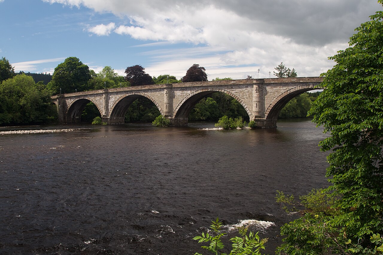
Image: Dunkeld Bridge by Tom Parnell, sourced from Wikimedia Commons and licensed under CC BY-SA 4.0.

Thomas Telford’s long seven-arch bridge transformed access to Dunkeld and remains the town’s principal crossing of the Tay.
Quick facts
- Date
- 1805–1809; dated 1809
- Architect / designer
- Thomas Telford, engineer
- Type
- Seven-arch road bridge
- Designation
- Listed building, Category A (LB5620)
- OS grid reference
- NO 02675 42453
Architecture and continuing use
Seven segmental ashlar arches stretch about 685 feet across the river and its banks. The central arch spans about ninety feet, flanked by graded river arches and land arches that carry the roadway into each settlement.
Its story
Telford engineered the bridge between 1805 and 1809, replacing unreliable ferry connections and redirecting movement through Dunkeld. Tolls funded the work and provoked long local resentment. The crossing now forms part of the A923 and remains essential to traffic and walking routes.
Why it is included
Category A listing recognises a major work by Telford, its disciplined masonry and its decisive influence on regional transport and the form of Dunkeld.
What to notice
- The broad central segmental arch.
- The regular progression of seven ashlar spans.
- Long views connecting river, cathedral and town.
Reading the surroundings
Use the pavements and formal road crossing points, remain alert to frequent traffic and never stop in the carriageway. Riverbanks and flood conditions can change, so do not climb parapets or descend onto masonry.
Timeline
- 1805 Construction began under Thomas Telford’s engineering direction.
- 1809 The seven-arch bridge opened across the Tay.
- 19th century Tolls financed the crossing but generated sustained local opposition.
- 2026 The bridge continued to carry the A923 and pedestrian traffic.
What we know — and what remains uncertain
The short statutory record does not provide a detailed construction account or identify every contractor and later repair.
Sources & further reading
- Historic Environment Scotland: Dunkeld Bridge, LB5620 — Current designation status, official mapped location, date, fabric and architectural or archaeological interest.
- Trove designation: LB5620 — Parallel national record identity and archival context.
- Perth and Kinross Council: Dunkeld conservation appraisal — Authoritative account of the bridge’s effect on movement and its continuing A923 role.
- Dunkeld Cathedral and Parish: Dunkeld history — Local institutional account of the 1809 bridge, tolls and settlement change.
Location
OS grid reference NO 02675 42453 · Location confidence: High: the current national designation supplies an exact mapped National Grid Reference; public text separately states access and current-use uncertainty. · Select the marker to open its satellite view in Google Maps. On desktop, drag Pegman (the yellow figure) onto a blue road. On mobile, turn on the Street View layer and tap a blue road. Other photo markers may be user-contributed.
Suggest a marker correction
Suggest a more accurate position
The teal marker is the current published position. The orange marker starts slightly to its right so both remain visible; this is only a visual starting position. Tap the correct place on the map or drag the orange marker. Sending this form creates a private review entry only; it does not move the published marker.
Check this area in Google Maps Choose the Satellite layer there if useful.
Map: © OpenStreetMap contributors. You can also enter checked coordinates below.