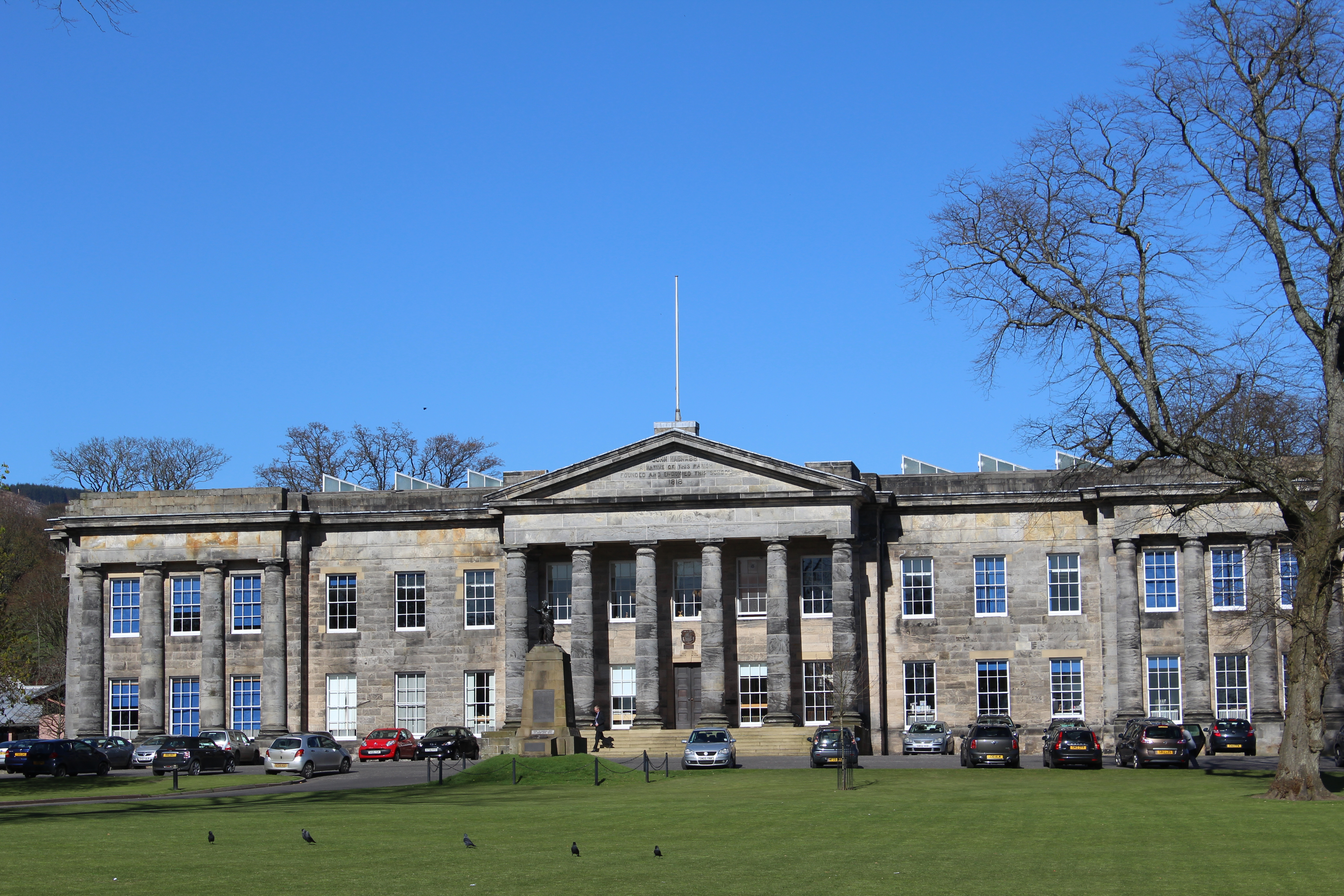
Dollar Academy — Playfair Building. Photograph: Leslie Barrie, 18 April 2014. Geograph photograph via Wikimedia Commons; CC BY-SA 2.0. Full composition retained.

In brief
Playfair’s Doric school frontage survives around a substantially reconstructed interior and anchors the planned nineteenth-century town.
Quick facts
- Date
- 1818–20; interior rebuilt after the 1961 fire, reopened 1966
- Architect / designer
- William Henry Playfair; later reconstruction
- Designation
- Listed building, Category A (LB24546)
- OS grid reference
- NS 96122 98192
A school with a monumental front
William Henry Playfair’s ashlar building dates from 1818–20. A six-column central portico and attached columns at the ends organise its long, two-storey frontage. The original T-shaped plan has been altered, and the surviving exterior should not be mistaken for an intact nineteenth-century interior.
Foundation and reconstruction
Andrew Mylne became the first rector in 1818 after a bequest from John McNabb. The Academy’s own history acknowledges that ships McNabb captained, owned or leased were involved in four voyages transporting enslaved people to the West Indies in 1789–91.
The 1961 fire
Fire destroyed the Playfair Building’s interior in 1961. The school records that reconstruction inserted three classroom floors within the older shell; it reopened in 1966. This remains a working school: use public viewpoints and the Academy’s own arrangements rather than treating the grounds or classrooms as freely accessible.
Sources and further reading
- Historic Environment Scotland — Dollar Academy, LB24546 — Category A listing, mapped reference, Playfair’s 1818–20 design and the rebuilt interior.
- Dollar Academy — history — Foundation, Andrew Mylne and John McNabb; the school’s acknowledgement of McNabb’s links with slave voyages; Playfair, the 1961 fire and 1966 reopening.
Explore Dollar
The Dollar Place entry connects the glen, old town, Academy and valley routes.
Location
OS grid reference NS 96122 98192 · Location confidence: High — HES mapped National Grid Reference transformed from OSGB36 to WGS84 · Select the marker to open its satellite view in Google Maps. On desktop, drag Pegman (the yellow figure) onto a blue road. On mobile, turn on the Street View layer and tap a blue road. Other photo markers may be user-contributed.
Suggest a marker correction
Suggest a more accurate position
The teal marker is the current published position. The orange marker starts slightly to its right so both remain visible; this is only a visual starting position. Tap the correct place on the map or drag the orange marker. Sending this form creates a private review entry only; it does not move the published marker.
Check this area in Google Maps Choose the Satellite layer there if useful.
Map: © OpenStreetMap contributors. You can also enter checked coordinates below.