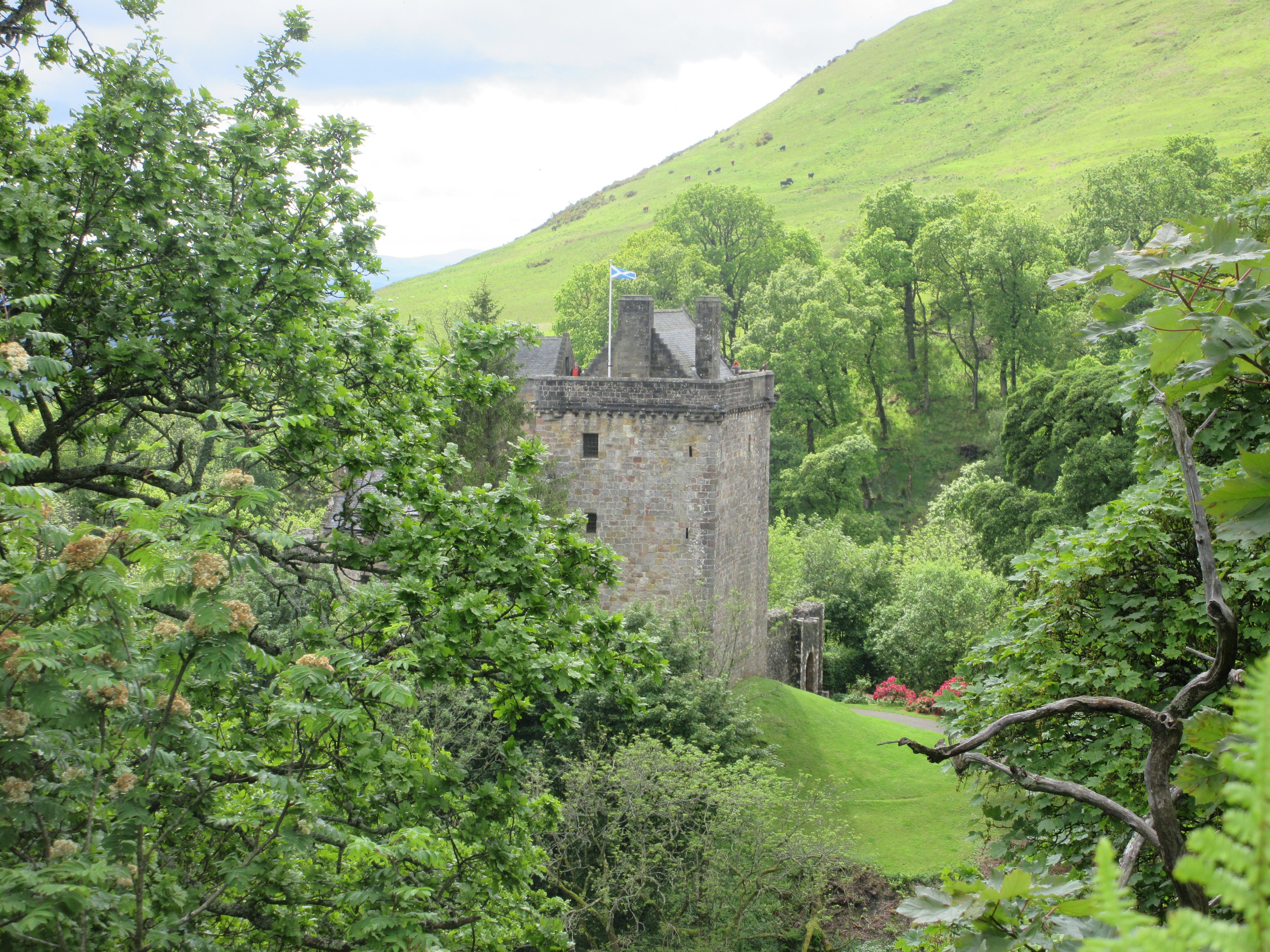
Castle Campbell from the north-east. Photograph: Scott Cormie, 2 June 2019. Geograph photograph via Wikimedia Commons; CC BY-SA 2.0. Full composition retained.

In brief
A tower-house, courtyard ranges and terraced gardens occupy a rocky spur above Dollar’s wooded gorges.
Quick facts
- Date
- Medieval castle with principal surviving fabric of the later fourteenth to seventeenth centuries; later picturesque landscape
- Architect / designer
- Successive builders; individual designers not securely identified
- Designation
- Scheduled monument; Inventory of Gardens and Designed Landscapes (SM13611; GDL00089)
- OS grid reference
- NS 96124 99290
A castle above two ravines
The Burns of Care and Sorrow cut around the spur on which Castle Campbell stands. The north tower is the earliest substantial standing range, dated by HES to the later fourteenth to mid-fifteenth century. A hall range followed around 1500, and the eastern galleries and loggia developed around 1600. The mound beneath the tower may preserve an earlier timber castle, but that remains an archaeological possibility.
Gardens and a wider landscape
Terraces below the castle form part of a separate designed-landscape inventory, GDL00089. Later picturesque walks changed how the wooded glen was experienced. The place called John Knox’s Pulpit should not be treated as proof of where he preached: HES questions that tradition and identifies the surviving feature as a nineteenth-century addition.
Visiting
The castle and glen have different managers and access arrangements. Consult HES and the National Trust for Scotland before visiting; steep, uneven paths and deep gorges require care. A designation or map marker does not establish a safe route.
Sources and further reading
- Historic Environment Scotland — Castle Campbell, SM13611 — Scheduling, mapped location and development of the tower, courtyard ranges and gardens, including possible earlier castle remains.
- Historic Environment Scotland — Castle Campbell designed landscape, GDL00089 — Separate landscape inventory, garden terraces, nineteenth-century picturesque walks and the disputed Knox’s Pulpit tradition.
- National Trust for Scotland — Dollar Glen — Woodland gorges, Burns of Care and Sorrow, habitats and the distinction between the glen and HES-managed castle.
- Historic Environment Scotland — visiting Castle Campbell — The responsible operator’s current visitor guidance and access information.
Explore Dollar
The Dollar Place entry connects the glen, old town, Academy and valley routes.
Location
OS grid reference NS 96124 99290 · Location confidence: High — HES mapped National Grid Reference transformed from OSGB36 to WGS84 · Select the marker to open its satellite view in Google Maps. On desktop, drag Pegman (the yellow figure) onto a blue road. On mobile, turn on the Street View layer and tap a blue road. Other photo markers may be user-contributed.
Suggest a marker correction
Suggest a more accurate position
The teal marker is the current published position. The orange marker starts slightly to its right so both remain visible; this is only a visual starting position. Tap the correct place on the map or drag the orange marker. Sending this form creates a private review entry only; it does not move the published marker.
Check this area in Google Maps Choose the Satellite layer there if useful.
Map: © OpenStreetMap contributors. You can also enter checked coordinates below.
In these guides: Families, Clans and Architecture: The Campbells and Inveraray