In brief
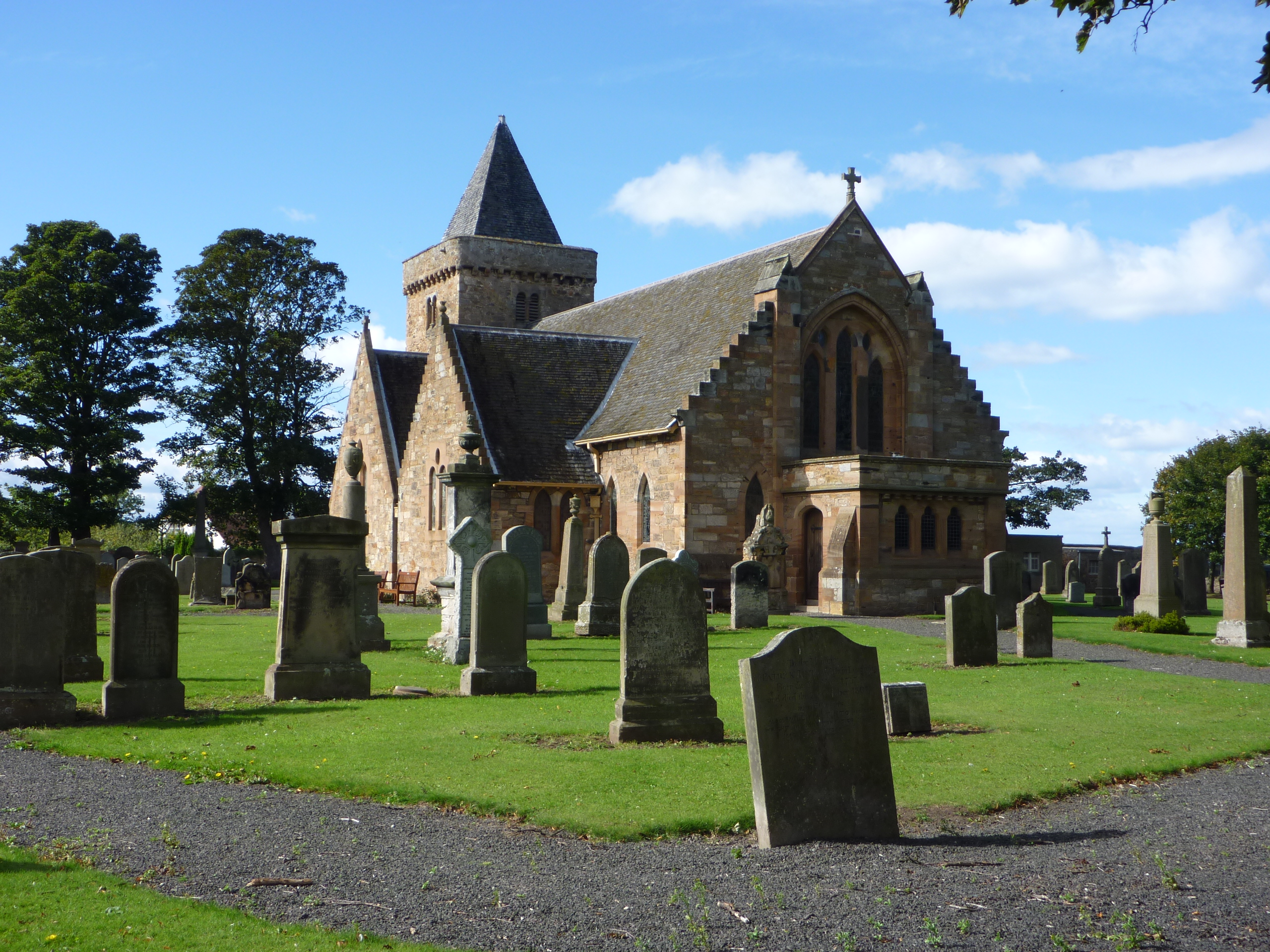
Aberlady Parish Church is not one building campaign but a sequence. The west tower is the clearest medieval survival. Sixteenth- and seventeenth-century burial aisles remain beside a nave rebuilt in 1773 and substantially recast by William Young in 1886. The result is a village church in which medieval, post-Reformation and Victorian fabric can be read together.


Quick facts
- National designation
- Category A listed building, LB6508
- Grid reference
- NT 46179 79850
- Main phases
- Medieval tower; burial aisles; 1773 nave; 1886 remodelling
- Access note
- Designation does not imply public access; current arrangements should be checked with the church
Medieval church and later rebuilding
The medieval parish was held by the bishops and monastery of Dunkeld. Documentary evidence records work to the choir in 1509–11, although that choir no longer survives. The west tower and possible fragments in the north wall carry the strongest evidence of the earlier church; the burial aisles mark later local patronage.
The 1773 rebuilding retained the tower and north-side aisles. William Young’s work of 1886 reshaped the body of the church again, so the present appearance should not be described simply as medieval or Georgian.
Early Christian fragment
A carved cross-shaft fragment was found built into the manse wall in 1863. The original is held by the National Museum of Scotland; a cast is displayed at the church. This is evidence for early Christian activity in the locality, but it does not by itself establish the exact form of an earlier church on the present footprint.
Sources
- Historic Environment Scotland — LB6508 — Current Category A listing, architectural description, phases, fittings and ecclesiastical use.
- Corpus of Scottish Medieval Parish Churches — Aberlady — Medieval ownership and fabric, 1509–11 choir work, later rebuilding and the early Christian cross-shaft fragment.
Explore the Place
Read the wider landscape and settlement story on the Aberlady Place page.
Location
OS grid reference NT 46179 79850 · Location confidence: High — coordinates derived from the current HES designation map reference · Select the marker to open its satellite view in Google Maps. On desktop, drag Pegman (the yellow figure) onto a blue road. On mobile, turn on the Street View layer and tap a blue road. Other photo markers may be user-contributed.
Suggest a marker correction
Suggest a more accurate position
The teal marker is the current published position. The orange marker starts slightly to its right so both remain visible; this is only a visual starting position. Tap the correct place on the map or drag the orange marker. Sending this form creates a private review entry only; it does not move the published marker.
Check this area in Google Maps Choose the Satellite layer there if useful.
Map: © OpenStreetMap contributors. You can also enter checked coordinates below.