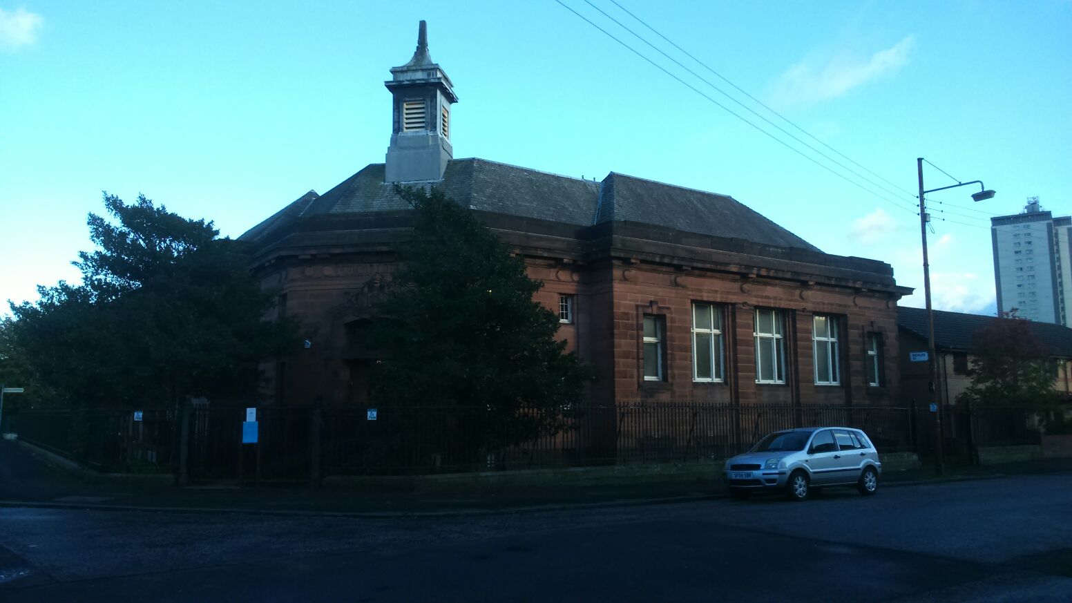


A boldly detailed interwar library continues to serve Whiteinch with books, study, events and digital services.
Quick facts
- Date
- Built 1923
- Architect / designer
- Glasgow Office of Public Works
- Type
- Red-sandstone district public library
- Designation
- Listed building, Category B (LB32283)
- OS grid reference
- NS 54108 67032
Architecture and continuing use
The single-storey, basemented L-plan building turns the corner with a strongly moulded entrance, enriched fanlight and carefully composed red-sandstone fronts.
Its story
Glasgow’s Office of Public Works designed the district library in 1923. It remains one of the city’s operating public libraries.
Why it is included
It demonstrates how interwar municipal architecture brought a carefully designed public interior into an expanding district.
What to notice
- Corner entrance and moulded surround.
- Warm red sandstone.
- L-plan response to the street corner.
Reading the surroundings
The library is free to enter during published hours. A ramp leads to the entrance and Glasgow Life provides current accessibility details.
Timeline
- Built 1923 Glasgow’s Office of Public Works designed the district library in 1923. It remains one of the city’s operating public libraries.
- Present Operating Glasgow public library and community venue.
What we know — and what remains uncertain
Opening hours and programmes change; confirm them with Glasgow Life.
Sources & further reading
- Historic Environment Scotland: Whiteinch Library, LB32283 — Designation category, mapped location, construction phases, fabric, authorship and architectural interest.
- Glasgow Life: Whiteinch Library — Current library operation, history, opening, services, access and address.
Location
OS grid reference NS 54108 67032 · Location confidence: High: the HES designation provides an official mapped National Grid Reference and the current source confirms the Place relationship or present identity. · Select the marker to open its satellite view in Google Maps. On desktop, drag Pegman (the yellow figure) onto a blue road. On mobile, turn on the Street View layer and tap a blue road. Other photo markers may be user-contributed.
Suggest a marker correction
Suggest a more accurate position
The teal marker is the current published position. The orange marker starts slightly to its right so both remain visible; this is only a visual starting position. Tap the correct place on the map or drag the orange marker. Sending this form creates a private review entry only; it does not move the published marker.
Check this area in Google Maps Choose the Satellite layer there if useful.
Map: © OpenStreetMap contributors. You can also enter checked coordinates below.