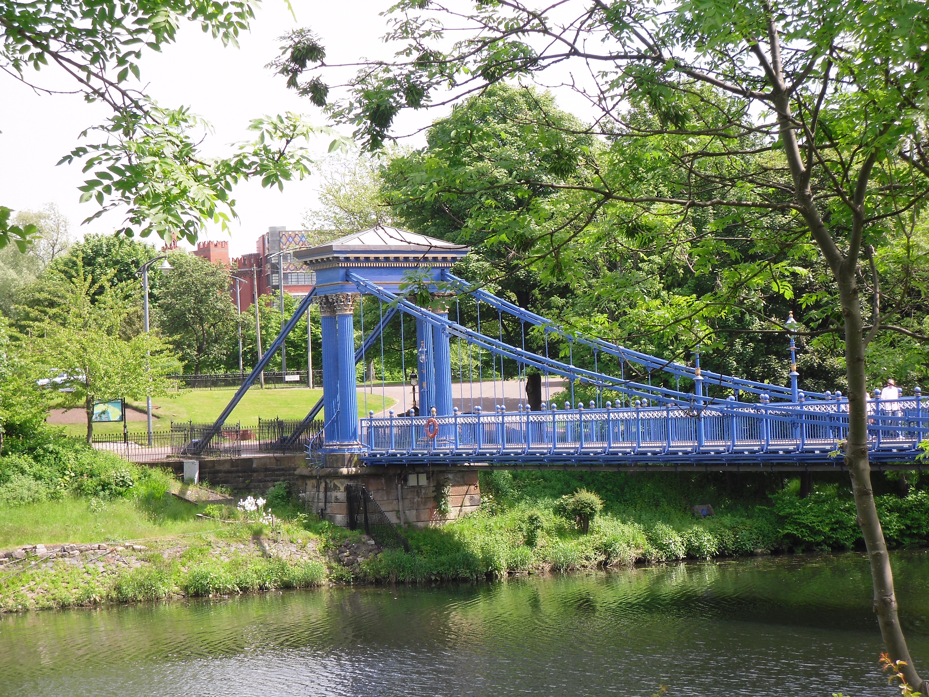
Image: St Andrew’s Suspension Bridge by Stevie Spiers, 3 June 2010, sourced from Wikimedia Commons and licensed under CC BY-SA 2.0.

Paired Corinthian columns and flat-link chains carry a light pedestrian crossing between Glasgow Green and the south bank.
Quick facts
- Date
- Built 1853–1855
- Architect / designer
- Neil Robson and Charles O’Neill
- Type
- Cast-iron pedestrian suspension bridge
- Designation
- Listed building, Category A (LB33692)
- OS grid reference
- NS 59959 64002
Architecture and continuing use
Cast-iron pylons group paired Corinthian columns around the suspension chains. Flat links support a lattice-girder deck, while iron railings continue the deliberately architectural treatment at each end.
Its story
The bridge opened in the mid-1850s to replace a ferry, connecting Hutchesontown with Glasgow Green. It remains part of the riverside walking and cycling network.
Why it is included
Its combination of elegant classical ironwork, civil engineering and continuing everyday use makes it one of the Green’s most rewarding structures.
What to notice
- Paired Corinthian columns at the pylons.
- Flat suspension links above the deck.
- Views along the Clyde toward the Green and city centre.
Reading the surroundings
Use the shared crossing considerately and follow any temporary closures. River conditions, wet surfaces and cyclists require attention; never climb the chains or pylons.
Timeline
- Built 1853–1855 The bridge opened in the mid-1850s to replace a ferry, connecting Hutchesontown with Glasgow Green. It remains part of the riverside walking and cycling network.
- Present Public pedestrian and cycle crossing of the River Clyde.
What we know — and what remains uncertain
Maintenance and lighting condition can change; current public use was checked through recent council material, but on-site restrictions take precedence.
Sources & further reading
- Historic Environment Scotland: St Andrew’s Suspension Bridge, LB33692 — Designation status, mapped location, construction phases, fabric, authorship and architectural or historical interest.
- The Glasgow Story: St Andrew’s Footbridge — Glasgow Museums-supported history, dimensions, materials and connection to Glasgow Green.
- Glasgow City Council: Clyde infrastructure motion — Recent council evidence that the bridge remains part of the city’s managed public infrastructure.
Location
OS grid reference NS 59959 64002 · Location confidence: High: the statutory designation supplies an official mapped National Grid Reference and the current source confirms the Place relationship or present identity. · Select the marker to open its satellite view in Google Maps. On desktop, drag Pegman (the yellow figure) onto a blue road. On mobile, turn on the Street View layer and tap a blue road. Other photo markers may be user-contributed.
Suggest a marker correction
Suggest a more accurate position
The teal marker is the current published position. The orange marker starts slightly to its right so both remain visible; this is only a visual starting position. Tap the correct place on the map or drag the orange marker. Sending this form creates a private review entry only; it does not move the published marker.
Check this area in Google Maps Choose the Satellite layer there if useful.
Map: © OpenStreetMap contributors. You can also enter checked coordinates below.