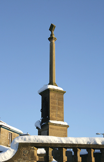
Image: Selkirk War Memorial by Walter Baxter, sourced from Wikimedia Commons and licensed under CC BY-SA 2.0.
.jpg)
Lorimer’s terraced stone setting culminates in a cross and sculpted Victory, combining architecture, landscape and commemoration.
Quick facts
- Date
- 1922; later Second World War panel
- Architect / designer
- Sir Robert Lorimer; sculpture by Thomas J. Clapperton
- Type
- Formal civic war memorial
- Designation
- Listed building, Category A (LB40581)
- OS grid reference
- NT 46917 28538
Architecture, archaeology and continuing use
Whinstone walls, ashlar steps and balustrades rise through formal levels to an octagonal shaft and Maltese cross. Bronze name panels and Clapperton’s figure of Victory are integrated into the composition rather than applied to a simple monument.
Its story
The memorial was completed after the First World War as a civic focus for Selkirk’s dead. A later central panel records losses from the Second World War, and the site continues to anchor collective remembrance.
Why it is included
Category A status, major designers and the unusually complete architectural setting make this one of Selkirk’s strongest twentieth-century works.
What to notice
- Stepped formal terraces.
- Bronze plaques within curved stonework.
- Victory figure below the Maltese cross.
Reading the surroundings
Approach respectfully from public space, keep steps clear and never climb on walls, sculpture or the cross. During ceremonies, follow stewarding and avoid intrusive photography of participants or mourners.
Timeline
- 1922 The completed memorial established a formal civic place of remembrance.
- After 1945 A central bronze panel added the names of Second World War dead.
What we know — and what remains uncertain
Ceremony dates and access management change annually and should be checked with local organisers.
Sources & further reading
- Historic Environment Scotland: Selkirk War Memorial, LB40581 — Designation status, mapped location, date, fabric and architectural or archaeological interest.
- Scottish Borders Council: Selkirk town trail — Public heritage interpretation, Place relationship and memorial context.
Location
OS grid reference NT 46917 28538 · Location confidence: High: the national designation supplies an official mapped National Grid Reference; the independent source confirms the Place relationship, history or current identity. · Select the marker to open its satellite view in Google Maps. On desktop, drag Pegman (the yellow figure) onto a blue road. On mobile, turn on the Street View layer and tap a blue road. Other photo markers may be user-contributed.
Suggest a marker correction
Suggest a more accurate position
The teal marker is the current published position. The orange marker starts slightly to its right so both remain visible; this is only a visual starting position. Tap the correct place on the map or drag the orange marker. Sending this form creates a private review entry only; it does not move the published marker.
Check this area in Google Maps Choose the Satellite layer there if useful.
Map: © OpenStreetMap contributors. You can also enter checked coordinates below.