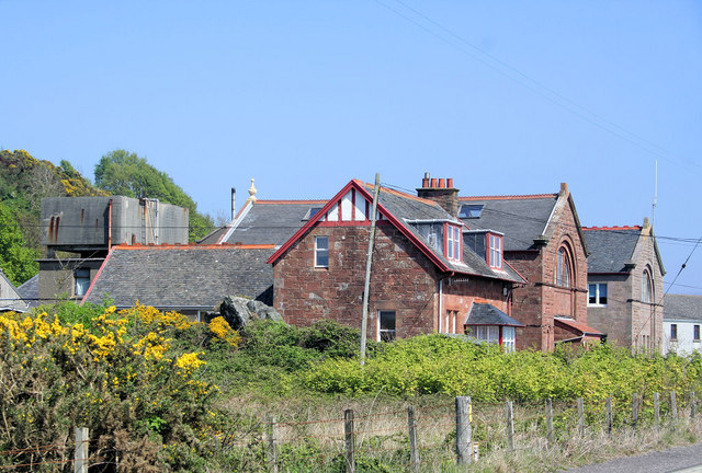
Gabled stone laboratories record the growth of marine research on Great Cumbrae from the late nineteenth century.


Quick facts
- Date
- 1896–97; additions in 1904 and 1939
- Architect
- Peter Macgregor Chalmers; later J. B. Wilson, Son & Honeyman
- Designation
- Category C listed building, LB52288
- OS grid reference
- NS 17556 54505
From the Ark to a permanent station
Marine work at Millport began before this building. John Murray brought the floating laboratory Ark to the bay in 1885, joining the investigations of local naturalist David Robertson. A permanent station gave that activity a more substantial base. Later work by Sheina Marshall and Andrew Picken Orr helped establish the importance of Calanus in marine food systems.
A building enlarged for science
Peter Macgregor Chalmers designed the western wing in 1896–97. An addition followed in 1904, and J. B. Wilson, Son & Honeyman supplied the eastern wing in 1939. The resulting U-shaped building uses red and cream rubble, slate roofs and prominent gables. Large semicircular windows on the seaward fronts are particularly distinctive.
Research, teaching and collections
The statutory history connects the expansions with aquarium, classroom, museum and library provision. The fabric therefore records changes in scientific practice as well as increasing accommodation. The Robertson Building is listed at Category C. The listing’s interior observations date from 2014; they are not a statement of present access or condition.
Sources and further reading
- Historic Environment Scotland — Robertson Building, LB52288 — Category C designation, phased construction, architects, fabric and official location.
- North Ayrshire Heritage Trails — Marine Station — The Ark, Robertson, Murray and marine research.
Location
OS grid reference NS 17556 54505 · Location confidence: HES statutory grid point transformed from OSGB36 to WGS84; approximate building location, not an entrance or designation boundary. · Select the marker to open its satellite view in Google Maps. On desktop, drag Pegman (the yellow figure) onto a blue road. On mobile, turn on the Street View layer and tap a blue road. Other photo markers may be user-contributed.
Suggest a marker correction
Suggest a more accurate position
The teal marker is the current published position. The orange marker starts slightly to its right so both remain visible; this is only a visual starting position. Tap the correct place on the map or drag the orange marker. Sending this form creates a private review entry only; it does not move the published marker.
Check this area in Google Maps Choose the Satellite layer there if useful.
Map: © OpenStreetMap contributors. You can also enter checked coordinates below.