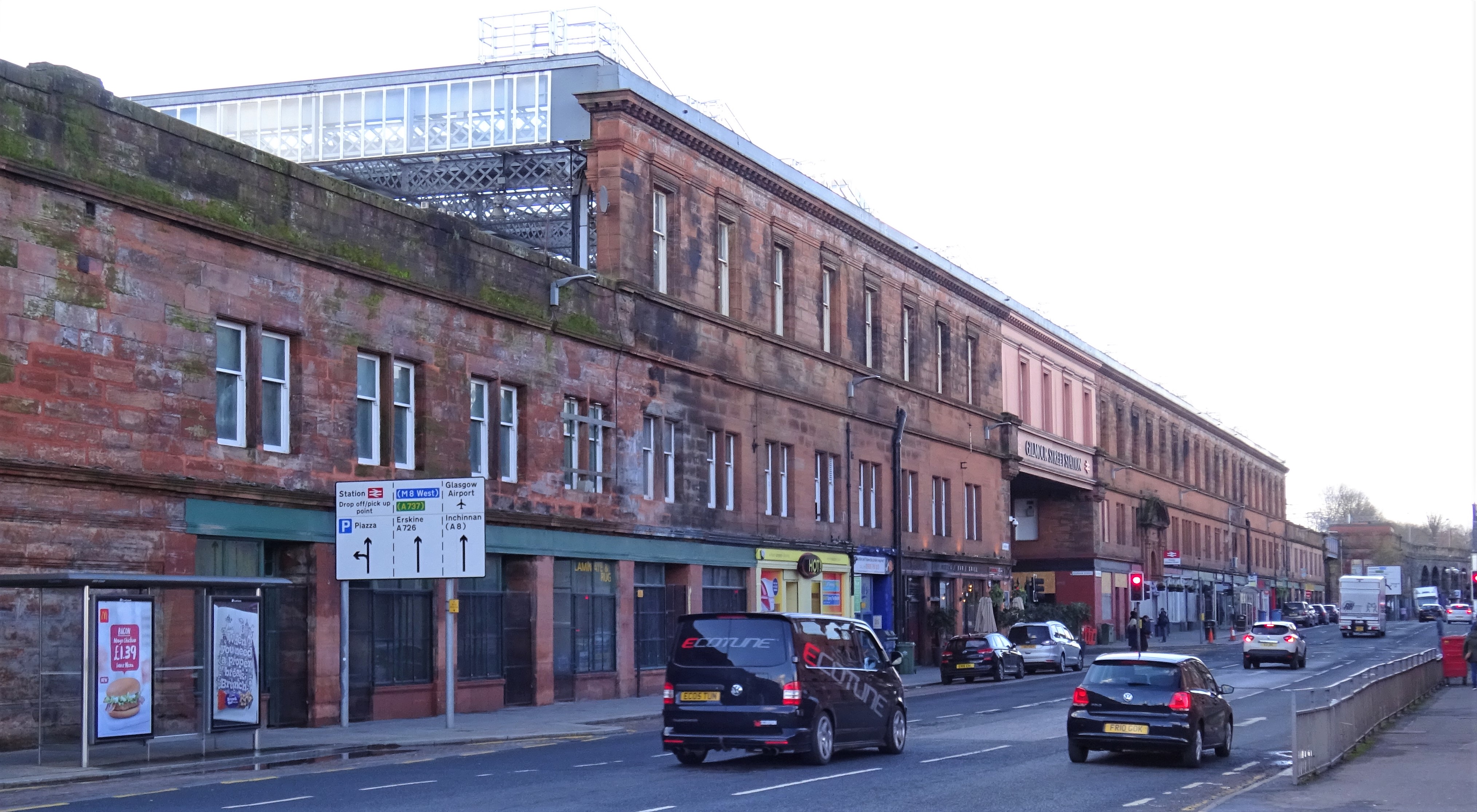


A battlemented Tudor station masks the complex engineering of bridge, viaduct and later red-sandstone extensions at Paisley’s principal rail interchange.
Quick facts
- Date
- Built about 1840; extended in 1866–1868 and again in the later nineteenth century
- Architect / designer
- Original designer not securely identified in the designation; major extension by Blyth and Cunningham
- Type
- Castellated Tudor railway station with viaduct, bridge and later Renaissance ranges
- Designation
- Listed building, Category B (LB38950)
- OS grid reference
- NS 48310 64230
Architecture and continuing use
The early five-bay front uses octagonal turrets, a four-centred entrance and battlements. Curved additions, viaduct arches and the long nineteenth-century track-level range reveal repeated expansion.
Its story
Built for the Glasgow and Paisley Joint Railway about 1840, the station expanded in 1866–1868 and again when additional tracks were laid in the 1880s.
Why it is included
It is both a key surviving early railway building and a living transport hub whose architecture makes Paisley’s nineteenth-century metropolitan connections visible.
What to notice
- The battlemented County Square frontage and octagonal turrets.
- Differences between the early castellated range and later Renaissance-style extension.
- Viaduct arches and bridge structures supporting the working railway above the streets.
Reading the surroundings
This is an operating station. Use designated passenger entrances and platforms, obey rail-safety instructions and consult ScotRail for step-free routes and assistance.
Timeline
- Built about 1840 Built for the Glasgow and Paisley Joint Railway about 1840, the station expanded in 1866–1868 and again when additional tracks were laid in the 1880s..
- Present Active staffed ScotRail railway station with passenger services and station facilities.
What we know — and what remains uncertain
The station is a multi-phase working complex and operational alterations continue. The designation does not securely name the architect of the original 1840 range.
Sources & further reading
- Historic Environment Scotland: Paisley Gilmour Street Station, LB38950 — Designation category, exact grid reference, construction phases, fabric, authorship and significance.
- ScotRail: Paisley Gilmour Street station — Current passenger use, address, facilities, accessibility and live travel-planning context.
Location
OS grid reference NS 48310 64230 · Location confidence: High: the statutory designation supplies an exact National Grid Reference and a current official, operator or responsible-organisation source confirms the Place relationship. · Select the marker to open its satellite view in Google Maps. On desktop, drag Pegman (the yellow figure) onto a blue road. On mobile, turn on the Street View layer and tap a blue road. Other photo markers may be user-contributed.
Suggest a marker correction
Suggest a more accurate position
The teal marker is the current published position. The orange marker starts slightly to its right so both remain visible; this is only a visual starting position. Tap the correct place on the map or drag the orange marker. Sending this form creates a private review entry only; it does not move the published marker.
Check this area in Google Maps Choose the Satellite layer there if useful.
Map: © OpenStreetMap contributors. You can also enter checked coordinates below.