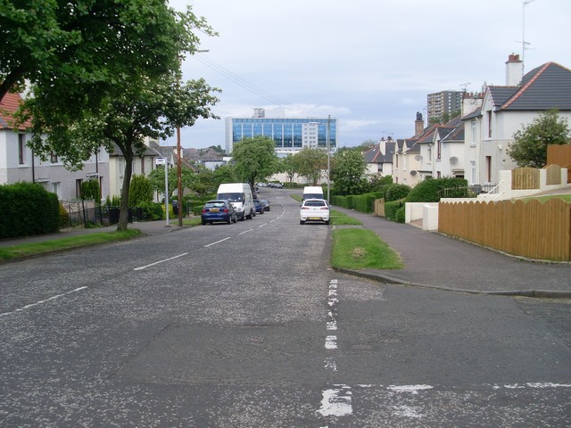
A municipal garden suburb of terraced, semi-detached and flatted cottages, laid out around the contours of a hill.
Quick facts
Date: 1920s
Design and delivery: Glasgow Corporation housing programme
Designation: Estate record; no single whole-estate listing asserted
A low-rise municipal suburb
Mosspark’s 1920s streets accommodated terraced houses, semi-detached houses and cottage flats. Trees, gardens and roads following the hillside gave the estate a spacious suburban character.
A cottage flat places separate homes on ground and upper floors within a low-rise building. Such buildings can resemble a large house from the street, while accommodating more than one household. Mosspark’s combination of types provided a range of layouts within a broadly consistent scale.
Design and affordability
The Corporation’s high standards of construction and generous planning also brought comparatively high rents. The Glasgow City Archives account describes many original occupants as skilled workers with steady employment.
The photograph looks along Mosspark Drive towards the later college building. Garden boundaries, trees and pitched roofs remain prominent in the street, while individual alterations and surface finishes distinguish neighbouring houses.
Location and Photos
Mosspark Boulevard, Mosspark Drive and the adjoining public streets allow the layout to be followed on foot. Gardens and house entrances are private.


Explore further
Sources & further reading
- Glasgow City Archives / TheGlasgowStory, Mosspark Housing — Municipal origin, house types, hillside layout and rent levels.
- Historic Environment Scotland, Trove, Ashdale Drive — Representative location within the estate.
Location
OS grid reference NS 5457 6307 · Location confidence: Representative Ashdale Drive location from HES Trove place 163263. · Select the marker to open its satellite view in Google Maps. On desktop, drag Pegman (the yellow figure) onto a blue road. On mobile, turn on the Street View layer and tap a blue road. Other photo markers may be user-contributed.
Suggest a marker correction
Suggest a more accurate position
The teal marker is the current published position. The orange marker starts slightly to its right so both remain visible; this is only a visual starting position. Tap the correct place on the map or drag the orange marker. Sending this form creates a private review entry only; it does not move the published marker.
Check this area in Google Maps Choose the Satellite layer there if useful.
Map: © OpenStreetMap contributors. You can also enter checked coordinates below.
In these guides: Public Housing in Scotland: A Photo Guide to Designs and Types