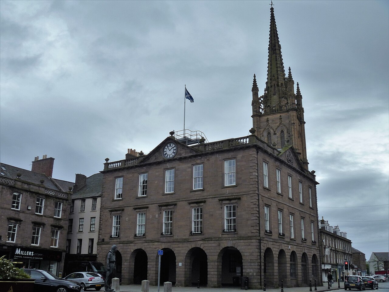
Image: Montrose Town House by Michael Dibb, sourced from Wikimedia Commons and licensed under CC BY-SA 2.0.
.jpg)
Set prominently within Montrose’s unusually broad High Street, the town house preserves the burgh’s civic centre in restrained eighteenth-century stone.
Quick facts
- Date
- Built 1763–1764; additional storey added in 1819
- Architect / designer
- John Hutcheson; later alterations
- Type
- Neoclassical burgh town house and former guildhall
- Designation
- Listed building, Category A (LB38083)
- OS grid reference
- NO 71452 57791
Architecture and continuing use
A symmetrical classical frontage and regular sash windows give the building calm authority. Its raised position beside the parish church makes the pair a defining composition in the High Street.
Its story
The burgh built a dedicated town house in 1763–1764, replacing civic functions previously associated with the medieval tolbooth. Guild funding helped add another storey in 1819, and the building remains in council use.
Why it is included
It anchors Montrose’s townscape and carries a rare continuity from royal-burgh government to present-day local public service.
What to notice
- The regular classical rhythm of the High Street elevation.
- Evidence in the masonry for the extra storey added in 1819.
- The close architectural relationship with the parish church and wide market space.
Reading the surroundings
This is a working council building and meeting place. Public entry depends on service or appointment arrangements; use council information before visiting.
Timeline
- Built 1763–1764 The burgh built a dedicated town house in 1763–1764, replacing civic functions previously associated with the medieval tolbooth.
- Present Active Angus Council locality hub, meeting place and civic building.
What we know — and what remains uncertain
The building has multiple civic phases and uses; the current description does not imply that every historic room remains accessible or unchanged.
Sources & further reading
- Historic Environment Scotland: Montrose Town House, LB38083 — Designation category, exact grid reference, construction phases, fabric, authorship and significance.
- Angus Council: meeting places — Current council use of Montrose Townhouse as a public meeting location.
Location
OS grid reference NO 71452 57791 · Location confidence: High: the statutory designation supplies an exact National Grid Reference and the current operator confirms the building and address. · Select the marker to open its satellite view in Google Maps. On desktop, drag Pegman (the yellow figure) onto a blue road. On mobile, turn on the Street View layer and tap a blue road. Other photo markers may be user-contributed.
Suggest a marker correction
Suggest a more accurate position
The teal marker is the current published position. The orange marker starts slightly to its right so both remain visible; this is only a visual starting position. Tap the correct place on the map or drag the orange marker. Sending this form creates a private review entry only; it does not move the published marker.
Check this area in Google Maps Choose the Satellite layer there if useful.
Map: © OpenStreetMap contributors. You can also enter checked coordinates below.