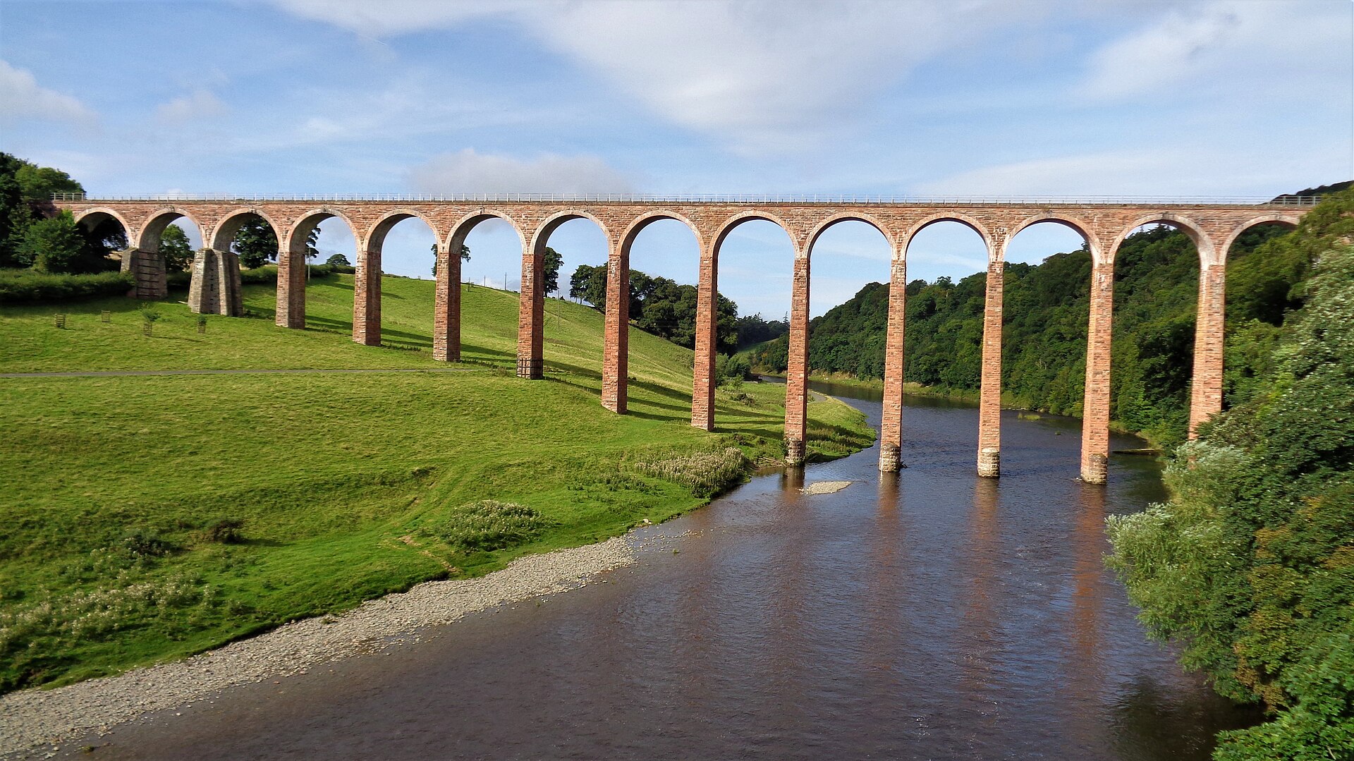
Nineteen slender arches lift a former railway 126 feet above the Tweed, making transport engineering the dominant landmark at Leaderfoot.
Quick facts
- Date
- 1865; line severed 1948; operational use ended 1965
- Architect / designer
- Charles Jopp with Wylie and Peddie
- Type
- Nineteen-arch railway viaduct
- Designation
- Listed building, Category A (LB15145)
- OS grid reference
- NT 57385 34743
Architecture and continuing use
Red sandstone piers rise to brick arches, each spanning forty-three feet. Repetition, height and narrow proportions give the structure an exceptional lightness despite its mass. Later strengthening at the end piers is subordinate to the long nineteenth-century rhythm.
Its story
The viaduct opened in 1865 for the Berwickshire Railway, linking the Waverley Route with Duns and Reston. Flood damage severed the line in 1948, though limited operational use continued until 1965. Repairs and strengthening in the early 1990s helped preserve the disused structure.
Why it is included
Category A listing recognises an exceptional railway work whose scale, engineering and relationship with neighbouring road bridges explain changing regional movement.
What to notice
- Nineteen equal arches stepping across the valley.
- Red sandstone piers beneath contrasting brick arch rings.
- Views that place rail, eighteenth-century road and modern road bridges together.
Reading the surroundings
Do not go onto the viaduct: it is fenced and not a public walkway. Use council-promoted paths and viewpoints, keep clear of fast roads and respect riverside conditions.
Timeline
- 1865 The Berwickshire Railway opened its high crossing of the Tweed.
- 1948 Flood damage severed the branch line.
- 1965 Remaining operational use of the viaduct ended.
- 1992–95 Strengthening work stabilised parts of the disused structure.
What we know — and what remains uncertain
It can be viewed but not crossed. Path, parking and road conditions can change, so current council information and on-site signs take precedence.
Sources & further reading
- Historic Environment Scotland: Leaderfoot Viaduct, LB15145 — Current designation status, official mapped location, date, fabric and architectural or archaeological interest.
- Trove designation: LB15145 — Parallel national record identity and archival context.
- Scottish Borders Council: easy access paths — Official public path and viewpoint guidance for Leaderfoot.
- Railscot: Leaderfoot Viaduct — Railway history and explicit confirmation that the viaduct itself is fenced and inaccessible.
Location
OS grid reference NT 57385 34743 · Location confidence: High: the current national designation supplies an exact mapped National Grid Reference; public text separately states access and current-use uncertainty. · Select the marker to open its satellite view in Google Maps. On desktop, drag Pegman (the yellow figure) onto a blue road. On mobile, turn on the Street View layer and tap a blue road. Other photo markers may be user-contributed.
Suggest a marker correction
Suggest a more accurate position
The teal marker is the current published position. The orange marker starts slightly to its right so both remain visible; this is only a visual starting position. Tap the correct place on the map or drag the orange marker. Sending this form creates a private review entry only; it does not move the published marker.
Check this area in Google Maps Choose the Satellite layer there if useful.
Map: © OpenStreetMap contributors. You can also enter checked coordinates below.
Leaderfoot Viaduct. Photograph: Kevin Waterhouse, 11 September 2016. CC BY-SA 2.0.
