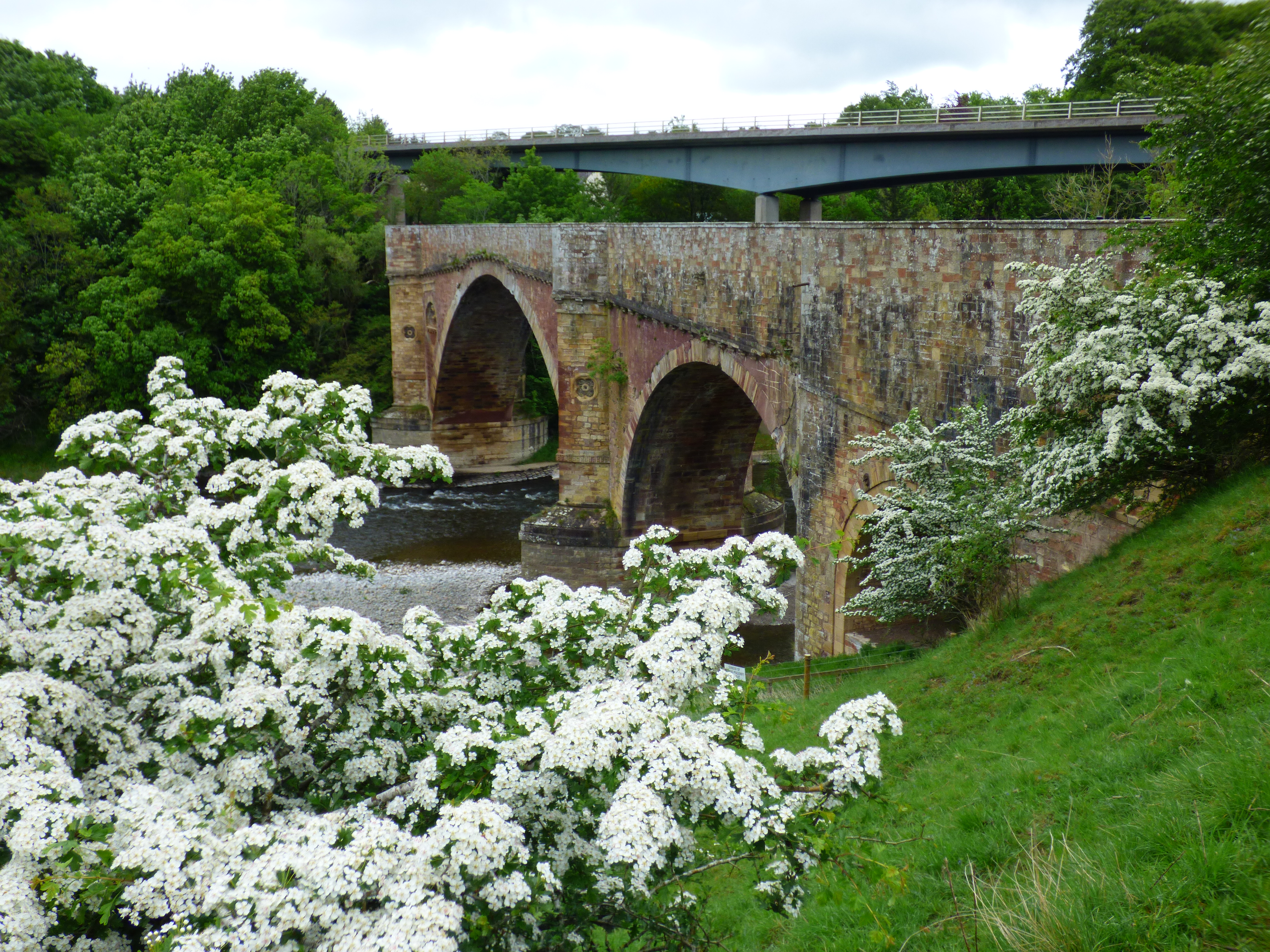
Image: Drygrange Old Bridge and New Bridge by Niki.L, 22 May 2022, sourced from Wikimedia Commons and licensed under CC BY-SA 4.0.

A broad central arch, pioneering cutwaters and carved urn panels make a former A68 crossing an outstanding work of Georgian engineering.
Quick facts
- Date
- 1778–80; bypassed 1974
- Architect / designer
- Alexander Stevens senior
- Type
- Three-main-span ashlar and rubble road bridge
- Designation
- Listed building, Category A (LB15106)
- OS grid reference
- NT 57530 34668
Architecture and continuing use
The bridge crosses the Tweed with a 105-foot segmental centre arch flanked by two round arches and a smaller opening. Curved and pointed cutwaters, weight-saving internal cavities, quatrefoil medallions, urn roundels and a dentilled string course unite technical experiment with architectural refinement.
Its story
Alexander Stevens designed the bridge between 1778 and 1780 to replace an earlier ferry route. It carried trunk-road traffic until a new A68 bridge opened in 1974. Removal of vehicles allowed the historic crossing to become a viewpoint toward Leaderfoot Viaduct and the modern bridge.
Why it is included
Category A listing recognises innovative late-eighteenth-century engineering and a key member of an intervisible group tracing two centuries of bridge design.
What to notice
- Prow-like cutwaters at the main piers.
- Urn ornaments recessed into the spandrels.
- The very thin crown of the broad central arch.
Reading the surroundings
Cross by the promoted path and keep within parapets. Watch for cyclists, wet stone and river hazards; do not climb the masonry or approach repair areas.
Timeline
- 1778–80 Stevens built an innovative road bridge over the Tweed.
- 1974 A modern replacement removed A68 traffic from the historic crossing.
- 2024–25 Scottish Borders Council completed masonry repairs.
- 2026 Council access guidance continues to promote the old bridge as a Leaderfoot viewpoint.
What we know — and what remains uncertain
The bridge’s historic Fly Boat name refers to an earlier ferry. Temporary maintenance or weather conditions may alter pedestrian access.
Sources & further reading
- Historic Environment Scotland: Drygrange Old Bridge, LB15106 — Current designation status, official mapped location, date, fabric and architectural or archaeological interest.
- Trove designation: LB15106 — Parallel national record identity and archival context.
- Scottish Borders Council: easy access paths — Official guidance for the accessible path across the old bridge and Leaderfoot views.
- Scottish Borders Council: 2024–25 roads and bridges programme — Official confirmation that masonry repairs to the B6361 old bridge were completed.
Location
OS grid reference NT 57530 34668 · Location confidence: High: the current national designation supplies an exact mapped National Grid Reference; public text separately states access and current-use uncertainty. · Select the marker to open its satellite view in Google Maps. On desktop, drag Pegman (the yellow figure) onto a blue road. On mobile, turn on the Street View layer and tap a blue road. Other photo markers may be user-contributed.
Suggest a marker correction
Suggest a more accurate position
The teal marker is the current published position. The orange marker starts slightly to its right so both remain visible; this is only a visual starting position. Tap the correct place on the map or drag the orange marker. Sending this form creates a private review entry only; it does not move the published marker.
Check this area in Google Maps Choose the Satellite layer there if useful.
Map: © OpenStreetMap contributors. You can also enter checked coordinates below.