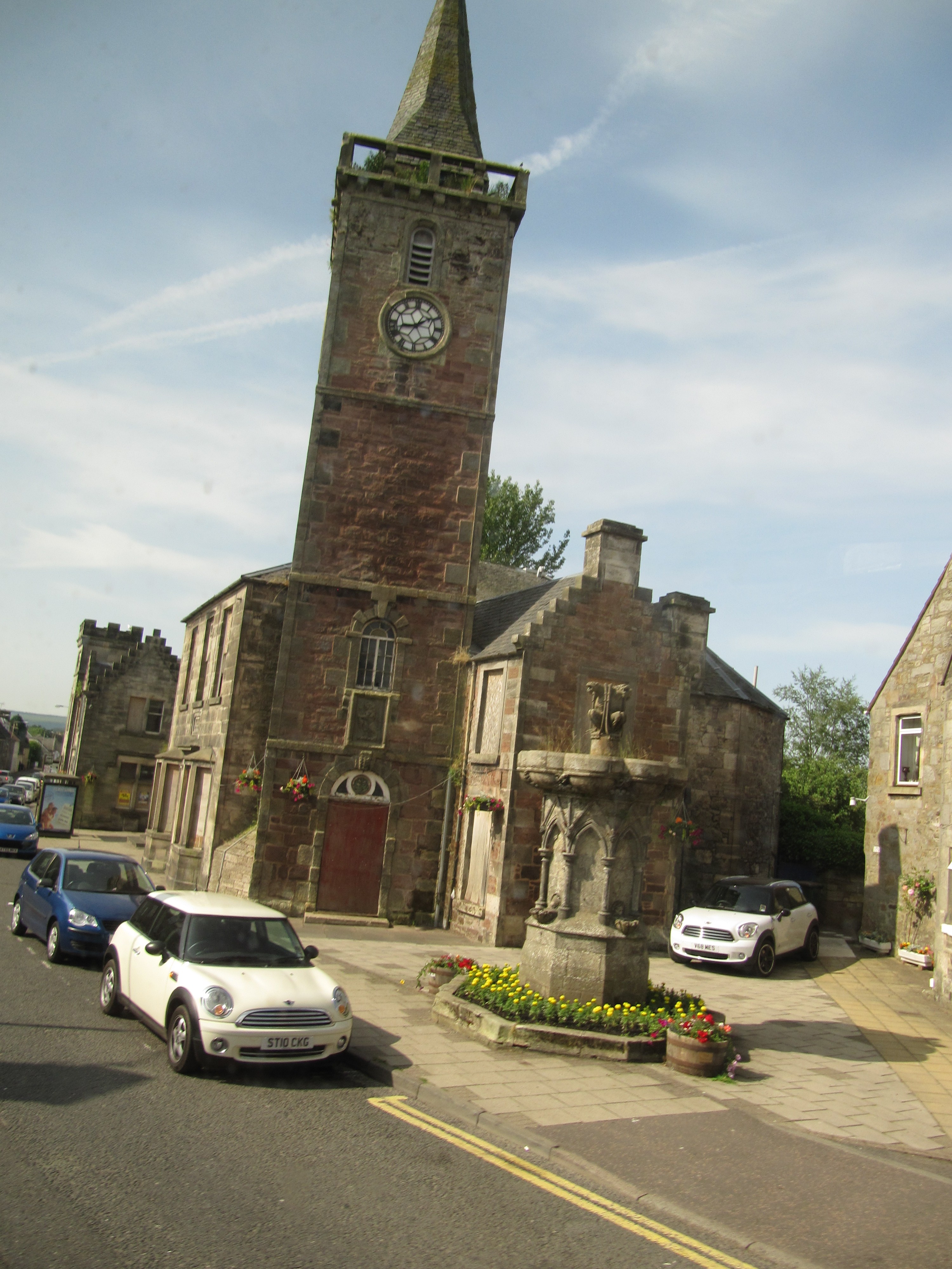


The lone survivor of an eighteenth-century parish kirk became a civic landmark through its later clock, belfry and links to the town-hall group.
Quick facts
- Date
- Completed 1751; clock and belfry fittings added 1875
- Architect / designer
- Designer unrecorded; built for the former parish kirk
- Type
- Four-stage church steeple adapted as a civic clock tower
- Designation
- Listed building, Category B (LB36297)
- OS grid reference
- NO 11929 02087
Architecture, archaeology and continuing use
A four-stage rubble tower rises from a round-headed Gibbs-style doorway to a corbelled balustrade and broach spire. Grey ashlar dressings sharpen the red sandstone, and the upper stage combines a clock face, louvred belfry, weathervane and surviving mechanism.
Its story
The steeple was completed in 1751 for a parish church begun in the 1740s. When a new kirk opened in Station Road, the old church body was removed but the tower remained. A clock was installed in 1875 and later civic buildings gathered closely around it.
Why it is included
Category B listing recognises a rare surviving fragment that connects worship, timekeeping and municipal identity at the centre of Kinross.
What to notice
- Carved thistle and fanlight above the entrance.
- Change from blind middle stages to the clock and belfry.
- Cockerel weathervane at the spire tip.
Reading the surroundings
Inspect from the public pavement and civic forecourt without blocking entrances. The stairs, clock mechanism and belfry are not presented as routinely open; seek explicit permission for any interior visit.
Timeline
- 1742–43 A new parish church was erected with provision for a separate steeple campaign.
- 1751 The four-stage tower reached completion.
- 1832 A replacement kirk opened and the older church body was subsequently removed.
- 1875 Clockwork and the belfry treatment established its modern civic role.
What we know — and what remains uncertain
The public record does not establish normal interior opening arrangements or a named original designer.
Sources & further reading
- Historic Environment Scotland: Kinross Clock Tower, LB36297 — Current designation status, mapped location, date, fabric and architectural or archaeological interest.
- Trove designation: LB36297 — Parallel national record identity and archival context.
- Perth and Kinross Council: Kinross conservation area appraisal — Townscape context for the clock tower and the adjacent civic group.
Location
OS grid reference NO 11929 02087 · Location confidence: High: the current national designation supplies an exact mapped National Grid Reference; public text separately states access and current-use uncertainty. · Select the marker to open its satellite view in Google Maps. On desktop, drag Pegman (the yellow figure) onto a blue road. On mobile, turn on the Street View layer and tap a blue road. Other photo markers may be user-contributed.
Suggest a marker correction
Suggest a more accurate position
The teal marker is the current published position. The orange marker starts slightly to its right so both remain visible; this is only a visual starting position. Tap the correct place on the map or drag the orange marker. Sending this form creates a private review entry only; it does not move the published marker.
Check this area in Google Maps Choose the Satellite layer there if useful.
Map: © OpenStreetMap contributors. You can also enter checked coordinates below.