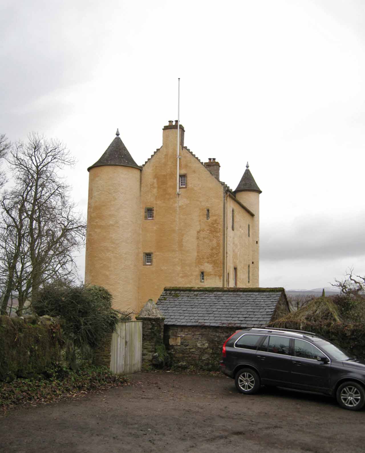
Image: Kinkell Castle by Richard Dorrell, sourced from Wikimedia Commons and licensed under CC BY-SA 2.0.
.jpg)
A compact late sixteenth-century tower house combines vaulted rooms, gunloops and circular stairs with a modern restoration that rescued it from abandonment.
Quick facts
- Date
- 1594; restored from 1966 to 1969
- Architect / designer
- Original mason unknown; restoration associated with Gerald Laing
- Type
- Harled Z-plan tower house with stair towers, gunloops and vaulted ground floor
- Designation
- Listed building, Category A (LB14906)
- OS grid reference
- NH 55388 54333
Architecture, archaeology and continuing use
The harled three-storey and attic house approximates a Z-plan. A circular stair tower rises at one corner and a smaller turret is corbelled out above first-floor level; crowsteps, steep slate roofs, vaulted ground rooms, gunloops and a dated hall fireplace retain the fortified character.
Its story
The hall fireplace records 1594, when Kinkell belonged to the Mackenzies of Gairloch. After agricultural use and abandonment, sculptor Gerald Laing led a restoration from 1966, removing a later wing and returning the tower to occupation by 1969.
Why it is included
Category A listing recognises a nationally important compact tower house whose defensive planning, interior vaults and carefully documented modern rescue remain unusually legible.
What to notice
- The larger circular stair tower and smaller corbelled turret.
- Gunloops at ground level and near the entrance.
- Crowstepped gables above the harled walls.
Reading the surroundings
The castle is private. Do not enter its drive, walls or studio-cottage area without explicit permission; use distant lawful viewpoints only.
Timeline
- 1594 The dated fireplace marks the late sixteenth-century tower-house phase.
- 19th–20th centuries Farm use was followed by abandonment and deterioration.
- 1966–1969 Gerald Laing’s restoration returned the tower to occupation.
What we know — and what remains uncertain
The exact survival of original internal finishes and the current relationship between castle, wall and studio cottage were not inspected.
Sources & further reading
- Historic Environment Scotland: Kinkell Castle, LB14906 — Designation status, mapped location, date, fabric and architectural or archaeological interest.
- Highland HER: Kinkell Castle — Castle plan, historical ownership, abandonment and twentieth-century restoration.
- Clan Mackenzie Initiative: Kinkell Castle — Clan-land context and the castle’s position near Conon Bridge.
Location
OS grid reference NH 55388 54333 · Location confidence: High: the national designation supplies an official mapped National Grid Reference; an additional source confirms the Place relationship, history or current identity. · Select the marker to open its satellite view in Google Maps. On desktop, drag Pegman (the yellow figure) onto a blue road. On mobile, turn on the Street View layer and tap a blue road. Other photo markers may be user-contributed.
Suggest a marker correction
Suggest a more accurate position
The teal marker is the current published position. The orange marker starts slightly to its right so both remain visible; this is only a visual starting position. Tap the correct place on the map or drag the orange marker. Sending this form creates a private review entry only; it does not move the published marker.
Check this area in Google Maps Choose the Satellite layer there if useful.
Map: © OpenStreetMap contributors. You can also enter checked coordinates below.