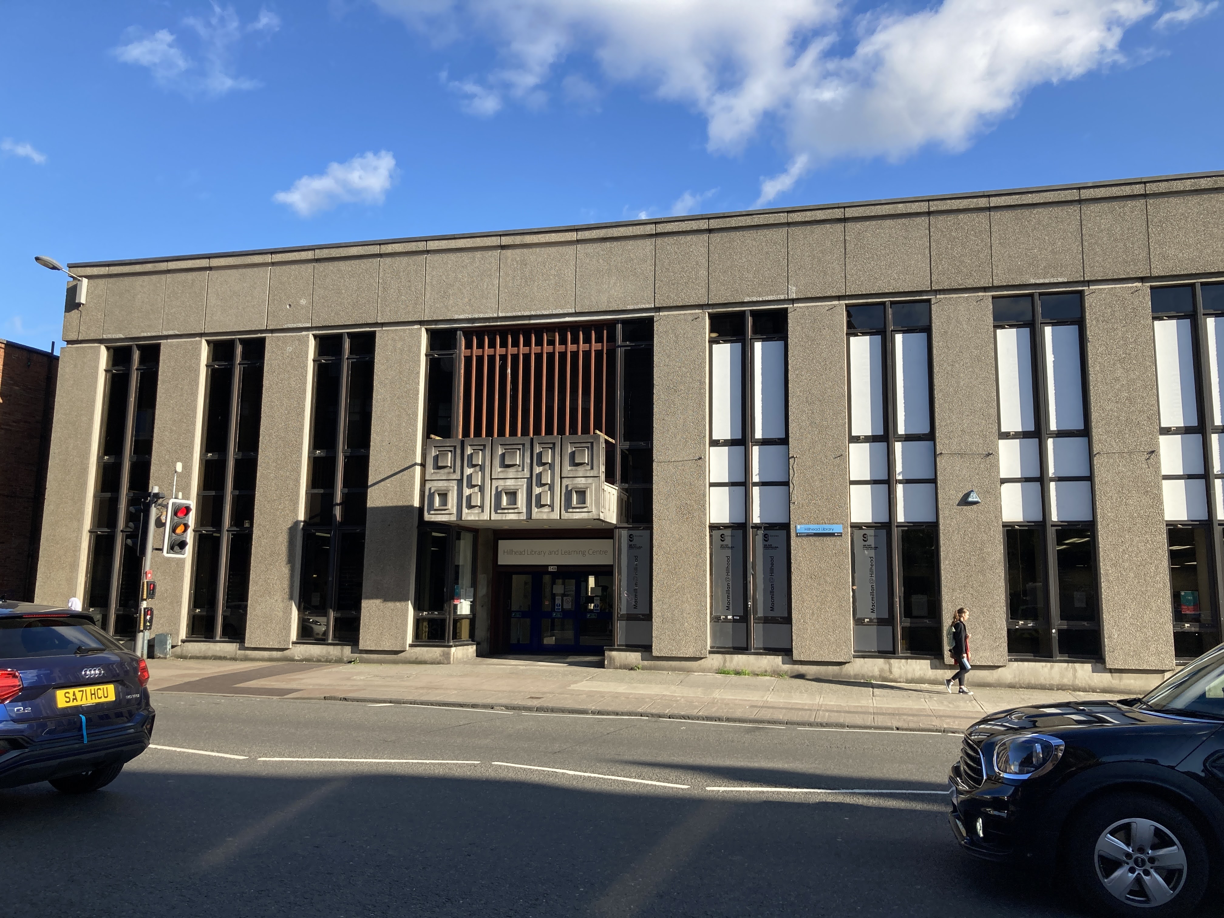


A bold concrete library remains a busy civic interior on Byres Road.
Quick facts
- Date
- Built 1972
- Architect / designer
- Robert Rogerson and Philip Spence with Glasgow Corporation Planning Department
- Type
- Purpose-built post-war Modernist public library
- Designation
- Listed building, Category B (LB52401)
- OS grid reference
- NS 56737 67220
Architecture and continuing use
A reinforced-concrete frame, narrow vertical windows, precast pilasters and a large cantilevered entrance canopy give the ten-bay façade sculptural weight.
Its story
Completed in 1972, Hillhead is a rare little-altered Scottish post-war library and continues to provide books, study, events and community rooms.
Why it is included
It brings high-quality late Modernism and a thriving public service into the architectural directory.
What to notice
- Tall narrow windows between concrete pilasters.
- Cantilevered decorative entrance canopy.
- The library’s prominent Byres Road frontage.
Reading the surroundings
The library is free to enter during published opening hours; use current accessibility and service information.
Timeline
- Built 1972 Completed in 1972, Hillhead is a rare little-altered Scottish post-war library and continues to provide books, study, events and community rooms.
- Present Operating Glasgow public library and community venue.
What we know — and what remains uncertain
Programmes and hours change; consult Glasgow Life before a dedicated visit.
Sources & further reading
- Historic Environment Scotland: Hillhead Library, LB52401 — Designation category, mapped location, construction phases, fabric, authorship and architectural interest.
- Glasgow Life: Hillhead Library — Current opening, services, events, access and address.
Location
OS grid reference NS 56737 67220 · Location confidence: High: the HES designation provides an official mapped National Grid Reference and the current source confirms the Place relationship or present identity. · Select the marker to open its satellite view in Google Maps. On desktop, drag Pegman (the yellow figure) onto a blue road. On mobile, turn on the Street View layer and tap a blue road. Other photo markers may be user-contributed.
Suggest a marker correction
Suggest a more accurate position
The teal marker is the current published position. The orange marker starts slightly to its right so both remain visible; this is only a visual starting position. Tap the correct place on the map or drag the orange marker. Sending this form creates a private review entry only; it does not move the published marker.
Check this area in Google Maps Choose the Satellite layer there if useful.
Map: © OpenStreetMap contributors. You can also enter checked coordinates below.