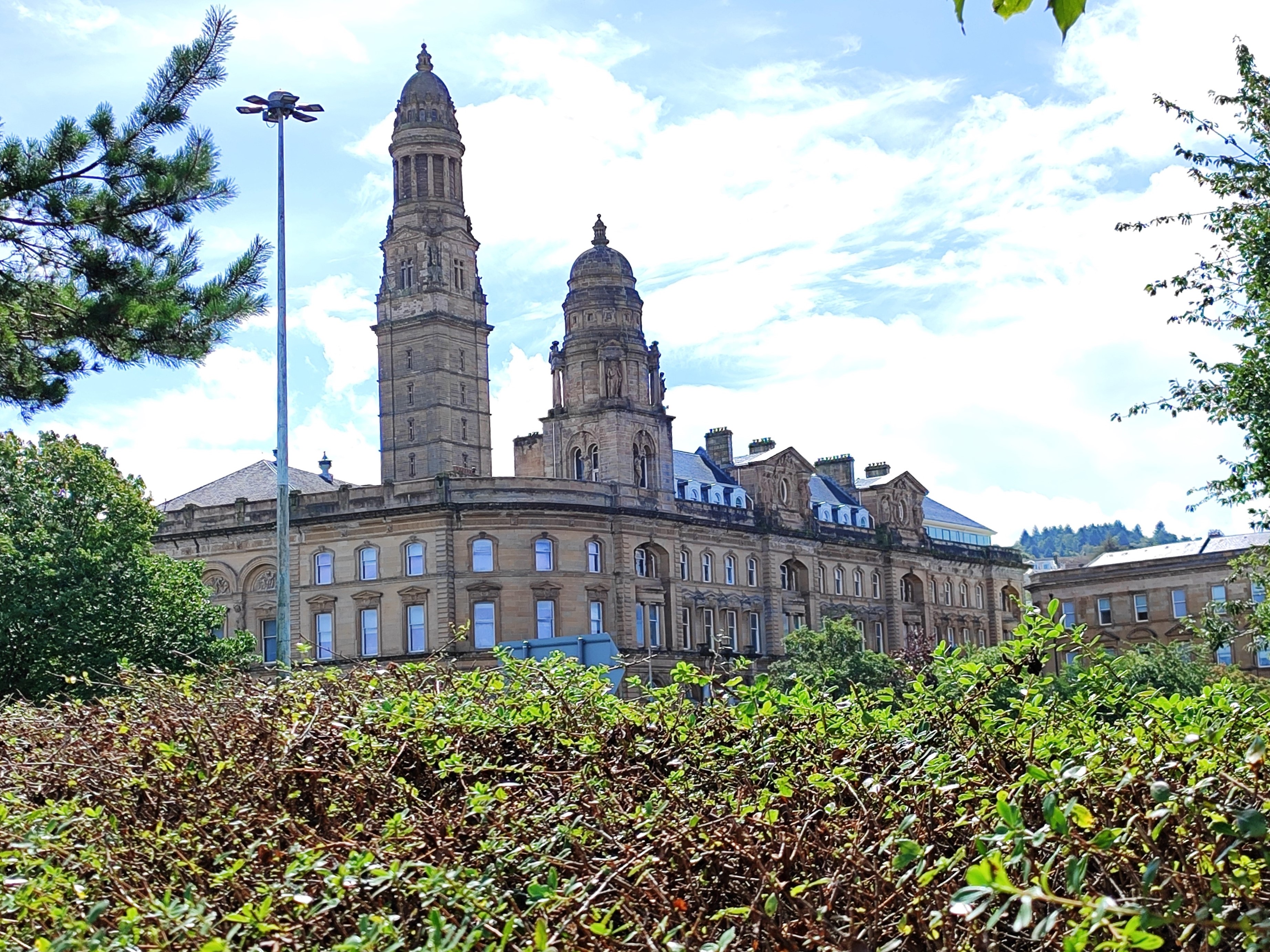
Image: Greenock Municipal Buildings above Clyde Square by Ilana Gillon, sourced from Wikimedia Commons and licensed under CC BY-SA 4.0.

A vast late-Victorian municipal complex whose dome-capped Victoria Tower, sculpture and offices express Greenock’s growth as an industrial and maritime town.
Quick facts
- Date
- Foundation stone laid 6 August 1881; completed 1886
- Architect / designer
- H. and D. Barclay, architects
- Type
- Municipal offices and town hall complex
- Designation
- Category A listed building (LB34122)
- OS grid reference
- NS 27987 76208
Government built at city scale
The Municipal Buildings occupy a large urban block in a richly modelled Renaissance and Italianate composition. Granite columns, carved figures, niches and the tall Victoria Tower turn the practical work of local government into a conspicuous civic landmark.
Its story
The foundation stone was laid on 6 August 1881 for a complex designed by the Glasgow architects H. and D. Barclay. Council records describe accommodation for municipal meetings and departments including police, cleansing and sanitary services. The buildings were completed in 1886 around the earlier Town Hall, creating a complex with several distinct historic phases.
Why it is included
It links architecture to the rapid growth, public administration and confidence of late-19th-century Greenock while remaining part of the town’s working civic infrastructure.
What to notice
- The Victoria Tower as a town-wide landmark rather than simply an element of one facade.
- The dense sculptural treatment, including granite columns, figures and niches described in the statutory listing.
- The interrupted corner known as Cowan’s Corner, where the intended composition was never completed.
Reading the surroundings
The complex addresses Clyde Square and several adjoining streets. Its scale and incomplete corner are best understood by walking around the public streets rather than viewing only the tower from a distance.
Timeline
- 6 August 1881 The foundation stone of the Municipal Buildings was laid.
- 1886 Inverclyde Council’s venue history gives this as the completion year.
- 1941 The shop occupying the uncompleted corner was destroyed during wartime bombing, leaving the opening now called Cowan’s Corner.
- 2024 A major external restoration of the Town Hall element was completed.
- Today The complex continues to contain Inverclyde Council offices and the working Town Hall venue.
What we know — and what remains uncertain
The listed complex contains the Municipal Buildings erected from 1881 and fabric associated with an earlier Town Hall that was altered in 1858. This record keeps those phases distinct and does not describe the entire block as a single 1880s construction.
Sources & further reading
- Historic Environment Scotland: Greenock Municipal Buildings, LB34122 — Designation, date, architects, architectural description and grid reference.
- Trove: Greenock Municipal Buildings — National record cross-reference, coordinates, archive holdings and historic classifications.
- Inverclyde Council: venue hire — Municipal Buildings — Completion date, Cowan’s Corner account and present council-office and venue use.
- Inverclyde Council: Greenock Town Hall restoration — Relationship between the Town Hall and Municipal Buildings, ownership and the 2024 restoration.
Location
OS grid reference NS 27987 76208 · Location confidence: High: Historic Environment Scotland and Trove give matching national-grid and coordinate locations. · Select the marker to open its satellite view in Google Maps. On desktop, drag Pegman (the yellow figure) onto a blue road. On mobile, turn on the Street View layer and tap a blue road. Other photo markers may be user-contributed.
Suggest a marker correction
Suggest a more accurate position
The teal marker is the current published position. The orange marker starts slightly to its right so both remain visible; this is only a visual starting position. Tap the correct place on the map or drag the orange marker. Sending this form creates a private review entry only; it does not move the published marker.
Check this area in Google Maps Choose the Satellite layer there if useful.
Map: © OpenStreetMap contributors. You can also enter checked coordinates below.