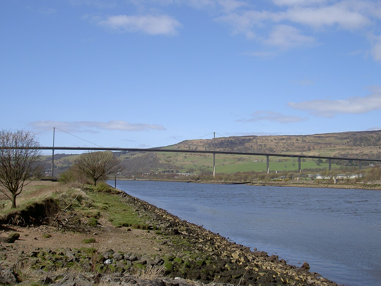
Image: Erskine Bridge by Bruce89, sourced from Wikimedia Commons and licensed under CC BY 2.5.

A slender single-plane cable system carries the A898 high across the Clyde in one of Scotland’s defining post-war engineering works.
Quick facts
- Date
- Designed from 1963; constructed 1967–71
- Architect / designer
- Freeman Fox & Partners; Oleg Kerensky, William Brown and Sir Gilbert Roberts; piers by W. A. Fairhurst & Partners
- Type
- Mono cable-stayed trunk-road bridge
- Designation
- Listed building, Category A (LB52482)
- OS grid reference
- NS 46242 72438
Architecture and continuing use
A 305-metre central span hangs from a single central plane of galvanised cables passing over two pylons. Fourteen diamond-plan concrete piers support an aerofoil box-girder deck, while long approach spans make the complete crossing more than 1.3 kilometres long.
Its story
Design began in 1963 as part of west-central Scotland’s motorway programme, and construction followed from 1967. Princess Anne opened the bridge in 1971, replacing the ferry with the first fixed link between Renfrewshire and Dunbartonshire at this point.
Why it is included
Category A listing recognises Scotland’s first large cable-stayed bridge, an internationally notable early mono-cable design that combines technical economy with an unusually light estuarial profile.
What to notice
- The single cable plane aligned along the deck centre.
- Diamond-shaped piers narrowing toward the roadway.
- The long shallow curve of the approaches before the main span.
Reading the surroundings
Use only the authorised footway or cycle provision and follow current traffic, wind and maintenance restrictions. Never enter the carriageway, bridge structure or works areas; conditions can change rapidly.
Timeline
- 1963 The Erskine Bridge Joint Committee advanced the fixed-crossing design.
- 1967 Foundation and bridge construction began on both sides of the Clyde.
- 1971 Princess Anne opened the completed crossing on 2 July.
- 2018 National listing recognised its exceptional post-war engineering interest.
What we know — and what remains uncertain
Maintenance and traffic arrangements are operational matters and should be checked through Transport Scotland or Traffic Scotland before a visit.
Sources & further reading
- Historic Environment Scotland: Erskine Bridge, LB52482 — Current designation status, mapped location, date, fabric and architectural or archaeological interest.
- Trove designation: LB52482 — Parallel national record identity and archival context.
- Transport Scotland: bridges and structures — Current trunk-road management role and recognition of the A898 Erskine Bridge.
- Transport Scotland: Erskine Bridge turns 50 — Opening date, strategic role, dimensions and continuing traffic use.
Location
OS grid reference NS 46242 72438 · Location confidence: High: the current national designation supplies an exact mapped National Grid Reference; public text separately states access and current-use uncertainty. · Select the marker to open its satellite view in Google Maps. On desktop, drag Pegman (the yellow figure) onto a blue road. On mobile, turn on the Street View layer and tap a blue road. Other photo markers may be user-contributed.
Suggest a marker correction
Suggest a more accurate position
The teal marker is the current published position. The orange marker starts slightly to its right so both remain visible; this is only a visual starting position. Tap the correct place on the map or drag the orange marker. Sending this form creates a private review entry only; it does not move the published marker.
Check this area in Google Maps Choose the Satellite layer there if useful.
Map: © OpenStreetMap contributors. You can also enter checked coordinates below.