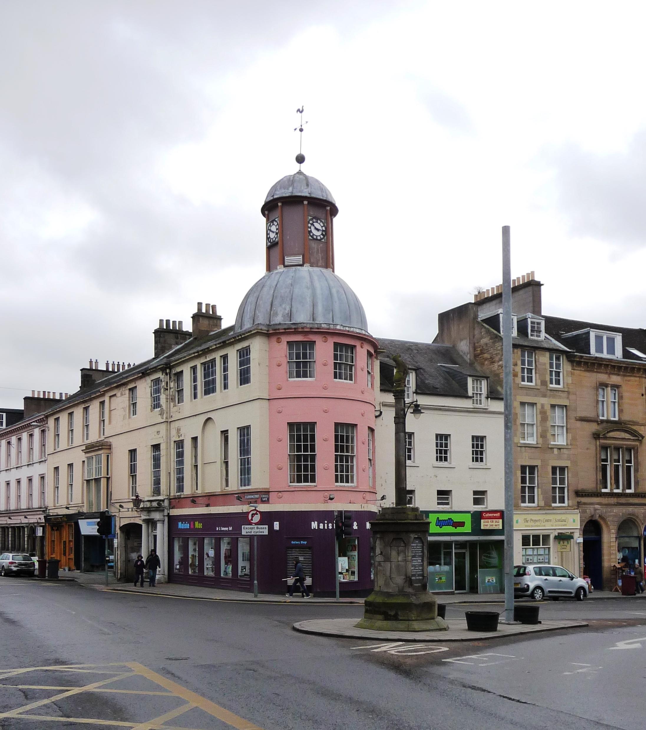


A bowed corner, clock cupola and classical doorway terminate Cupar's civic street with a deliberately urban composition.
Quick facts
- Date
- 1815-17
- Architect / designer
- Robert Hutchison, probably developing a James Gillespie Graham streetscape
- Type
- Classical town hall and burgh chambers with shops
- Designation
- Listed building, Category B (LB24156)
- OS grid reference
- NO 37550 14562
Architecture and continuing use
The three-storey painted-ashlar building is restrained except at the Crossgate bow, where a dome, clock and slender-columned cupola rise above the street. A Roman Doric doorway once announced the council chamber over ground-floor shops.
Its story
Provost John Ferguson promoted a new street after 1809, and Robert Hutchison completed the town hall in 1815-17. Municipal use later ended; a conservation programme repaired the structure and adapted upper floors while retaining shops below.
Why it is included
Its planned relationship to St Catherine Street, surviving civic form and careful reuse make the hall important despite its changed function.
What to notice
- The bow turning the facade into Crossgate.
- The domed clock cupola above the roofline.
- Roman Doric detail beside later shop fronts.
Reading the surroundings
Ground-floor businesses have their own arrangements, and the adapted upper floors are not general public rooms. Appreciate the exterior from pavements without entering private accommodation.
Timeline
- 1809 Provost Ferguson began assembling land for a new civic street.
- 1815-17 Hutchison completed the burgh hall and commercial frontage.
- 2014-19 Townscape investment repaired and adapted the former municipal rooms.
What we know — and what remains uncertain
The checked project source records upper-floor adaptation but does not establish unrestricted visitor access or the occupancy of every unit.
Sources & further reading
- Historic Environment Scotland: Cupar Town Hall and Former Burgh Chambers, LB24156 — Designation category, mapped location, date, fabric, authorship and architectural or historical interest.
- Fife Historic Buildings Trust: Cupar — Conservation programme, former Burgh Chambers repair and adaptive-reuse status.
Location
OS grid reference NO 37550 14562 · Location confidence: High: the statutory designation supplies an official mapped National Grid Reference and the current source confirms the Place relationship or present identity. · Select the marker to open its satellite view in Google Maps. On desktop, drag Pegman (the yellow figure) onto a blue road. On mobile, turn on the Street View layer and tap a blue road. Other photo markers may be user-contributed.
Suggest a marker correction
Suggest a more accurate position
The teal marker is the current published position. The orange marker starts slightly to its right so both remain visible; this is only a visual starting position. Tap the correct place on the map or drag the orange marker. Sending this form creates a private review entry only; it does not move the published marker.
Check this area in Google Maps Choose the Satellite layer there if useful.
Map: © OpenStreetMap contributors. You can also enter checked coordinates below.