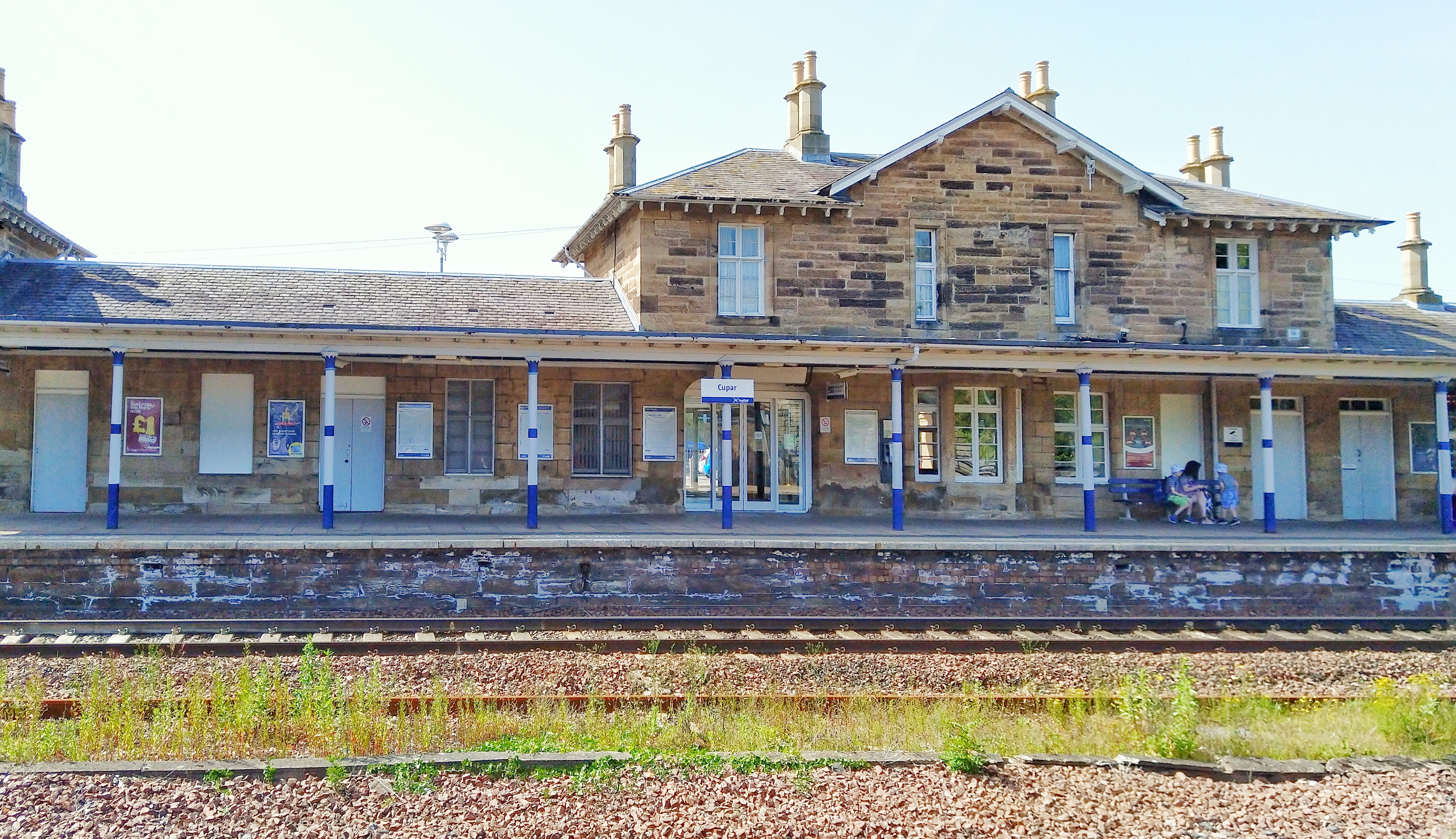


An Italianate station with broad roofs and a cast-iron platform veranda still serves the railway that transformed Cupar's regional connections.
Quick facts
- Date
- 1847
- Architect / designer
- Thomas Grainger for the Edinburgh and Northern Railway
- Type
- Italianate railway station
- Designation
- Listed building, Category B (LB24292)
- OS grid reference
- NO 37665 14313
Architecture and continuing use
A symmetrical ashlar composition centres on paired semi-elliptical entrance arches with an oriel above. Broad eaves, low roofs and the iron platform canopy give the building a distinctive early-railway profile.
Its story
Thomas Grainger's design was considered by the railway company in 1846 and opened with the line in 1847. Continued passenger use has preserved the station as both infrastructure and a town gateway.
Why it is included
Early railway architecture, clear authorship, Category B status and uninterrupted transport use provide strong historical and everyday significance.
What to notice
- Twin entrance arches below the central oriel.
- Deep eaves giving the station a low Italianate outline.
- Cast-iron structure along the working platform.
Reading the surroundings
This is a live station. Use authorised entrances and platforms with a valid travel purpose where required, remain behind safety lines and do not enter operational areas.
Timeline
- 4 March 1846 Railway directors considered Grainger's proposed station plan.
- 1847 The Edinburgh and Northern Railway opened the Cupar stop.
- 2026 Staffed passenger facilities continue to serve regional journeys.
What we know — and what remains uncertain
ScotRail manages the current station, while train services and access hours can change with operational requirements.
Sources & further reading
- Historic Environment Scotland: Cupar Railway Station, LB24292 — Designation category, mapped location, date, fabric, authorship and architectural or historical interest.
- ScotRail: Cupar Station — Current operation, management, passenger facilities, address and accessibility information.
Location
OS grid reference NO 37665 14313 · Location confidence: High: the statutory designation supplies an official mapped National Grid Reference and the current source confirms the Place relationship or present identity. · Select the marker to open its satellite view in Google Maps. On desktop, drag Pegman (the yellow figure) onto a blue road. On mobile, turn on the Street View layer and tap a blue road. Other photo markers may be user-contributed.
Suggest a marker correction
Suggest a more accurate position
The teal marker is the current published position. The orange marker starts slightly to its right so both remain visible; this is only a visual starting position. Tap the correct place on the map or drag the orange marker. Sending this form creates a private review entry only; it does not move the published marker.
Check this area in Google Maps Choose the Satellite layer there if useful.
Map: © OpenStreetMap contributors. You can also enter checked coordinates below.