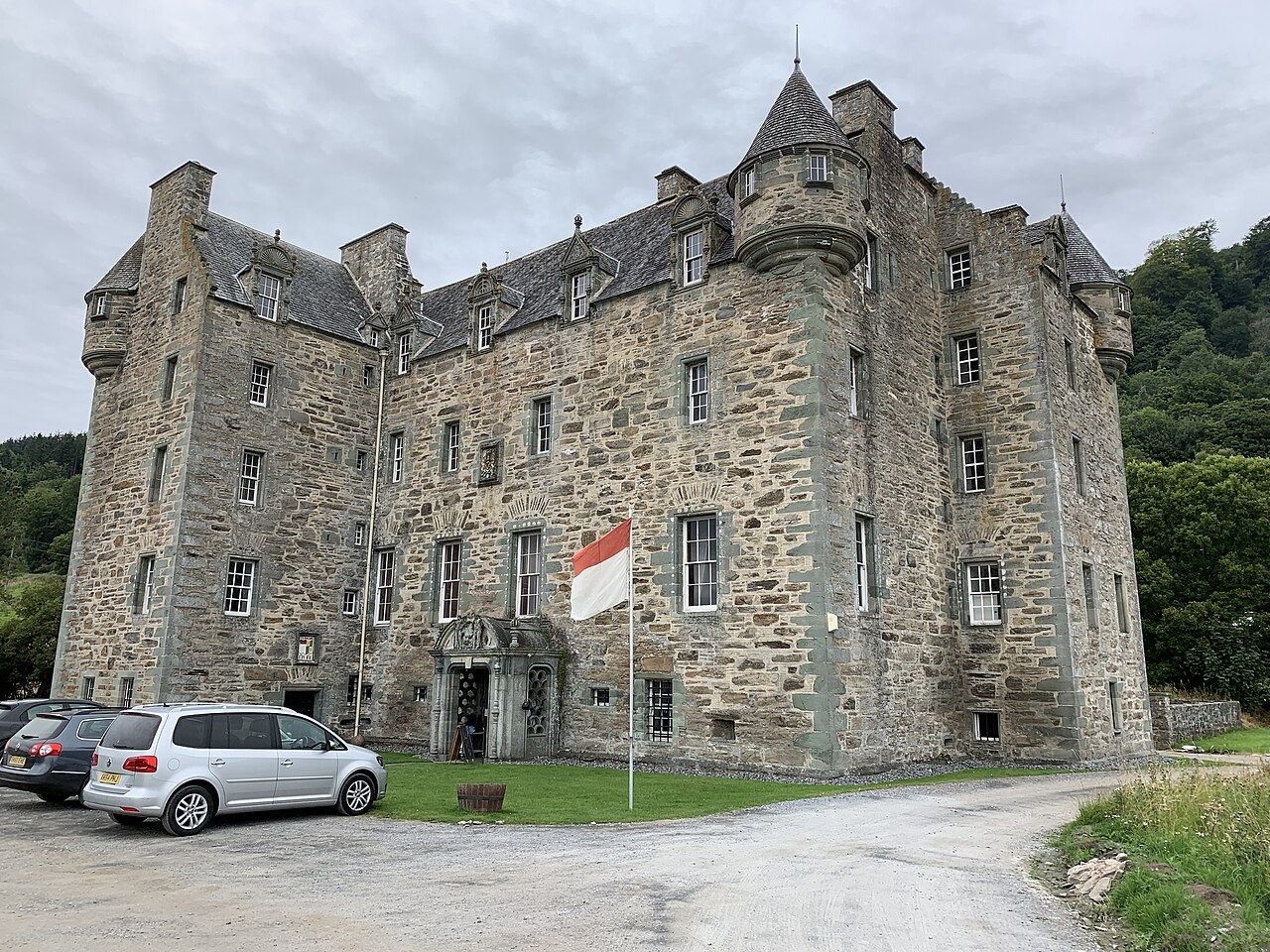
Image: Castle Menzies by Andrewrabbott, sourced from Wikimedia Commons and licensed under CC BY-SA 4.0.

A richly detailed sixteenth-century tower house, later enlarged by William Burn, has been rescued from dereliction as the principal public monument of Clan Menzies.
Quick facts
- Date
- Principal Z-plan house dated 1571 and 1577; west wing 1840
- Architect / designer
- Early designer unrecorded; west wing by William Burn
- Type
- Z-plan tower house enlarged as a country residence
- Designation
- Listed building, Category A (LB43568)
- OS grid reference
- NN 83701 49613
Architecture, archaeology and continuing use
The original three-storey and attic Z-plan block has angle turrets, sculpted dormer heads and an iron yett. Eighteenth-century circulation changes and William Burn’s substantial west wing show its development from fortified seat to country house.
Its story
Dated stones mark building campaigns in the 1570s, and the castle remained the Menzies chiefs’ seat for centuries. After decline and dereliction, the Menzies Clan Society acquired it in 1957 and began a long restoration.
Why it is included
Category A designation recognises major architectural and clan-historical importance. Its rescue also demonstrates how a ruined private seat can become a publicly interpreted heritage place.
What to notice
- The Z-plan arrangement of main block and angle towers.
- Sculpted dormer heads carrying dates and heraldry.
- The contrast between the sixteenth-century core and William Burn’s 1840 wing.
Reading the surroundings
The castle opens seasonally and also hosts events. Check current arrangements, follow staff directions and do not enter closed restoration, service or private areas.
Timeline
- 1571 A dated armorial panel marked work on the principal tower house.
- 1577 A dormer inscription recorded a further phase of the early residence.
- 1840 William Burn added the west wing and a new entrance arrangement.
- 1957 Clan-led acquisition began the castle’s rescue from dereliction.
What we know — and what remains uncertain
The statutory description predates much restoration and still calls the building derelict, so current visitor use is established from later independent sources.
Sources & further reading
- Historic Environment Scotland: Castle Menzies, LB43568 — Designation status, mapped location, date, fabric and architectural or archaeological interest.
- Visit Aberfeldy: heritage and history — Current visitor status, restoration history and the castle’s Jacobite associations.
- Castle Menzies — Official organisation and visitor source; opening details should be checked directly because access is seasonal.
Location
OS grid reference NN 83701 49613 · Location confidence: High: the national designation supplies an official mapped National Grid Reference; the independent source confirms the Place relationship, history or current identity. · Select the marker to open its satellite view in Google Maps. On desktop, drag Pegman (the yellow figure) onto a blue road. On mobile, turn on the Street View layer and tap a blue road. Other photo markers may be user-contributed.
Suggest a marker correction
Suggest a more accurate position
The teal marker is the current published position. The orange marker starts slightly to its right so both remain visible; this is only a visual starting position. Tap the correct place on the map or drag the orange marker. Sending this form creates a private review entry only; it does not move the published marker.
Check this area in Google Maps Choose the Satellite layer there if useful.
Map: © OpenStreetMap contributors. You can also enter checked coordinates below.