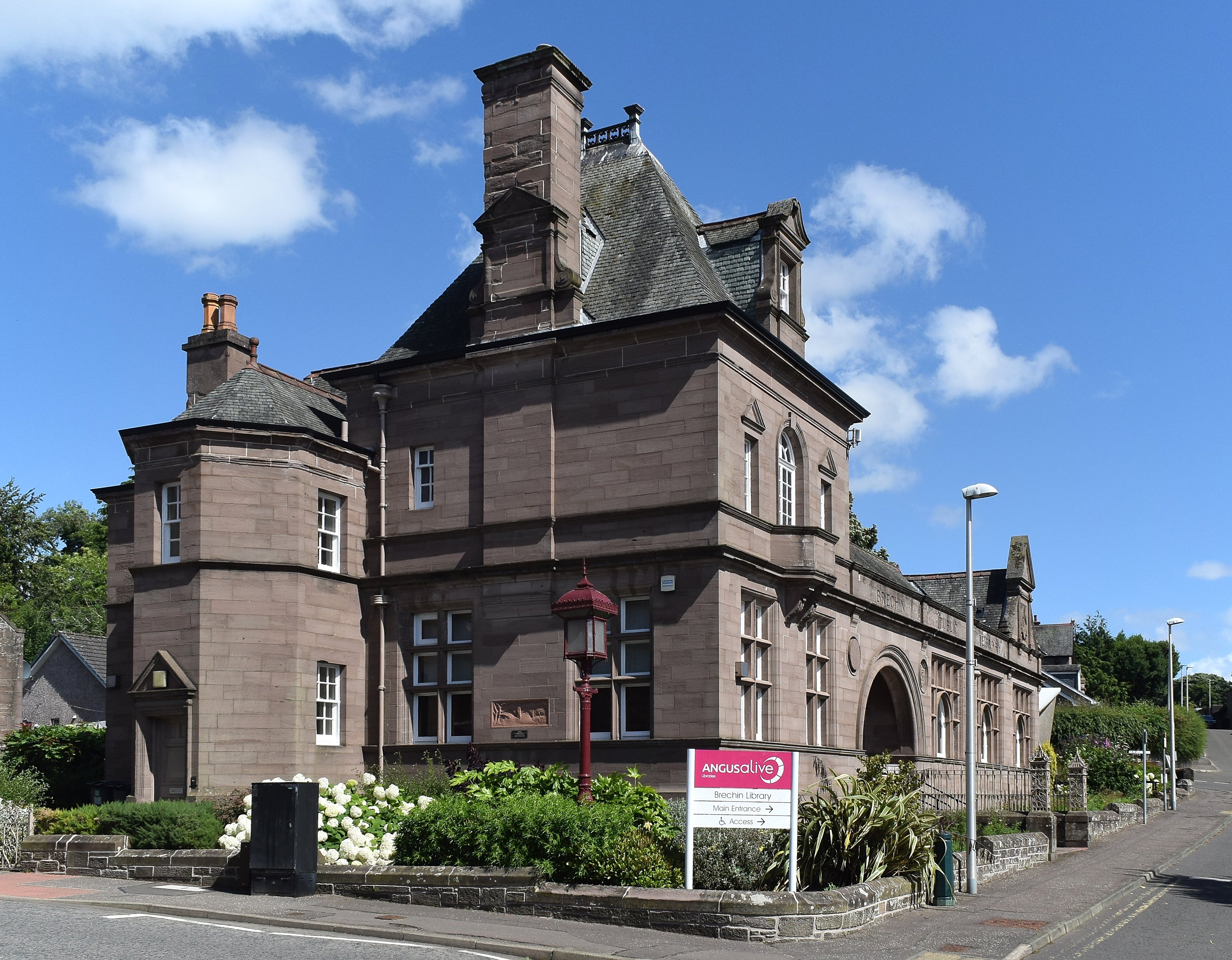


An inventive late Victorian library continues to combine reading, local history, digital access and community services.
Quick facts
- Date
- Built 1892
- Architect / designer
- J. Graham Fairley
- Type
- Victorian Renaissance public library with corner custodian’s house
- Designation
- Listed building, Category B (LB22570)
- OS grid reference
- NO 60075 60273
Architecture and continuing use
A single-storey reading-room wing meets a taller corner pavilion. Mullioned and transomed windows, an arched entrance, deep parapets, an ogee ventilator and an aedicular gable mix French and American influences.
Its story
Opened in 1892, the purpose-built library joined the town’s expanding public institutions. Continued library use has accommodated computers, children’s provision, activities and assisted access to council services.
Why it is included
Strong design, Category B designation and uninterrupted civic usefulness make it an important everyday building.
What to notice
- Arched entrance and four-light reading-room windows.
- Two-storey corner pavilion and semi-octagonal porch.
- Ogee-roofed ventilator and small pedimented gable.
Reading the surroundings
Use ANGUSalive’s current hours and contact details. Services and activities may have separate timetables; ask staff about assistance and accessible routes.
Timeline
- Built 1892 Opened in 1892, the purpose-built library joined the town’s expanding public institutions. Continued library use has accommodated computers, children’s provision, activities and assisted access to council services.
- Present Active ANGUSalive public library, local-history collection and community hub.
What we know — and what remains uncertain
Opening hours and individual services change, so the live library page is authoritative.
Sources & further reading
- Historic Environment Scotland: Brechin Public Library, LB22570 — Designation status, mapped location, construction phases, fabric, authorship and architectural or historical interest.
- ANGUSalive: Brechin Library — Current address, opening, services, activities and local-history collection.
Location
OS grid reference NO 60075 60273 · Location confidence: High: the statutory designation supplies an official mapped National Grid Reference and the current source confirms the Place relationship or present identity. · Select the marker to open its satellite view in Google Maps. On desktop, drag Pegman (the yellow figure) onto a blue road. On mobile, turn on the Street View layer and tap a blue road. Other photo markers may be user-contributed.
Suggest a marker correction
Suggest a more accurate position
The teal marker is the current published position. The orange marker starts slightly to its right so both remain visible; this is only a visual starting position. Tap the correct place on the map or drag the orange marker. Sending this form creates a private review entry only; it does not move the published marker.
Check this area in Google Maps Choose the Satellite layer there if useful.
Map: © OpenStreetMap contributors. You can also enter checked coordinates below.