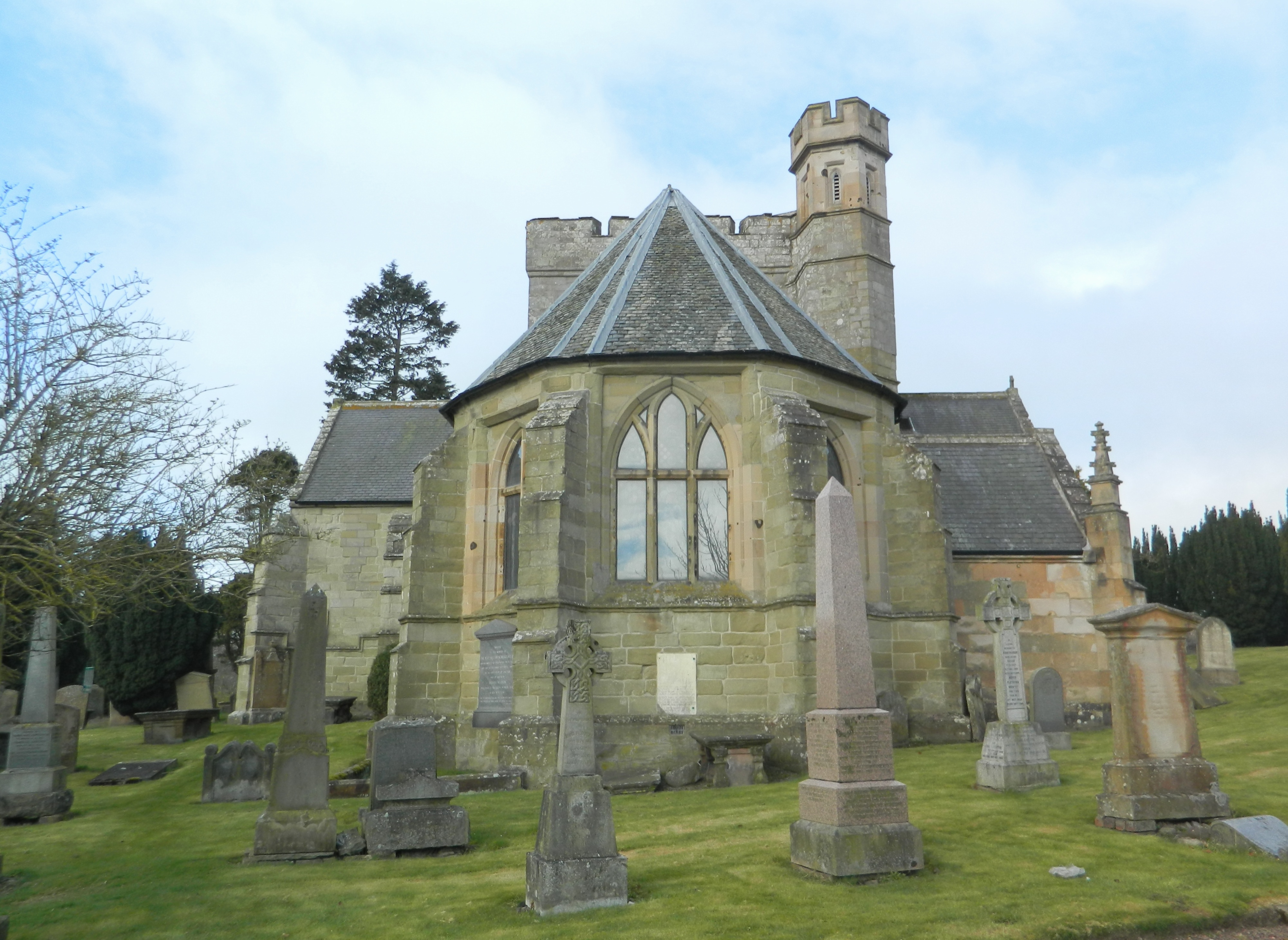
Image: Biggar Kirk by John Lord, sourced from Wikimedia Commons and licensed under CC BY-SA 2.0.

A rare late-medieval collegiate foundation whose cruciform plan, crossing tower and later fittings remain at the heart of Biggar’s worshipping life.
Quick facts
- Date
- 1545–47; altered 1870; restored 1934–35
- Architect / designer
- Founded by Malcolm, 3rd Lord Fleming; later work by David Bryce
- Type
- Late medieval cruciform parish church
- Designation
- Listed building, Category A (LB22257)
- OS grid reference
- NT 04047 37895
Architecture, archaeology and continuing use
Ashlar and rubble walls form a nave, transepts and apsidal chancel beneath slate roofs, with a square tower over the crossing. Traceried windows and Victorian rebuilding sit beside earlier moulded openings, while the stripped stone interior preserves a strong sense of the sixteenth-century plan.
Its story
Malcolm, 3rd Lord Fleming, founded the church in the 1540s as a collegiate institution. David Bryce altered openings and rebuilt ancillary parts in 1870; a further restoration in the 1930s removed plaster and renewed the furnishings.
Why it is included
Category A status, exceptional survival from the decades before the Reformation and continuing parish use make this Biggar’s essential architectural record.
What to notice
- Square crossing tower above the cruciform roofs.
- Apsidal chancel and traceried nave windows.
- Moulded south-transept doorway with carved bosses.
Reading the surroundings
This is an active place of worship. Check the church’s current service and visitor information, enter quietly when open and do not photograph services, worshippers or private prayer without consent.
Timeline
- 1545–47 The Fleming collegiate foundation established the surviving cruciform church.
- 1870 David Bryce enlarged windows and rebuilt the porch and chapterhouse.
- 1934–35 Restoration exposed the internal masonry and renewed the furnishings.
- 2026 Published church information confirms regular worship and community use.
What we know — and what remains uncertain
Opening outside advertised worship or events can vary, and interior access should be checked directly with the congregation.
Sources & further reading
- Historic Environment Scotland: Biggar Kirk, LB22257 — Designation status, mapped location, date, fabric and architectural or archaeological interest.
- Biggar Kirk — Current parish identity, worship, welcome and access information.
- Biggar Kirk: history — Congregational history of the church and its later unions.
Location
OS grid reference NT 04047 37895 · Location confidence: High: the national designation supplies an official mapped National Grid Reference; the independent source confirms the Place relationship, history or current identity. · Select the marker to open its satellite view in Google Maps. On desktop, drag Pegman (the yellow figure) onto a blue road. On mobile, turn on the Street View layer and tap a blue road. Other photo markers may be user-contributed.
Suggest a marker correction
Suggest a more accurate position
The teal marker is the current published position. The orange marker starts slightly to its right so both remain visible; this is only a visual starting position. Tap the correct place on the map or drag the orange marker. Sending this form creates a private review entry only; it does not move the published marker.
Check this area in Google Maps Choose the Satellite layer there if useful.
Map: © OpenStreetMap contributors. You can also enter checked coordinates below.