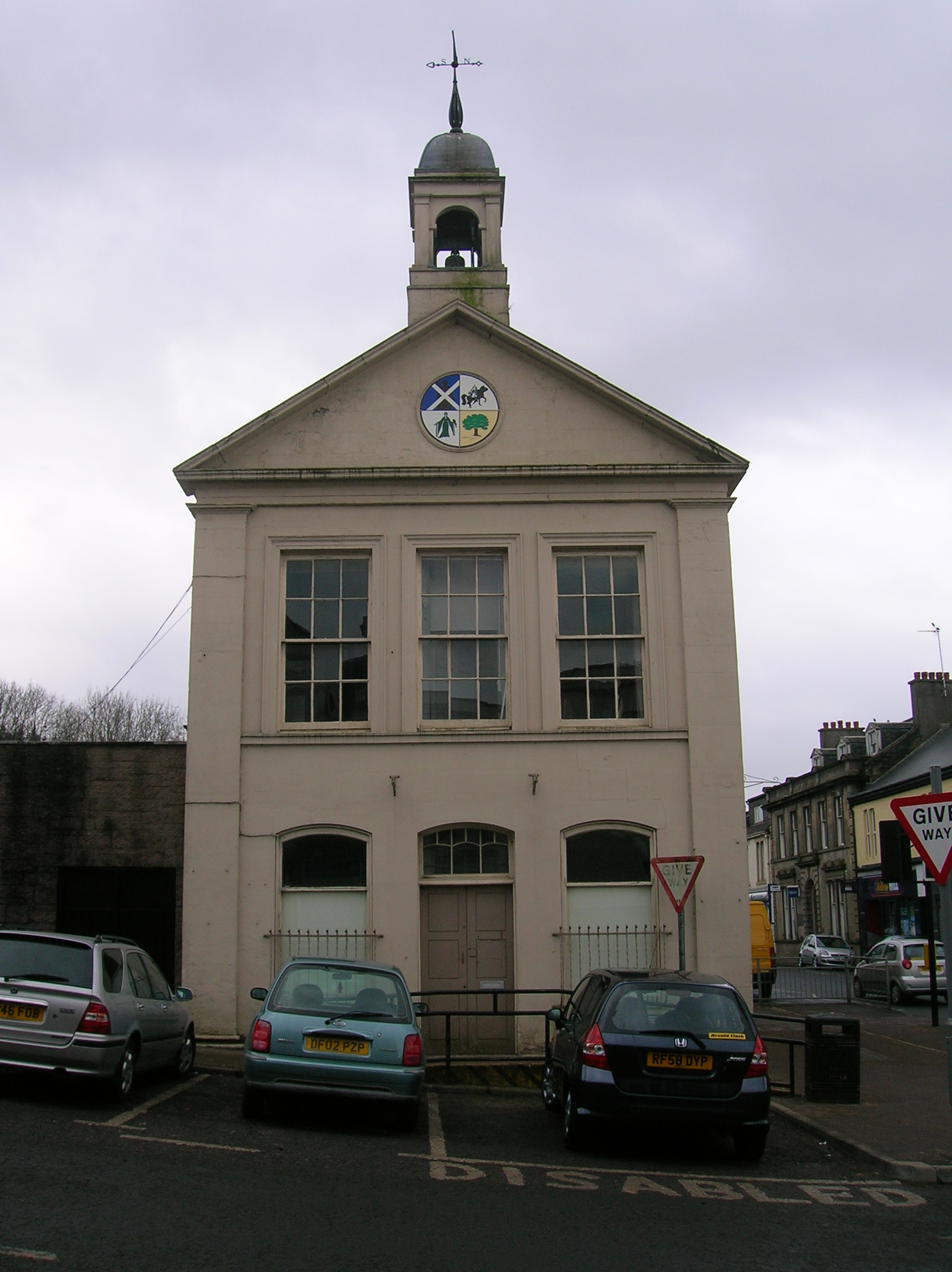


Built by public subscription, Beith Townhouse still serves the town as a free heritage centre and local museum.
Quick facts
- Date
- 1817
- Architect / designer
- William Dobie
- Type
- Classical townhouse with public hall and bellcote
- Designation
- Listed building, Category B (LB937)
- OS grid reference
- NS 34812 53893
Architecture and continuing use
A pedimented two-storey hall turns the corner between The Strand and Eglinton Street. Pilasters, a painted town coat of arms and an ogee-capped bellcote give the compact building civic identity.
Its story
Subscribers funded the building in 1817, with shops below and court, meeting and reading uses above. A local heritage society later restored it and reopened the ground floor in 2011.
Why it is included
Few records join early municipal justice, commercial rents and present volunteer-led heritage interpretation so directly.
What to notice
- The bellcote and weather vane.
- Painted town arms in the pediment.
- Regency joinery in the first-floor public room.
Reading the surroundings
Visit during published opening hours or announced events. Upper rooms may not be routinely accessible; follow staff guidance and current accessibility information.
Timeline
- 1817 Public subscription financed the new townhouse on the site of an earlier tolbooth.
- 1823 George Shedden donated the bell cast by Thomas Mears.
- April 2011 The restored ground floor reopened as an information and heritage centre.
- 2014 Further work improved the building’s weather protection.
What we know — and what remains uncertain
Published opening times and access to upper rooms can change, so visitors should confirm arrangements.
Sources & further reading
- Historic Environment Scotland: Beith Townhouse, LB937 — Current designation status, official mapped location, date, fabric and significance.
- North Ayrshire Heritage: Beith Townhouse — Current museum purpose, address, collections and opening information.
- North Ayrshire Council asset register — Current council property identity for the Townhouse at 2 The Strand.
- Trove search: Beith Town House — National collection search for site records, surveys and archive material.
Location
OS grid reference NS 34812 53893 · Location confidence: High: the current national designation supplies an exact mapped National Grid Reference; public text separately states access and current-use uncertainty. · Select the marker to open its satellite view in Google Maps. On desktop, drag Pegman (the yellow figure) onto a blue road. On mobile, turn on the Street View layer and tap a blue road. Other photo markers may be user-contributed.
Suggest a marker correction
Suggest a more accurate position
The teal marker is the current published position. The orange marker starts slightly to its right so both remain visible; this is only a visual starting position. Tap the correct place on the map or drag the orange marker. Sending this form creates a private review entry only; it does not move the published marker.
Check this area in Google Maps Choose the Satellite layer there if useful.
Map: © OpenStreetMap contributors. You can also enter checked coordinates below.