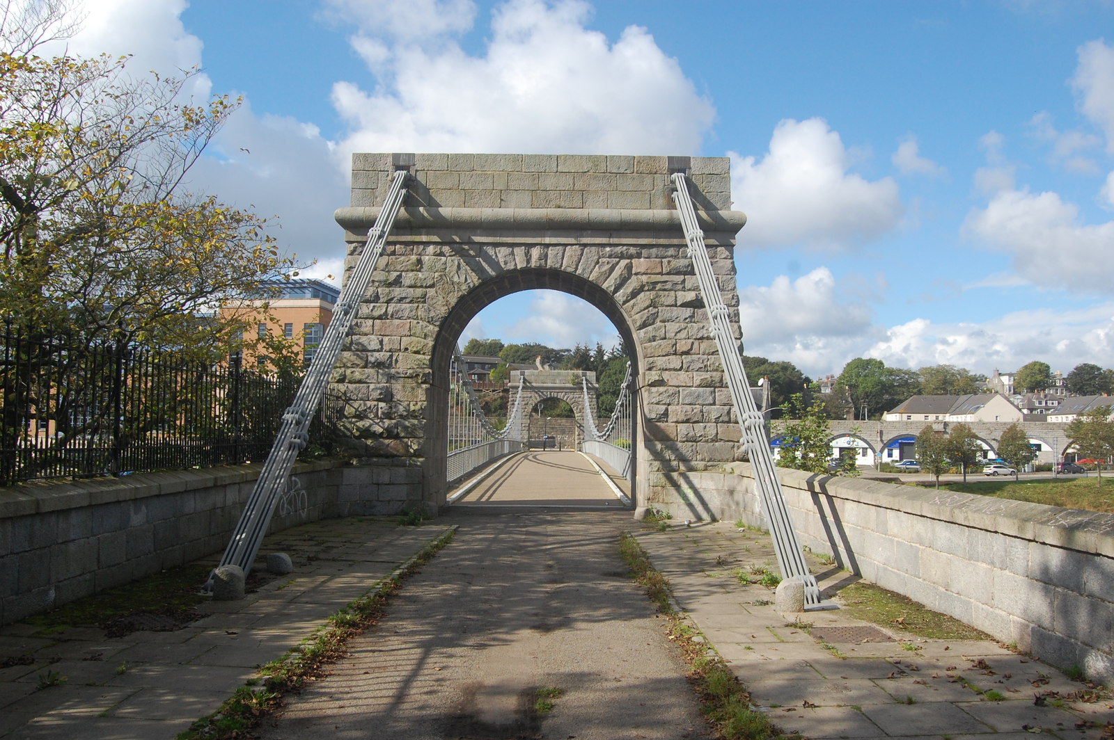
Image: Wellington Suspension Bridge by Bill Harrison, 20 September 2014, sourced from Wikimedia Commons and licensed under CC BY-SA 2.0.

Granite pylons and iron chains carry an exceptionally early surviving suspension bridge across the Dee.
Quick facts
- Date
- Built 1829–1831; reconstructed 1930; restored 2006–2009
- Architect / designer
- Captain Samuel Brown; masonry by John Smith; engineering assistance by James Slight
- Type
- Suspension footbridge with granite pylons and bar-link chains
- Designation
- Listed building, Category A (LB20073)
- OS grid reference
- NJ 94316 04968
Architecture and continuing use
Tall masonry pylons frame a light suspended deck carried by bar-link chains. The contrast between massive granite supports and the slender crossing gives the bridge its distinctive character.
Its story
The bridge linked growing communities across the Dee. Later strengthening and restoration removed road traffic but secured its continuing role for walking and cycling.
Why it is included
It is the sole survivor of Aberdeen’s four early suspension bridges and an important work in the development of the type.
What to notice
- Granite pylon openings at each bank.
- Iron bar-link chains and suspended deck.
- Long views along the Dee from the crossing.
Reading the surroundings
Use the shared path and allow space for other walkers and cyclists. Obey temporary closures and take care in wind, ice or high water.
Timeline
- Built 1829–1831 The bridge linked growing communities across the Dee. Later strengthening and restoration removed road traffic but secured its continuing role for walking and cycling.
- Present Public pedestrian and cycle crossing.
What we know — and what remains uncertain
Maintenance and active-travel works can affect access; current on-site notices take precedence.
Sources & further reading
- Historic Environment Scotland: Wellington Suspension Bridge, LB20073 — Designation status, mapped location, construction phases, fabric, authorship and architectural or historical interest.
- Aberdeen City Council collections: Wellington Suspension Bridge — Municipal collection record documenting the bridge, its 1830 date and historic city setting.
Location
OS grid reference NJ 94316 04968 · Location confidence: High: the statutory designation supplies an official mapped National Grid Reference and the current source confirms the Place relationship or present identity. · Select the marker to open its satellite view in Google Maps. On desktop, drag Pegman (the yellow figure) onto a blue road. On mobile, turn on the Street View layer and tap a blue road. Other photo markers may be user-contributed.
Suggest a marker correction
Suggest a more accurate position
The teal marker is the current published position. The orange marker starts slightly to its right so both remain visible; this is only a visual starting position. Tap the correct place on the map or drag the orange marker. Sending this form creates a private review entry only; it does not move the published marker.
Check this area in Google Maps Choose the Satellite layer there if useful.
Map: © OpenStreetMap contributors. You can also enter checked coordinates below.