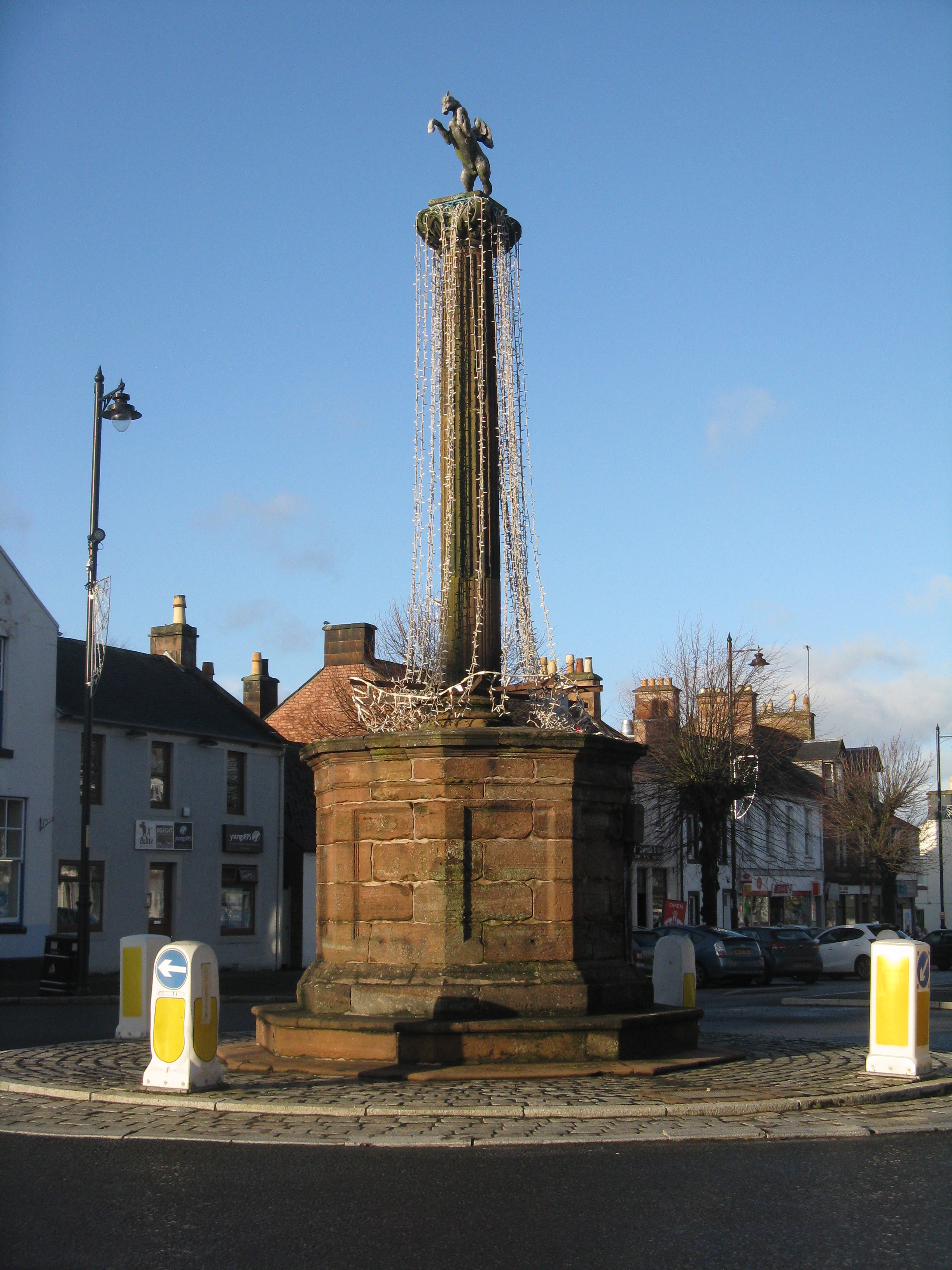
Image: Market Cross, Thornhill by M J Richardson, 7 December 2018, sourced from Wikimedia Commons and licensed under CC BY-SA 2.0.
.jpg)
.jpg#file)
A lead Pegasus above a classical column marks the centre of Thornhill and the settlement's early connection with a new road.
Quick facts
- Date
- 1714; moved to its present position around 1772
- Architect / designer
- Possibly James Smith
- Type
- Red-ashlar market cross with Ionic column and lead Pegasus
- Designation
- Listed building, Category A (LB17337)
- OS grid reference
- NX 87879 95478
Architecture, archaeology and continuing use
A fluted Ionic column rises from a panelled octagonal drum and stepped red-ashlar plinth. Swags enrich the capital, which supports a small lead Pegasus: a compact classical monument with an unusually animated silhouette.
Its story
The cross was erected in 1714 when the new road line passed through Thornhill. It first stood farther along Drumlanrig Street, required stabilisation in 1744, and was probably moved around 1772 as the planned village developed.
Why it is included
Category A listing recognises a rare and highly distinctive market cross whose relocation helps explain the creation of Thornhill's ordered street centre.
What to notice
- The lead Pegasus poised above the capital.
- Fluting and carved swags on the Ionic column.
- The octagonal base and successive stepped plinths.
Reading the surroundings
View from the public street space while watching traffic and other pedestrians. Do not climb the steps or column, touch the lead figure or obstruct the junction.
Timeline
- 1714 The road-building period produced a new market cross for Thornhill.
- 1744 Estate accounts recorded work to secure the monument against falling.
- Circa 1772 Village planning probably prompted removal to the present crossroads.
What we know — and what remains uncertain
James Smith's authorship and the exact year of relocation are both qualified in the official record rather than documented with certainty.
Sources & further reading
- Historic Environment Scotland: Thornhill Market Cross, LB17337 — Designation status, mapped location, date, fabric and architectural or archaeological interest.
- Thornhill Community Council: history — Local account of the planned settlement, road traffic and coaching-era development.
Location
OS grid reference NX 87879 95478 · Location confidence: High: the national designation supplies an official mapped National Grid Reference; an additional source confirms the Place relationship, history or current identity. · Select the marker to open its satellite view in Google Maps. On desktop, drag Pegman (the yellow figure) onto a blue road. On mobile, turn on the Street View layer and tap a blue road. Other photo markers may be user-contributed.
Suggest a marker correction
Suggest a more accurate position
The teal marker is the current published position. The orange marker starts slightly to its right so both remain visible; this is only a visual starting position. Tap the correct place on the map or drag the orange marker. Sending this form creates a private review entry only; it does not move the published marker.
Check this area in Google Maps Choose the Satellite layer there if useful.
Map: © OpenStreetMap contributors. You can also enter checked coordinates below.