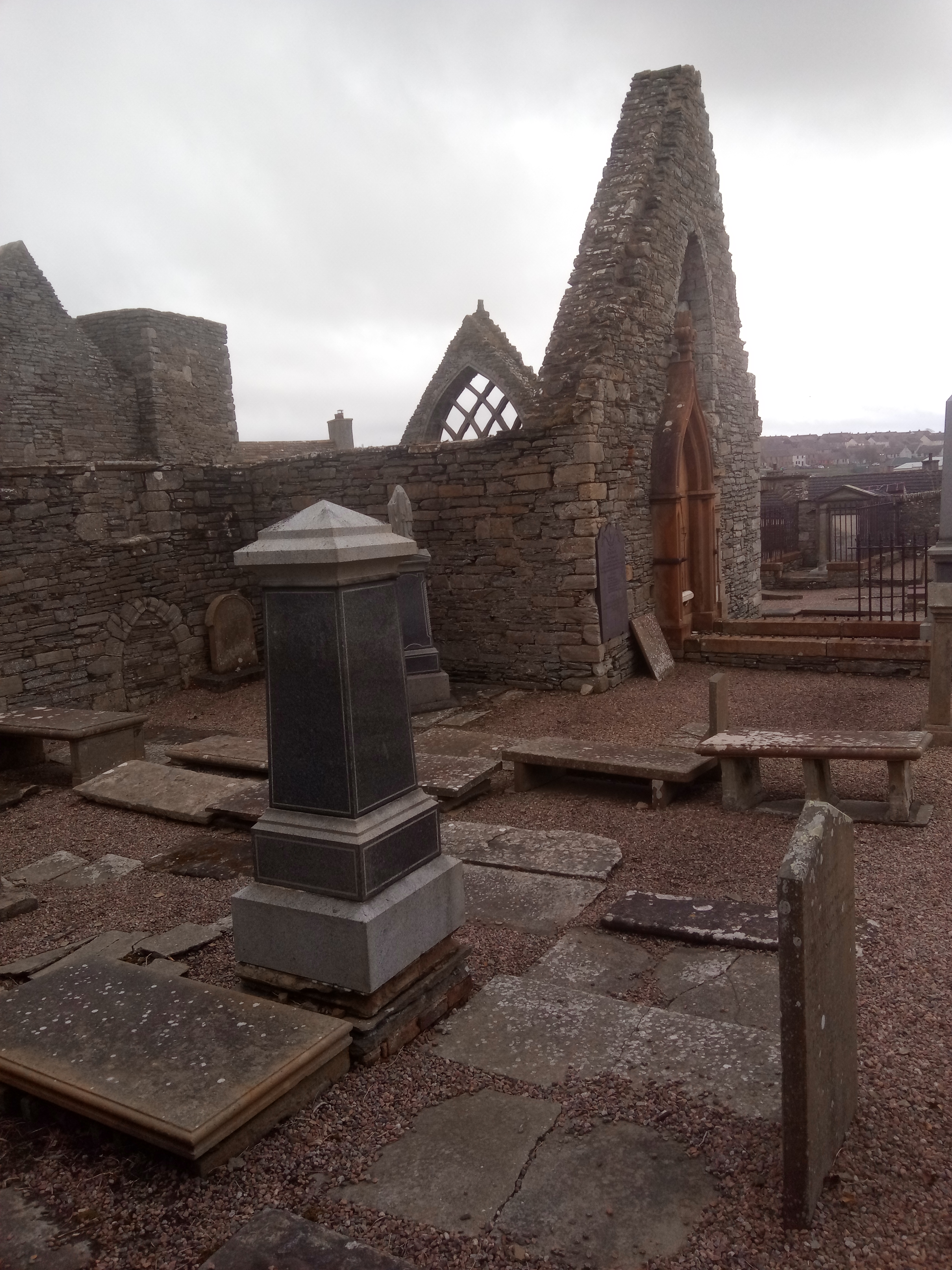
Image: Roofless stone gables and grave monuments within Old St Peter’s Church and Burial Ground in Thurso by Mainlymazza, licensed under CC BY-SA 4.0.

Thurso’s most important medieval survival preserves an unusually complex church beside the old town and river.
Quick facts
- Date
- Originating by the thirteenth century at the latest; early seventeenth-century transepts; abandoned for worship in 1832
- Architect / designer
- Medieval builders unknown; later work by local masons
- Type
- Roofless medieval and early modern parish church with burial ground
- Designation
- Scheduled monument (SM618)
- OS grid reference
- ND 12030 68615
Architecture and continuing use
The roofless church has a nave, barrel-vaulted chancel, angled tower and two misaligned transeptal aisles. The chancel is apsidal within but square outside, and the masonry preserves several building phases.
Its story
Tradition associates the foundation with Bishop Gilbert Murray, who died in 1245. The church was enlarged after the Reformation, served the parish until 1832 and subsequently became a protected ruin.
Why it is included
Its national importance, surviving medieval fabric, runic stone and close relationship with the old burgh make it the essential first Thurso record.
What to notice
- The angled tower and its unusual semicircular buttresses.
- The contrast between the compact chancel and later transeptal aisles.
- Grave monuments and enclosure walls as part of the scheduled whole.
Reading the surroundings
Inspect from public approaches and obey local barriers and cemetery guidance. Masonry, uneven ground and graves must not be climbed or disturbed.
Timeline
- Originating by the thirteenth century at the latest Tradition associates the foundation with Bishop Gilbert Murray, who died in 1245. The church was enlarged after the Reformation, served the parish until 1832 and subsequently became a protected ruin.
- Present Scheduled church ruin and historic burial ground.
What we know — and what remains uncertain
The exact date of the earliest fabric remains debated; the scheduling description places the origin in the thirteenth century at the latest.
Sources & further reading
- Historic Environment Scotland: Old St Peter’s Church and Burial Ground, SM618 — Designation status, mapped location, construction phases, fabric, authorship and architectural or historical interest.
- Canmore: Old St Peter’s Church and burial ground — Archaeological interpretation, recorded fabric, research history and official location.
- Proceedings of the Society of Antiquaries of Scotland: St Peter’s Kirk — Detailed scholarly analysis of the building’s phases and early fabric.
Location
OS grid reference ND 12030 68615 · Location confidence: High: the statutory designation supplies an official mapped National Grid Reference and the current source confirms the Place relationship or present identity. · Select the marker to open its satellite view in Google Maps. On desktop, drag Pegman (the yellow figure) onto a blue road. On mobile, turn on the Street View layer and tap a blue road. Other photo markers may be user-contributed.
Suggest a marker correction
Suggest a more accurate position
The teal marker is the current published position. The orange marker starts slightly to its right so both remain visible; this is only a visual starting position. Tap the correct place on the map or drag the orange marker. Sending this form creates a private review entry only; it does not move the published marker.
Check this area in Google Maps Choose the Satellite layer there if useful.
Map: © OpenStreetMap contributors. You can also enter checked coordinates below.