
.jpg)
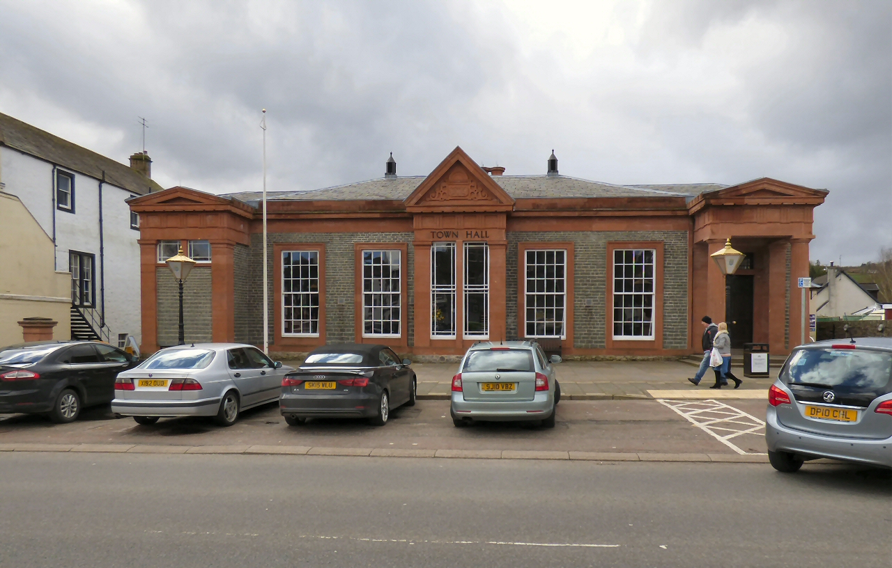
A long classical range built for spa bathing now serves as Moffat’s community-run town hall.
Quick facts
- Date
- 1827; later alterations
- Architect / designer
- Designer unrecorded
- Type
- Classical bath rooms, town hall and former police station
- Designation
- Listed building, Category B (LB37927)
- OS grid reference
- NT 08425 05326
Architecture, archaeology and continuing use
Seven irregular bays are gathered by a Doric entrance portico, a steep central pediment and painted ashlar dressings against whinstone. Rear additions and a two-storey flank record later civic adaptation.
Its story
The building opened as bath rooms for spa visitors. Burgh commissioners purchased it in 1897, after which municipal, police and community functions reshaped its programme.
Why it is included
Its change from spa facility to active civic venue encapsulates two major phases of Moffat’s public life.
What to notice
- Fluted Doric columns at the north entrance.
- The dated central gable interrupting the long low front.
- Twenty-four-pane windows across the principal range.
Reading the surroundings
The Town Hall Trust publishes events and room use. Enter for advertised activities or bookings and respect offices and closed rooms.
Timeline
- 1827 Purpose-built bath rooms opened on the High Street.
- 1897 Burgh commissioners purchased the building.
- 2012 Community stewardship began through the Town Hall Trust.
- 2026 Events, clubs and public services continue in the hall.
What we know — and what remains uncertain
Later alterations are extensive and not all carry secure individual dates.
Sources & further reading
- Historic Environment Scotland: Moffat Town Hall, LB37927 — Designation status, mapped location, date, fabric and architectural or archaeological interest.
- Moffat Town Hall Trust: about the hall — Current community use, ownership context and institutional history.
Location
OS grid reference NT 08425 05326 · Location confidence: High: the national designation supplies an official mapped National Grid Reference; the independent source confirms the Place relationship, history or current identity. · Select the marker to open its satellite view in Google Maps. On desktop, drag Pegman (the yellow figure) onto a blue road. On mobile, turn on the Street View layer and tap a blue road. Other photo markers may be user-contributed.
Suggest a marker correction
Suggest a more accurate position
The teal marker is the current published position. The orange marker starts slightly to its right so both remain visible; this is only a visual starting position. Tap the correct place on the map or drag the orange marker. Sending this form creates a private review entry only; it does not move the published marker.
Check this area in Google Maps Choose the Satellite layer there if useful.
Map: © OpenStreetMap contributors. You can also enter checked coordinates below.