
.JPG)
A Victorian memorial church on a site with a much longer burial history.
Quick facts
- Date
- 1875
- Architect / designer
- Built for Sir James Colquhoun; architect not established here
- Type
- Gothic parish church
- OS grid reference
- NS 36100 92865
The building
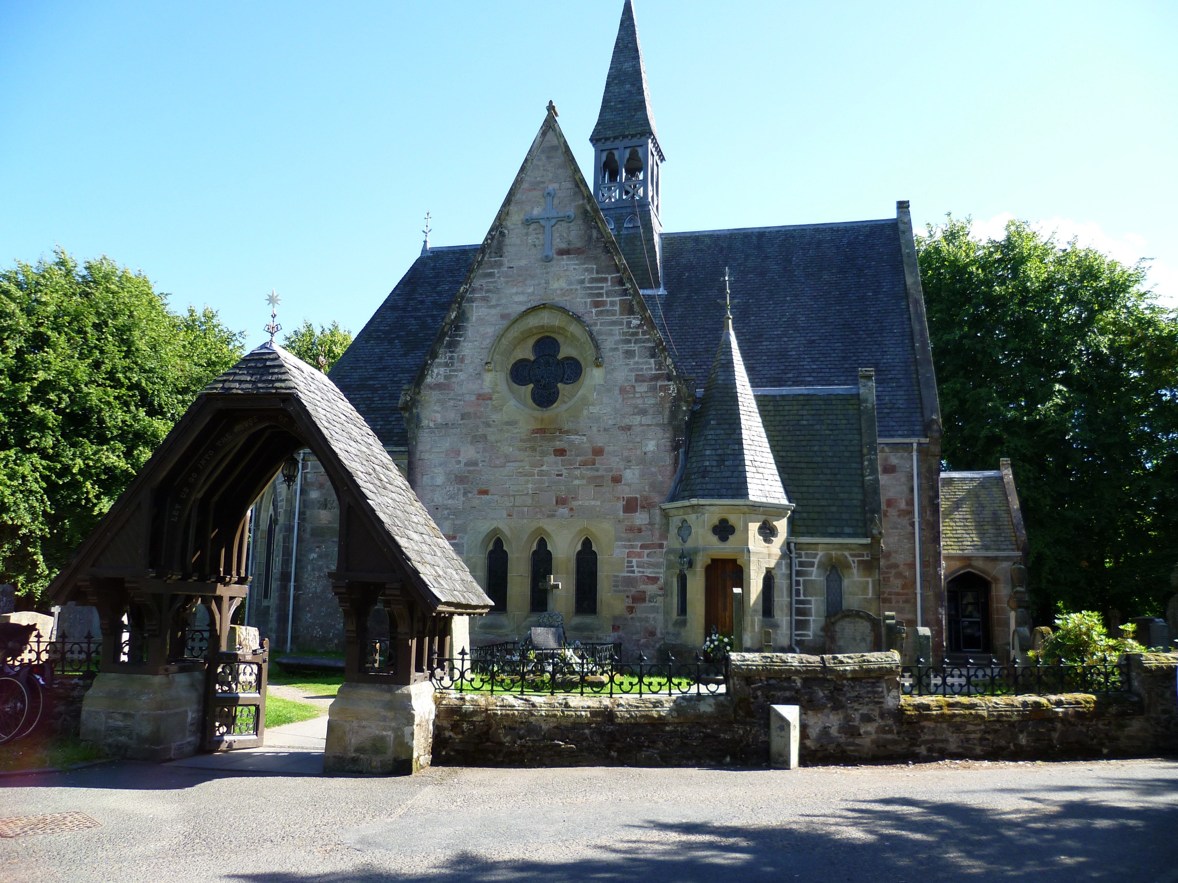
Pink stone walls are contrasted with warmer-coloured sandstone dressings. The T-shaped building has an apsed east end, Gothic windows and an elaborate open timber roof.
Its story
The present church was built in 1875. National Records of Scotland identifies it as Sir James Colquhoun’s memorial to his father, replacing a parish church of 1771.
Why it is included
It joins Victorian commemoration to a longstanding religious site without disguising the difference in their ages.
What to look for
- The contrast between wall stone and window dressings.
- The rose window and varied gables.
- The open timber roof, if the church is accessible.
Reading the surroundings
The burial ground contains separately scheduled remains under SM2461, explicitly excluded from this building’s listing.
Timeline
- 1771 Preceding parish church built.
- 1875 Present memorial church erected.
What we know — and what remains uncertain
The age of the religious site should not be confused with the date of the surviving church. This entry makes no claim that the present walls are medieval.
Sources & further reading
- Historic Environment Scotland: LB14430 — Designation boundary, date and fabric.
- National Records of Scotland: CH2/481 — Successive churches and memorial patronage.
- Scotland’s Churches Trust: Luss Parish Church — Interior heraldic memorials.
Location
OS grid reference NS 36100 92865 · Location confidence: High: HES National Grid reference converted to WGS84; catalogue point, not an entrance. · Select the marker to open its satellite view in Google Maps. On desktop, drag Pegman (the yellow figure) onto a blue road. On mobile, turn on the Street View layer and tap a blue road. Other photo markers may be user-contributed.
Suggest a marker correction
Suggest a more accurate position
The teal marker is the current published position. The orange marker starts slightly to its right so both remain visible; this is only a visual starting position. Tap the correct place on the map or drag the orange marker. Sending this form creates a private review entry only; it does not move the published marker.
Check this area in Google Maps Choose the Satellite layer there if useful.
Map: © OpenStreetMap contributors. You can also enter checked coordinates below.