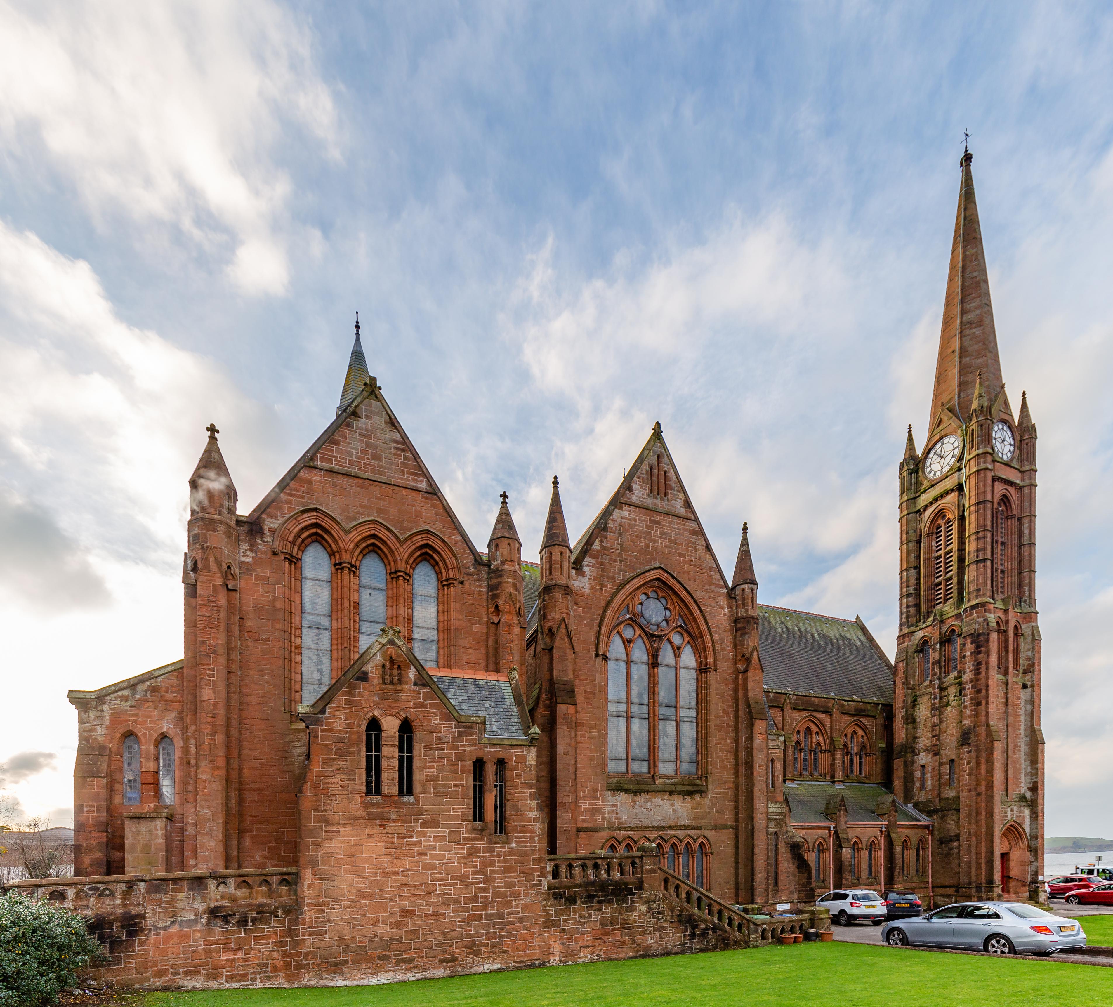


A tall clock tower and spire mark a former parish church whose future remains unsettled.
Quick facts
- Date
- 1891–93; opened 1892
- Architect / designer
- Henry Steele and Andrew Balfour
- Type
- Former church and hall
- OS grid reference
- NS 20255 59629
The building and its setting
Red stone, pointed arches and a cruciform plan give the building a strong seafront presence. The tower occupies a corner, while galleries and a substantial hall show how much accommodation lay behind the prominent front.
Its story
The building replaced an earlier nineteenth-century church. It housed a Willis organ and stained glass by several workshops. Scotland’s Churches Trust records the final service on 30 June 2024 and subsequent marketing. The Church of Scotland’s sale brochure describes the church and hall as a property for possible reuse.
Why it is included
Documents a major landmark at a moment of uncertain reuse.
What to look for
- The tower’s clock faces and spire
- The relationship between church and attached hall
Reading the surroundings
View from public streets. The former visitor and worship arrangements no longer apply; do not enter closed premises.
What we know — and what remains uncertain
The listing’s phrase indicating continuing worship is outdated. The Trust reported an accepted competing bid in March 2026, but this does not establish completed ownership transfer or a new use. Access and the retention of fittings should not be assumed.
Sources & further reading
- Historic Environment Scotland: LB37163 — Designation, location and architectural description; older observations are not a current condition survey.
- Scotland’s Churches Trust: St Columba’s — Closure, marketing and reported uncertainty over the building’s future.
- Church of Scotland: sale brochure — Primary evidence of marketing and accommodation; suggested uses are proposals.
Location
OS grid reference NS 20255 59629 · Location confidence: HES national-grid point converted to WGS84; approximate building location, not an entrance or statutory boundary. · Select the marker to open its satellite view in Google Maps. On desktop, drag Pegman (the yellow figure) onto a blue road. On mobile, turn on the Street View layer and tap a blue road. Other photo markers may be user-contributed.
Suggest a marker correction
Suggest a more accurate position
The teal marker is the current published position. The orange marker starts slightly to its right so both remain visible; this is only a visual starting position. Tap the correct place on the map or drag the orange marker. Sending this form creates a private review entry only; it does not move the published marker.
Check this area in Google Maps Choose the Satellite layer there if useful.
Map: © OpenStreetMap contributors. You can also enter checked coordinates below.