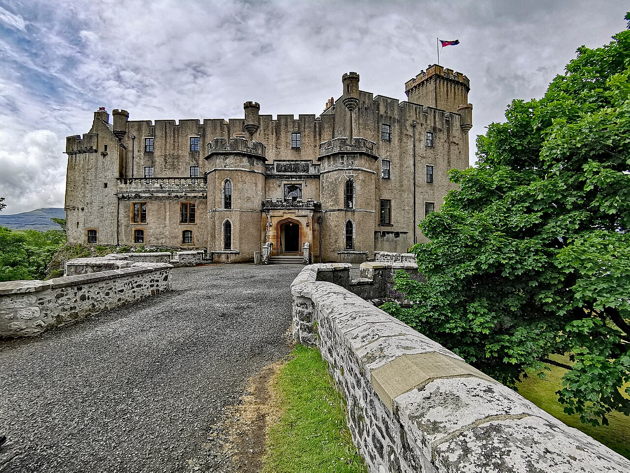
Image: Dunvegan Castle by Gunther Tschuch (PaulT), sourced from Wikimedia Commons and licensed under CC BY-SA 4.0.

A castle whose Victorian exterior brings together centuries of building.
Quick facts
- Date
- Medieval core; major remodelling 1840–50; restoration 1939
- Architect / designer
- Robert Brown junior, nineteenth-century remodelling; Colin Sinclair, 1939 restoration
- Type
- Castle and country house
- OS grid reference
- NG 24740 49106
The structure
The castle occupies a rocky outcrop reached by a bridge and parapeted causeway. Harled walls, battlements and projecting turrets give the group a unified outline. A square tower house survives at the south-east.
Its story
HES identifies a fourteenth-century core within the later north wing. Robert Brown’s nineteenth-century work reshaped the group; the owner’s history dates this campaign to 1840–50 and describes five buildings beneath the unified exterior. Colin Sinclair carried out restoration in 1939.
Why it is included
Dunvegan shows how an inhabited castle could be repeatedly adapted while retaining older structures inside a new architectural image.
What to look for
- The causeway and gatehouse-like east entrance
- The south-east tower and changing roofline
Reading the surroundings
The seaward gateway recalls a different approach to the rock. The listing also includes the bridge over the burn near the south-east tower.
Timeline
- 14th century Core identified by HES.
- 1840–50 Robert Brown’s remodelling created much of the present appearance.
- 1939 Restoration by Colin Sinclair.
What we know — and what remains uncertain
The visible exterior is not a reliable guide to the age of every wall. Broad phase dates follow the designation record and the owner’s account; this is not a room-by-room fabric survey.
Sources & further reading
- HES: Dunvegan Castle, LB501 — Designation, fabric, architects, datestone and grid reference.
- Dunvegan Castle: Castle History — Owner’s account of the 1840–50 campaign and earlier buildings.
Location
OS grid reference NG 24740 49106 · Location confidence: High: HES National Grid reference converted to WGS84; catalogue point, not an entrance. · Select the marker to open its satellite view in Google Maps. On desktop, drag Pegman (the yellow figure) onto a blue road. On mobile, turn on the Street View layer and tap a blue road. Other photo markers may be user-contributed.
Suggest a marker correction
Suggest a more accurate position
The teal marker is the current published position. The orange marker starts slightly to its right so both remain visible; this is only a visual starting position. Tap the correct place on the map or drag the orange marker. Sending this form creates a private review entry only; it does not move the published marker.
Check this area in Google Maps Choose the Satellite layer there if useful.
Map: © OpenStreetMap contributors. You can also enter checked coordinates below.