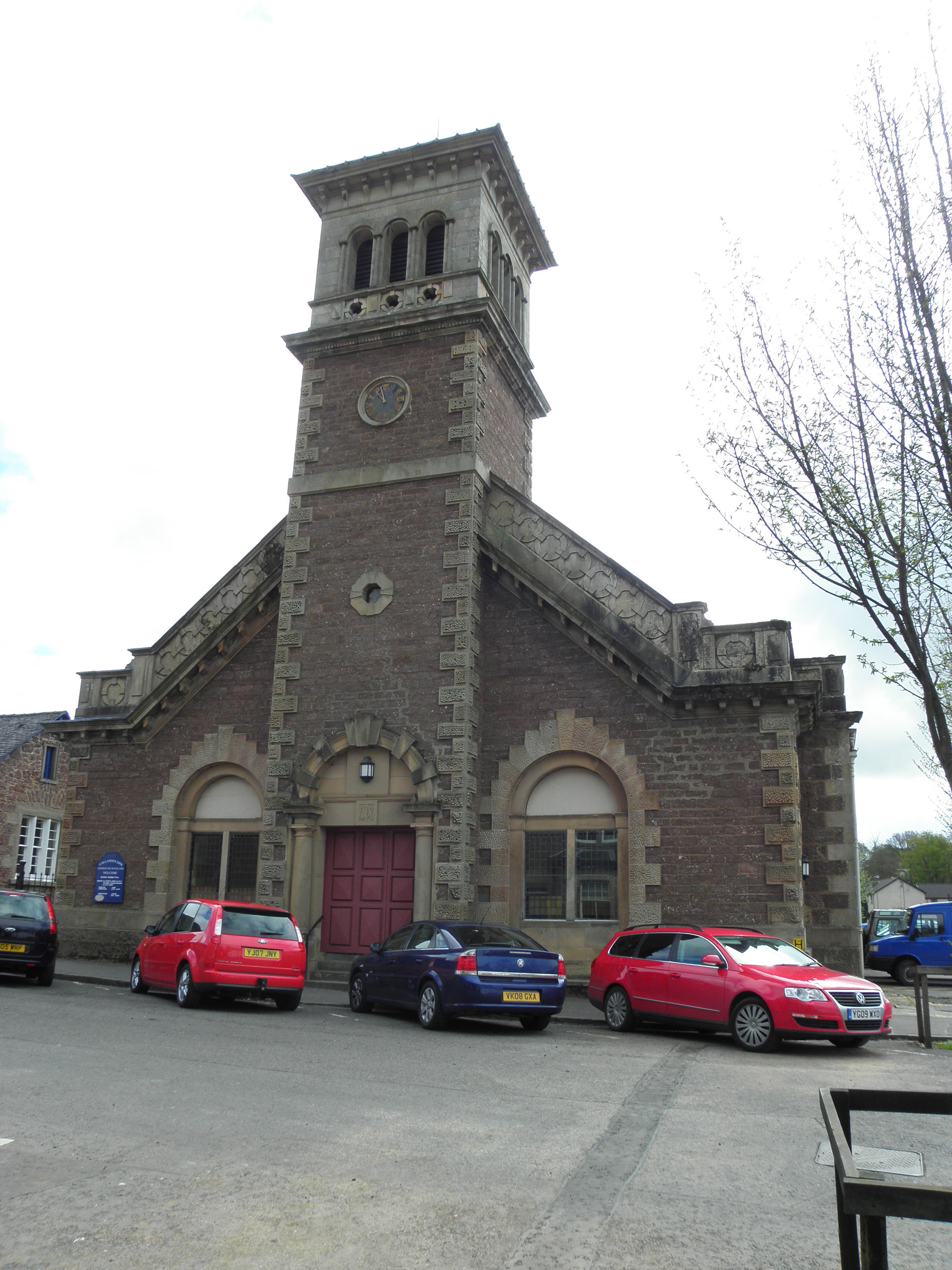


A Free Church building transformed by a tower with an Italianate character.
Quick facts
- Date
- 1844; enlarged 1861; altered 1907
- Architect / designer
- Kennedy and Dalgleish, 1861 alterations
- Type
- Church with Italianate tower
- OS grid reference
- NN 62959 07775
The structure
The tower rises above a broad entrance front and ends in an open, round-arched belfry beneath a shallow pyramidal roof. The central entrance has classical columns.
Its story
HES dates the original St Bride’s Free Church to 1844. Kennedy and Dalgleish enlarged it in 1861, adding the chancel and tower. Further work in 1907 rearranged the entrance. The congregation adopted the name Callander Kirk after union with St Kessog’s in 1985.
Why it is included
It connects religious change with a striking transformation in architectural expression.
What to look for
- The round-arched openings of the belfry.
- The classical central doorway.
- Differences between the two side elevations.
Reading the surroundings
The kirk stands near the river and its neighbouring hall, which has a separate listing.
Timeline
- 1844 Original Free Church built.
- 1861 Tower and chancel added.
- 1907 Entrance rearranged.
What we know — and what remains uncertain
Some summaries give 1843 rather than 1844. This entry follows the HES listing and National Records of Scotland’s congregation history for the building date.
Sources & further reading
- Historic Environment Scotland: LB22901 — Designation, phases, architectural details and former Pearl Street setting.
- National Park: Callander Heritage Trail — Town context and interpretation of the Italianate additions.
- National Records of Scotland: CH3/1169 — Congregation formed in 1843; church built in 1844.
Location
OS grid reference NN 62959 07775 · Location confidence: High: HES National Grid reference converted to WGS84; catalogue point, not an entrance. · Select the marker to open its satellite view in Google Maps. On desktop, drag Pegman (the yellow figure) onto a blue road. On mobile, turn on the Street View layer and tap a blue road. Other photo markers may be user-contributed.
Suggest a marker correction
Suggest a more accurate position
The teal marker is the current published position. The orange marker starts slightly to its right so both remain visible; this is only a visual starting position. Tap the correct place on the map or drag the orange marker. Sending this form creates a private review entry only; it does not move the published marker.
Check this area in Google Maps Choose the Satellite layer there if useful.
Map: © OpenStreetMap contributors. You can also enter checked coordinates below.