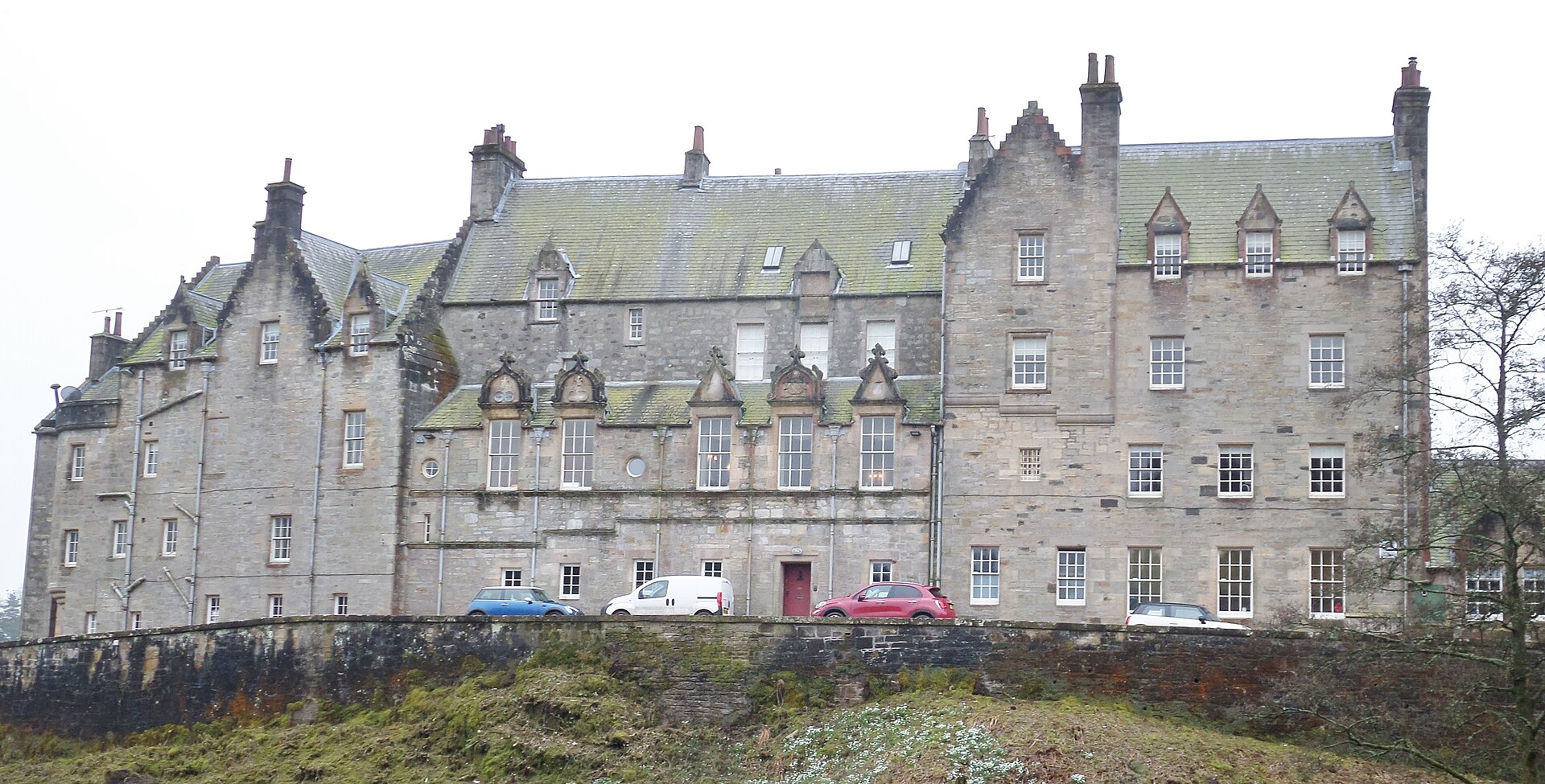
Image: Blair House, Dalry, from the north by Rosser1954, 19 February 2017, sourced from Wikimedia Commons and licensed under CC BY-SA 4.0.

Blair House grew from a sixteenth-century tower into a large Jacobean composition whose dated wings and later refronting make several centuries visible.
Quick facts
- Date
- Sixteenth-century core; major work dated 1617, 1668 and 1893
- Architect / designer
- Successive builders; 1893 work by Thomas Leadbetter
- Type
- Multi-phase Scottish Jacobean country house
- Designation
- Listed building, Category A (LB1196)
- OS grid reference
- NS 30453 48034
Architecture and continuing use
Rubble and ashlar ranges now form a rough T-plan of three and four storeys. Crowstepped gables, corbelled projections, carved doorways and turrets unite sixteenth- and seventeenth-century work with Thomas Leadbetter’s 1893 north wing and alterations.
Its story
The house developed around a tower, with dated evidence for work in 1617 and a substantial south wing in 1668. Leadbetter reworked and enlarged it in 1893. The Hunter Foundation now uses the estate for leadership programmes and occasionally releases it for exclusive events.
Why it is included
It provides Dalry’s strongest example of long-lived landed architecture and a current use that remains private and programme-led rather than routinely touristic.
What to notice
- The doorway in the south re-entrant tower with Blair arms.
- Crowstepped dormers dated 1668.
- How Leadbetter’s 1893 work echoes earlier Jacobean forms.
Reading the surroundings
The estate is private. Visit only for an advertised opening, booked programme or invitation; do not drive or walk in speculatively, and follow any event route exactly.
Timeline
- Sixteenth century A tower house formed the core of the later Blair House.
- 1668 A substantial south wing added dated crowstepped dormers.
- 1893 Thomas Leadbetter built the north wing and reworked the east range.
- 2026 The Hunter Foundation used Blair as its headquarters and leadership-programme setting.
What we know — and what remains uncertain
The estate promotes the name Blair Castle while the statutory designation uses Blair House. General public access is not implied by occasional charity garden openings.
Sources & further reading
- Historic Environment Scotland: Blair House, LB1196 — Current designation status, official mapped location, date, fabric and significance.
- Blair Castle and Estate — Current owner’s account of headquarters, leadership programmes and limited exclusive use.
- Scotland’s Gardens Scheme: Blair House and Estate — Independent current evidence for rare advertised garden openings and access conditions.
- Trove search: Blair House Dalry Ayrshire — National collection search for site records, surveys and archive material.
Location
OS grid reference NS 30453 48034 · Location confidence: High: the current national designation supplies an exact mapped National Grid Reference; public text separately states access and current-use uncertainty. · Select the marker to open its satellite view in Google Maps. On desktop, drag Pegman (the yellow figure) onto a blue road. On mobile, turn on the Street View layer and tap a blue road. Other photo markers may be user-contributed.
Suggest a marker correction
Suggest a more accurate position
The teal marker is the current published position. The orange marker starts slightly to its right so both remain visible; this is only a visual starting position. Tap the correct place on the map or drag the orange marker. Sending this form creates a private review entry only; it does not move the published marker.
Check this area in Google Maps Choose the Satellite layer there if useful.
Map: © OpenStreetMap contributors. You can also enter checked coordinates below.