In brief
A sixteenth-century tower and later church form the ecclesiastical part of today’s Dreel Halls.
Quick facts
- Place
- Anstruther, Fife
- Date
- Sixteenth-century tower; work in 1761 of uncertain extent
- Designation
- Category A listed building, LB36191
An old tower beside the Dreel
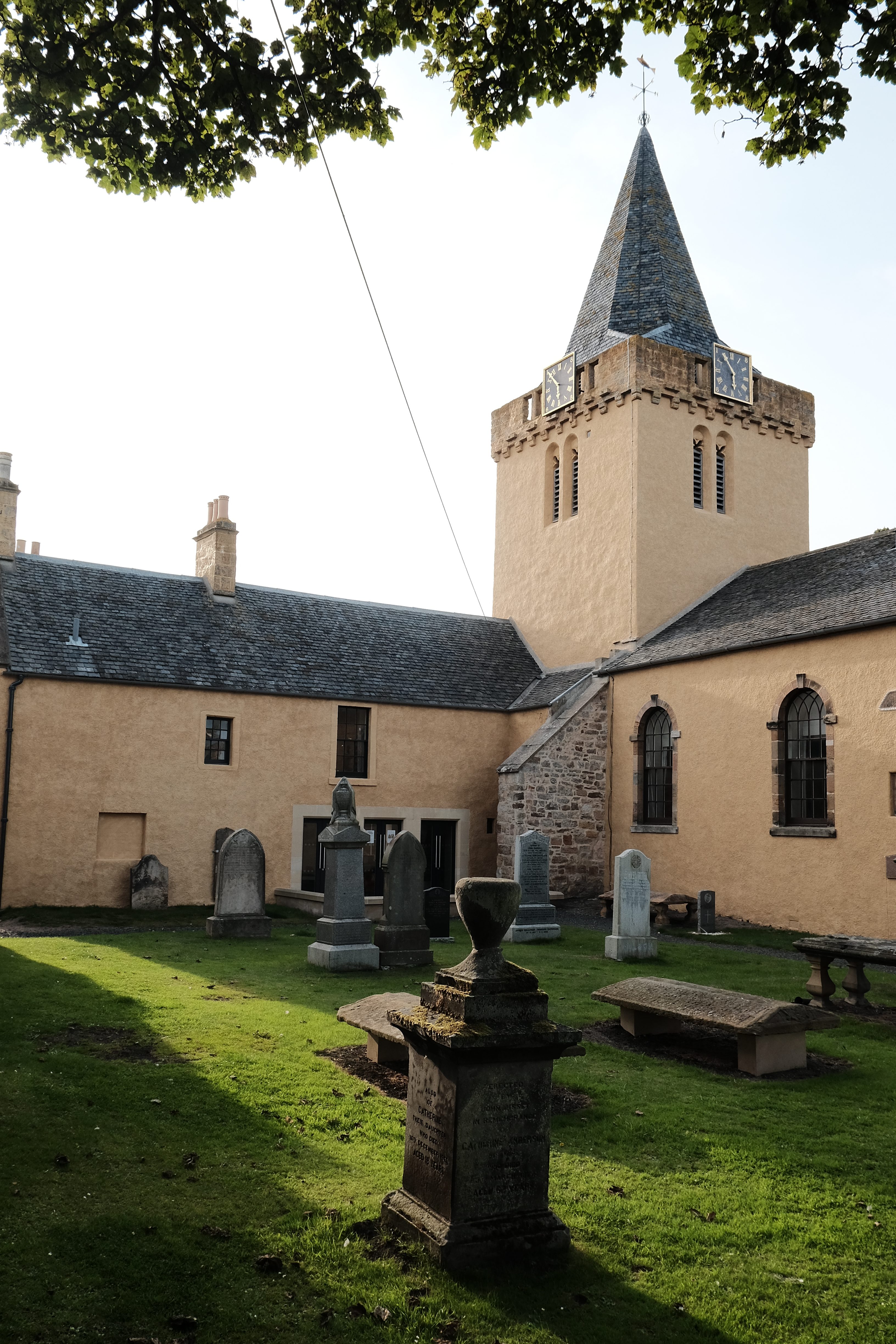
The four-storey rubble tower has paired bell-chamber openings, a projecting parapet and a slated broach spire. Beside it stands a harled, crowstepped rectangular church with arched windows.
The simple church has a Georgian appearance. The extent of work in 1761 remains uncertain: HES notes that the older account refers to reroofing, rather than a complete rebuild. The former church now belongs to the wider Dreel Halls community complex, whose restored buildings combine church and former municipal spaces.
What to notice
- The tower’s paired bell-chamber windows.
- The simpler rectangular church beside the older vertical landmark.
Visiting
Consult Anstruther Improvements Association for current events and access. Respect the adjacent burial ground and keep clear of the tidal burn edge.
Sources and further reading
- HES — Anstruther Wester Parish Church, LB36191 — Sixteenth-century tower and uncertainty over the extent of work in 1761.
- Anstruther Improvements Association — Dreel Halls — Community ownership, conservation works and interior improvements completed in 2020.
Explore Anstruther
The Anstruther Place entry introduces the Easter and Wester burghs, their landscape and other associated records.
Location
OS grid reference NO 56444 03532 · Location confidence: High — HES statutory grid coordinates transformed from OSGB36 to WGS84 · Select the marker to open its satellite view in Google Maps. On desktop, drag Pegman (the yellow figure) onto a blue road. On mobile, turn on the Street View layer and tap a blue road. Other photo markers may be user-contributed.
Suggest a marker correction
Suggest a more accurate position
The teal marker is the current published position. The orange marker starts slightly to its right so both remain visible; this is only a visual starting position. Tap the correct place on the map or drag the orange marker. Sending this form creates a private review entry only; it does not move the published marker.
Check this area in Google Maps Choose the Satellite layer there if useful.
Map: © OpenStreetMap contributors. You can also enter checked coordinates below.